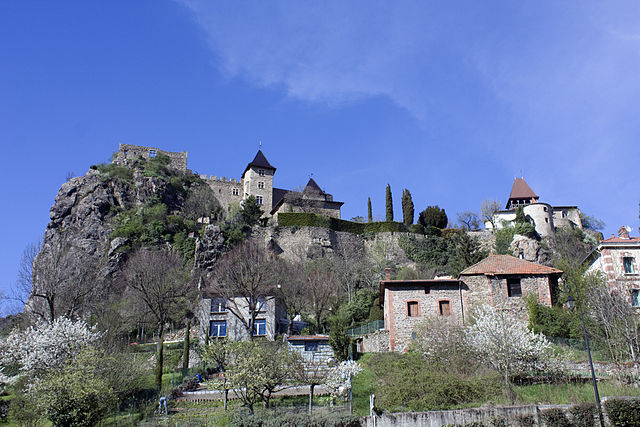
Aurec-sur-Loire (Aurec-sur-Loire)

- commune in Haute-Loire, France
- Country:

- Postal Code: 43110
- Coordinates: 45° 22' 9" N, 4° 12' 6" E


- GPS tracks (wikiloc): [Link]
- Area: 22.44 sq km
- Population: 6102
- Web site: http://www.mairie-aurec.fr
- Wikipedia en: wiki(en)
- Wikipedia: wiki(fr)
- Wikidata storage: Wikidata: Q250555
- Wikipedia Commons Category: [Link]
- Freebase ID: [/m/03nthkm]
- GeoNames ID: Alt: [3036054]
- SIREN number: [214300121]
- BnF ID: [15259917m]
- VIAF ID: Alt: [130355329]
- Library of Congress authority ID: Alt: [n97005976]
- INSEE municipality code: 43012
Shares border with regions:
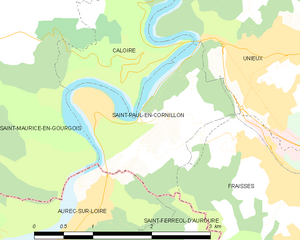
Saint-Paul-en-Cornillon
- commune in Loire, France
- Country:
- Postal Code: 42240
- Coordinates: 45° 23' 50" N, 4° 14' 26" E
- GPS tracks (wikiloc): [Link]
- Area: 3.72 sq km
- Population: 1358


Saint-Maurice-en-Gourgois
- commune in Loire, France
- Country:
- Postal Code: 42240
- Coordinates: 45° 24' 5" N, 4° 11' 0" E
- GPS tracks (wikiloc): [Link]
- Area: 31.83 sq km
- Population: 1797
- Web site: [Link]
La Chapelle-d'Aurec
- commune in Haute-Loire, France
- Country:
- Postal Code: 43120
- Coordinates: 45° 20' 6" N, 4° 12' 24" E
- GPS tracks (wikiloc): [Link]
- Area: 11.79 sq km
- Population: 984


Pont-Salomon
- commune in Haute-Loire, France
- Country:
- Postal Code: 43330
- Coordinates: 45° 20' 16" N, 4° 14' 52" E
- GPS tracks (wikiloc): [Link]
- Area: 8.43 sq km
- Population: 2067
- Web site: [Link]
Malvalette
- commune in Haute-Loire, France
- Country:
- Postal Code: 43210
- Coordinates: 45° 21' 18" N, 4° 9' 31" E
- GPS tracks (wikiloc): [Link]
- Area: 21.01 sq km
- Population: 813

Saint-Ferréol-d'Auroure
- commune in Haute-Loire, France
- Country:
- Postal Code: 43330
- Coordinates: 45° 21' 18" N, 4° 15' 17" E
- GPS tracks (wikiloc): [Link]
- Area: 10.85 sq km
- Population: 2438