Auriac-du-Périgord (Auriac-du-Périgord)

- commune in Dordogne, France
- Country:

- Postal Code: 24290
- Coordinates: 45° 6' 23" N, 1° 8' 13" E


- GPS tracks (wikiloc): [Link]
- Area: 18.63 sq km
- Population: 384
- Web site: http://www.auriac-du-perigord.fr
- Wikipedia en: wiki(en)
- Wikipedia: wiki(fr)
- Wikidata storage: Wikidata: Q1013324
- Wikipedia Commons Category: [Link]
- Freebase ID: [/m/03mfgtj]
- Freebase ID: [/m/03mfgtj]
- GeoNames ID: Alt: [3036031]
- GeoNames ID: Alt: [3036031]
- SIREN number: [212400188]
- SIREN number: [212400188]
- BnF ID: [152516693]
- BnF ID: [152516693]
- VIAF ID: Alt: [248739640]
- VIAF ID: Alt: [248739640]
- PACTOLS thesaurus ID: [pcrtTG6Z02ASbz]
- PACTOLS thesaurus ID: [pcrtTG6Z02ASbz]
- INSEE municipality code: 24018
- INSEE municipality code: 24018
Shares border with regions:

Aubas
- commune in Dordogne, France
- Country:
- Postal Code: 24290
- Coordinates: 45° 4' 54" N, 1° 11' 27" E
- GPS tracks (wikiloc): [Link]
- Area: 17.53 sq km
- Population: 633
- Web site: [Link]


La Bachellerie
- commune in Dordogne, France
- Country:
- Postal Code: 24210
- Coordinates: 45° 8' 45" N, 1° 9' 13" E
- GPS tracks (wikiloc): [Link]
- AboveSeaLevel: 121 м m
- Area: 17.34 sq km
- Population: 908
- Web site: [Link]

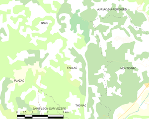
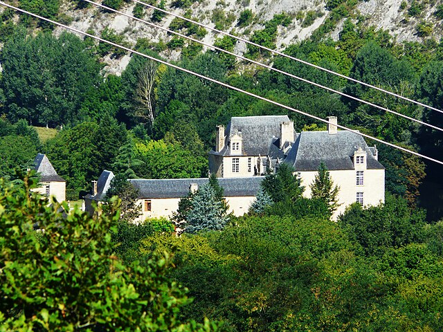
Fanlac
- commune in Dordogne, France
- Country:
- Postal Code: 24290
- Coordinates: 45° 3' 57" N, 1° 5' 45" E
- GPS tracks (wikiloc): [Link]
- Area: 14.37 sq km
- Population: 131
- Web site: [Link]


Thenon
- commune in Dordogne, France
- Country:
- Postal Code: 24210
- Coordinates: 45° 8' 14" N, 1° 4' 14" E
- GPS tracks (wikiloc): [Link]
- Area: 25.92 sq km
- Population: 1255


Azerat
- commune in Dordogne, France
- Country:
- Postal Code: 24210
- Coordinates: 45° 9' 0" N, 1° 7' 24" E
- GPS tracks (wikiloc): [Link]
- Area: 20.05 sq km
- Population: 449
- Web site: [Link]


Bars
- commune in Dordogne, France
- Country:
- Postal Code: 24210
- Coordinates: 45° 5' 57" N, 1° 3' 48" E
- GPS tracks (wikiloc): [Link]
- Area: 22.58 sq km
- Population: 232
- Web site: [Link]


Montignac
- commune in Dordogne, France
- Country:
- Postal Code: 24290
- Coordinates: 45° 3' 59" N, 1° 9' 41" E
- GPS tracks (wikiloc): [Link]
- AboveSeaLevel: 77 м m
- Area: 37.15 sq km
- Population: 2807
- Web site: [Link]