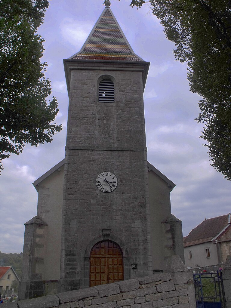
Autechaux (Autechaux)

- commune in Doubs, France
 Hiking in Autechaux
Autechaux, located in the Doubs department of France, offers a variety of scenic hiking opportunities. The region is characterized by its rolling hills, dense forests, and picturesque views, making it an excellent destination for nature enthusiasts.
Hiking Trails
-
Local Circuit Trails: There are several marked trails around Autechaux that are suitable for different skill levels. You can find short loops for beginners as well as longer, more challenging routes for experienced hikers.
-
Vallée du Doubs: Nearby, the Doubs River provides additional trails that follow the riverside, with beautiful views of the water and varied landscapes.
-
Forests and Natural Parks: The area is surrounded by lush forests, including the Franche-Comté region's unique flora and fauna, making hikes through these woods particularly rewarding.
Recommended Hikes
- Les Chemins de Ronde: This is a popular local trail that offers great views of the landscape and is often used by both hikers and mountain bikers.
- Sentier des Forges: This trail not only provides scenic views but also leads you through historical sites related to the local industry.
Tips for Hiking in Autechaux
- Gear Up: Wear appropriate hiking shoes and bring plenty of water, especially if you plan to tackle longer trails.
- Check Local Conditions: Weather can change quickly in the region, so it's a good idea to check forecasts and trail conditions before heading out.
- Respect Nature: Stick to marked trails and follow local guidelines to protect the natural environment.
Wildlife and Flora
While hiking, keep an eye out for the local wildlife, including various bird species, deer, and other animals native to the region. The diverse flora also adds to the experience, especially during the spring and summer months.
Whether you're looking for a casual walk or a more strenuous hike, Autechaux and its surrounding areas offer plenty of options to enjoy the great outdoors!
- Country:

- Postal Code: 25110
- Coordinates: 47° 22' 40" N, 6° 23' 7" E


- GPS tracks (wikiloc): [Link]
- AboveSeaLevel: 437 м m
- Area: 6.59 sq km
- Population: 418
- Web site: http://www.autechaux.fr/
- Wikipedia en: wiki(en)
- Wikipedia: wiki(fr)
- Wikidata storage: Wikidata: Q784505
- Wikipedia Commons Category: [Link]
- Freebase ID: [/m/03mgbvg]
- Freebase ID: [/m/03mgbvg]
- GeoNames ID: Alt: [6455011]
- GeoNames ID: Alt: [6455011]
- SIREN number: [212500326]
- SIREN number: [212500326]
- BnF ID: [15252258k]
- BnF ID: [15252258k]
- INSEE municipality code: 25032
- INSEE municipality code: 25032
Shares border with regions:
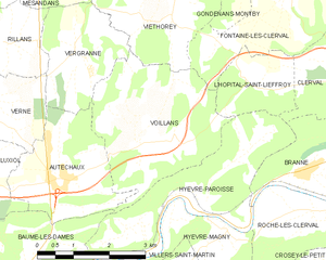
Voillans
- commune in Doubs, France
Hiking in Voillans
Voillans is a picturesque village located in the Franche-Comté region of eastern France, known for its beautiful landscapes and serene natural surroundings. Hiking in and around Voillans offers a great opportunity to explore the scenic beauty of the area, including rolling hills, forests, and small rivers....
- Country:
- Postal Code: 25110
- Coordinates: 47° 23' 12" N, 6° 24' 47" E
- GPS tracks (wikiloc): [Link]
- Area: 10.12 sq km
- Population: 207


Vergranne
- commune in Doubs, France
Hiking in Vergranne
Vergranne does not appear to be a well-known hiking destination, and it is possible that you may be referring to a specific location that is less widely recognized or that the name may be a misspelling. However, if you are interested in hiking in a particular region or natural area with a similar name or if you have a specific destination in mind, please provide more details....
- Country:
- Postal Code: 25110
- Coordinates: 47° 24' 32" N, 6° 23' 27" E
- GPS tracks (wikiloc): [Link]
- Area: 5.18 sq km
- Population: 107


Verne
- commune in Doubs, France
Hiking in Verne
Verne, located in the Doubs department of the Bourgogne-Franche-Comté region in eastern France, offers a variety of hiking opportunities for outdoor enthusiasts. The area is characterized by its beautiful natural landscapes, with rolling hills, lush forests, and picturesque valleys....
- Country:
- Postal Code: 25110
- Coordinates: 47° 23' 53" N, 6° 21' 14" E
- GPS tracks (wikiloc): [Link]
- Area: 7.82 sq km
- Population: 130
- Web site: [Link]