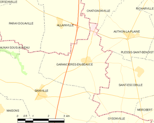
Authon-la-Plaine (Authon-la-Plaine)

- commune in Essonne, France
- Country:

- Postal Code: 91410
- Coordinates: 48° 27' 2" N, 1° 57' 24" E


- GPS tracks (wikiloc): [Link]
- Area: 10.59 sq km
- Population: 372
- Web site: http://www.authonlaplaine.org
- Wikipedia en: wiki(en)
- Wikipedia: wiki(fr)
- Wikidata storage: Wikidata: Q773307
- Wikipedia Commons Category: [Link]
- Freebase ID: [/m/03mfyky]
- Freebase ID: [/m/03mfyky]
- GeoNames ID: Alt: [3035937]
- GeoNames ID: Alt: [3035937]
- SIREN number: [219100351]
- SIREN number: [219100351]
- BnF ID: [15280054s]
- BnF ID: [15280054s]
- VIAF ID: Alt: [239188517]
- VIAF ID: Alt: [239188517]
- TGN ID: [1031929]
- TGN ID: [1031929]
- INSEE municipality code: 91035
- INSEE municipality code: 91035
Shares border with regions:

Saint-Escobille
- commune in Essonne, France
- Country:
- Postal Code: 91410
- Coordinates: 48° 25' 47" N, 1° 57' 56" E
- GPS tracks (wikiloc): [Link]
- Area: 12 sq km
- Population: 540
- Web site: [Link]

Garancières-en-Beauce
- commune in Eure-et-Loir, France
- Country:
- Postal Code: 28700
- Coordinates: 48° 26' 10" N, 1° 55' 13" E
- GPS tracks (wikiloc): [Link]
- Area: 11.26 sq km
- Population: 221

Corbreuse
- commune in Essonne, France
- Country:
- Postal Code: 91410
- Coordinates: 48° 29' 56" N, 1° 57' 40" E
- GPS tracks (wikiloc): [Link]
- Area: 15.79 sq km
- Population: 1760
- Web site: [Link]

Richarville
- commune in Essonne, France
- Country:
- Postal Code: 91410
- Coordinates: 48° 28' 18" N, 2° 0' 3" E
- GPS tracks (wikiloc): [Link]
- Area: 10.35 sq km
- Population: 401
- Web site: [Link]

Chatignonville
- commune in Essonne, France
- Country:
- Postal Code: 91410
- Coordinates: 48° 28' 3" N, 1° 55' 54" E
- GPS tracks (wikiloc): [Link]
- Area: 5.13 sq km
- Population: 60

Plessis-Saint-Benoist
- commune in Essonne, France
- Country:
- Postal Code: 91410
- Coordinates: 48° 26' 36" N, 2° 0' 21" E
- GPS tracks (wikiloc): [Link]
- Area: 9.16 sq km
- Population: 317