Auxais (Auxais)

- commune in Manche, France
- Country:

- Postal Code: 50500
- Coordinates: 49° 12' 47" N, 1° 17' 55" E


- GPS tracks (wikiloc): [Link]
- Area: 7.76 sq km
- Population: 173
- Wikipedia en: wiki(en)
- Wikipedia: wiki(fr)
- Wikidata storage: Wikidata: Q784949
- Wikipedia Commons Category: [Link]
- Freebase ID: [/m/03qcpzh]
- Freebase ID: [/m/03qcpzh]
- GeoNames ID: Alt: [6449456]
- GeoNames ID: Alt: [6449456]
- SIREN number: [215000241]
- SIREN number: [215000241]
- BnF ID: [15262003z]
- BnF ID: [15262003z]
- PACTOLS thesaurus ID: [pcrtQSp1mTrvse]
- PACTOLS thesaurus ID: [pcrtQSp1mTrvse]
- INSEE municipality code: 50024
- INSEE municipality code: 50024
Shares border with regions:


Saint-Georges-de-Bohon
- former commune in Manche, France
- Country:
- Postal Code: 50500
- Coordinates: 49° 15' 2" N, 1° 16' 10" E
- GPS tracks (wikiloc): [Link]
- Area: 13.96 sq km
- Population: 403


Saint-André-de-Bohon
- commune in Manche, France
- Country:
- Postal Code: 50500
- Coordinates: 49° 14' 4" N, 1° 15' 8" E
- GPS tracks (wikiloc): [Link]
- Area: 10.43 sq km
- Population: 334

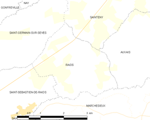
Raids
- commune in Manche, France
- Country:
- Postal Code: 50500
- Coordinates: 49° 13' 1" N, 1° 20' 39" E
- GPS tracks (wikiloc): [Link]
- Area: 6.8 sq km
- Population: 182


Marchésieux
- commune in Manche, France
- Country:
- Postal Code: 50190
- Coordinates: 49° 11' 15" N, 1° 17' 28" E
- GPS tracks (wikiloc): [Link]
- Area: 19.89 sq km
- Population: 724