Auzeville-Tolosane (Auzeville-Tolosane)

- commune in Haute-Garonne, France
- Country:

- Postal Code: 31320
- Coordinates: 43° 31' 38" N, 1° 28' 54" E


- GPS tracks (wikiloc): [Link]
- Area: 6.66 sq km
- Population: 4162
- Web site: http://www.auzeville31.fr
- Wikipedia en: wiki(en)
- Wikipedia: wiki(fr)
- Wikidata storage: Wikidata: Q267464
- Wikipedia Commons Category: [Link]
- Freebase ID: [/m/03nq1fg]
- Freebase ID: [/m/03nq1fg]
- GeoNames ID: Alt: [6448259]
- GeoNames ID: Alt: [6448259]
- SIREN number: [213100357]
- SIREN number: [213100357]
- BnF ID: [15255031q]
- BnF ID: [15255031q]
- PACTOLS thesaurus ID: [pcrtSSksQHknTU]
- PACTOLS thesaurus ID: [pcrtSSksQHknTU]
- INSEE municipality code: 31035
- INSEE municipality code: 31035
Shares border with regions:


Castanet-Tolosan
- commune in Haute-Garonne, France
- Country:
- Postal Code: 31320
- Coordinates: 43° 30' 56" N, 1° 29' 53" E
- GPS tracks (wikiloc): [Link]
- Area: 8.22 sq km
- Population: 12833
- Web site: [Link]


Pechbusque
- commune in Haute-Garonne, France
- Country:
- Postal Code: 31320
- Coordinates: 43° 31' 41" N, 1° 27' 33" E
- GPS tracks (wikiloc): [Link]
- Area: 3.14 sq km
- Population: 844

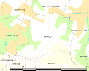
Mervilla
- commune in Haute-Garonne, France
- Country:
- Postal Code: 31320
- Coordinates: 43° 30' 27" N, 1° 28' 23" E
- GPS tracks (wikiloc): [Link]
- Area: 2.76 sq km
- Population: 262


Ramonville-Saint-Agne
- commune in Haute-Garonne, France
- Country:
- Postal Code: 31520
- Coordinates: 43° 32' 46" N, 1° 28' 32" E
- GPS tracks (wikiloc): [Link]
- Area: 6.46 sq km
- Population: 13829
- Web site: [Link]


Labège
- commune in Haute-Garonne, France
- Country:
- Postal Code: 31670
- Coordinates: 43° 31' 45" N, 1° 31' 48" E
- GPS tracks (wikiloc): [Link]
- Area: 7.65 sq km
- Population: 4277
- Web site: [Link]