Avenas (Avenas)

- commune in Rhône, France
- Country:

- Postal Code: 69430
- Coordinates: 46° 11' 41" N, 4° 36' 18" E


- GPS tracks (wikiloc): [Link]
- Area: 9.49 sq km
- Population: 123
- Wikipedia en: wiki(en)
- Wikipedia: wiki(fr)
- Wikidata storage: Wikidata: Q1153432
- Wikipedia Commons Category: [Link]
- Freebase ID: [/m/03qgf2j]
- GeoNames ID: Alt: [6450712]
- SIREN number: [216900159]
- BnF ID: [15272103f]
- VIAF ID: Alt: [311728629]
- GND ID: Alt: [1062635353]
- TGN ID: [7008762]
- INSEE municipality code: 69015
Shares border with regions:

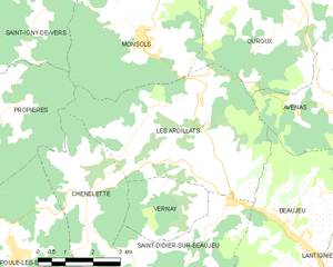
Les Ardillats
- commune in Rhône, France
- Country:
- Postal Code: 69430
- Coordinates: 46° 10' 46" N, 4° 32' 26" E
- GPS tracks (wikiloc): [Link]
- Area: 23.1 sq km
- Population: 633
- Web site: [Link]


Villié-Morgon
- commune in Rhône, France
- Country:
- Postal Code: 69910
- Coordinates: 46° 9' 44" N, 4° 40' 50" E
- GPS tracks (wikiloc): [Link]
- Area: 18.74 sq km
- Population: 2108
- Web site: [Link]


Régnié-Durette
- commune in Rhône, France
- Country:
- Postal Code: 69430
- Coordinates: 46° 8' 16" N, 4° 38' 29" E
- GPS tracks (wikiloc): [Link]
- AboveSeaLevel: 316 м m
- Area: 11.72 sq km
- Population: 1107
- Web site: [Link]

Lantignié
- commune in Rhône, France
- Country:
- Postal Code: 69430
- Coordinates: 46° 8' 50" N, 4° 37' 24" E
- GPS tracks (wikiloc): [Link]
- Area: 7.4 sq km
- Population: 886


Ouroux
- commune in Rhône, France
- Country:
- Postal Code: 69860
- Coordinates: 46° 13' 51" N, 4° 35' 40" E
- GPS tracks (wikiloc): [Link]
- Area: 21.06 sq km
- Population: 337
- Web site: [Link]


Vauxrenard
- commune in Rhône, France
- Country:
- Postal Code: 69820
- Coordinates: 46° 12' 34" N, 4° 38' 39" E
- GPS tracks (wikiloc): [Link]
- Area: 19.19 sq km
- Population: 320


Beaujeu
- commune in Rhône, France
- Country:
- Postal Code: 69430
- Coordinates: 46° 9' 15" N, 4° 35' 18" E
- GPS tracks (wikiloc): [Link]
- Area: 17.85 sq km
- Population: 2087

Chiroubles
- commune in Rhône, France
- Country:
- Postal Code: 69115
- Coordinates: 46° 10' 50" N, 4° 39' 56" E
- GPS tracks (wikiloc): [Link]
- Area: 7.32 sq km
- Population: 410