Bérat (Bérat)

- commune in Haute-Garonne, France
- Country:

- Postal Code: 31370
- Coordinates: 43° 22' 40" N, 1° 10' 33" E


- GPS tracks (wikiloc): [Link]
- Area: 24.46 sq km
- Population: 2951
- Web site: http://www.berat.fr
- Wikipedia en: wiki(en)
- Wikipedia: wiki(fr)
- Wikidata storage: Wikidata: Q1467107
- Wikipedia Commons Category: [Link]
- Freebase ID: [/m/03nq21d]
- Freebase ID: [/m/03nq21d]
- GeoNames ID: Alt: [6448282]
- GeoNames ID: Alt: [6448282]
- SIREN number: [213100654]
- SIREN number: [213100654]
- BnF ID: [15255061n]
- BnF ID: [15255061n]
- Twitter username: Alt: [MairiedeBerat]
- Twitter username: Alt: [MairiedeBerat]
- INSEE municipality code: 31065
- INSEE municipality code: 31065
Shares border with regions:

Rieumes
- commune in Haute-Garonne, France
- Country:
- Postal Code: 31370
- Coordinates: 43° 24' 45" N, 1° 7' 4" E
- GPS tracks (wikiloc): [Link]
- Area: 30.9 sq km
- Population: 3515
- Web site: [Link]


Savères
- commune in Haute-Garonne, France
- Country:
- Postal Code: 31370
- Coordinates: 43° 22' 14" N, 1° 6' 14" E
- GPS tracks (wikiloc): [Link]
- Area: 10.71 sq km
- Population: 209


Lavernose-Lacasse
- commune in Haute-Garonne, France
- Country:
- Postal Code: 31410
- Coordinates: 43° 23' 46" N, 1° 15' 37" E
- GPS tracks (wikiloc): [Link]
- AboveSeaLevel: 198 м m
- Area: 17.83 sq km
- Population: 2941
- Web site: [Link]


Labastide-Clermont
- commune in Haute-Garonne, France
- Country:
- Postal Code: 31370
- Coordinates: 43° 20' 55" N, 1° 7' 16" E
- GPS tracks (wikiloc): [Link]
- Area: 14.58 sq km
- Population: 668
- Web site: [Link]

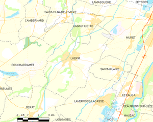
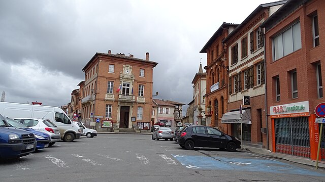
Lherm
- commune in Haute-Garonne, France
- Country:
- Postal Code: 31600
- Coordinates: 43° 25' 48" N, 1° 13' 19" E
- GPS tracks (wikiloc): [Link]
- AboveSeaLevel: 225 м m
- Area: 27.26 sq km
- Population: 3587
- Web site: [Link]


Longages
- commune in Haute-Garonne, France
- Country:
- Postal Code: 31410
- Coordinates: 43° 21' 18" N, 1° 14' 24" E
- GPS tracks (wikiloc): [Link]
- Area: 21.42 sq km
- Population: 2958
- Web site: [Link]

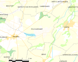
Poucharramet
- commune in Haute-Garonne, France
- Country:
- Postal Code: 31370
- Coordinates: 43° 25' 2" N, 1° 10' 26" E
- GPS tracks (wikiloc): [Link]
- Area: 22.53 sq km
- Population: 855
- Web site: [Link]


Bois-de-la-Pierre
- commune in Haute-Garonne, France
- Country:
- Postal Code: 31390
- Coordinates: 43° 20' 38" N, 1° 9' 3" E
- GPS tracks (wikiloc): [Link]
- Area: 7.42 sq km
- Population: 425