Bévenais (Bévenais)

- commune in Isère, France
 Hiking in Bévenais
Bévenais is a charming commune located in the Rhône department of France. It is situated near the foothills of the Massif Central, offering a picturesque landscape that is ideal for hiking enthusiasts. Here are some highlights about hiking in Bévenais:
-
Scenic Trails: The area around Bévenais features a variety of trails that wind through lush forests, rolling hills, and beautiful vineyards. You can expect varying levels of difficulty, accommodating both novice and experienced hikers.
-
Natural Beauty: Hiking in Bévenais offers breathtaking views, particularly during the spring and fall when the scenery is vibrant. The landscape is characterized by its diverse flora and fauna, providing ample opportunities for nature photography.
-
Cultural Landmarks: As you hike, you may encounter historical sites and charming villages that reflect the local culture and history. Keeping an eye out for such landmarks can enhance your hiking experience.
-
Local Gastronomy: After a day of hiking, you can enjoy the local cuisine in nearby villages. Sampling local wines and cheeses can be a rewarding way to relax and refuel.
-
Nearby Natural Parks: Bévenais is relatively close to natural parks and reserves that offer additional hiking opportunities, such as the Parc Naturel Régional du Pilat, which is known for its extensive network of trails.
-
Weather Considerations: Be mindful of the weather conditions before heading out. The best times for hiking in this region are usually spring and fall, as summer can be quite hot and winter may bring snow in higher altitudes.
-
Preparation: Always prepare adequately for your hike by bringing enough water, snacks, a map or GPS device, appropriate clothing, and good hiking shoes. It’s also advisable to inform someone about your hiking itinerary.
Whether you are looking for a peaceful day hike or a challenging trek, Bévenais offers a delightful experience surrounded by nature. Happy hiking!
- Country:

- Postal Code: 38690
- Coordinates: 45° 23' 53" N, 5° 23' 22" E


- GPS tracks (wikiloc): [Link]
- Area: 14.08 sq km
- Population: 987
- Web site: http://www.bevenais.fr
- Wikipedia en: wiki(en)
- Wikipedia: wiki(fr)
- Wikidata storage: Wikidata: Q1008873
- Wikipedia Commons Category: [Link]
- Freebase ID: [/m/03g_70w]
- GeoNames ID: Alt: [6613287]
- SIREN number: [213800428]
- INSEE municipality code: 38042
Shares border with regions:
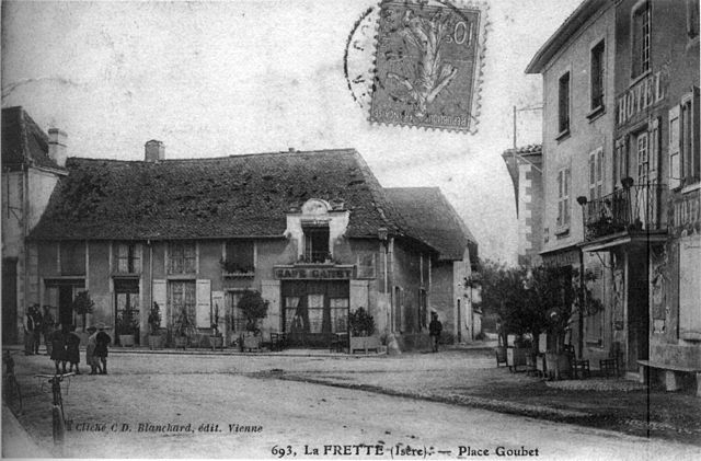

La Frette
- commune in Isère, France
Hiking in La Frette
La Frette, located in the Isère department of southeastern France, offers a variety of hiking opportunities that cater to different skill levels and preferences. Nestled in the picturesque landscape of the French Alps, La Frette is surrounded by stunning scenery, including mountains, forests, and rivers....
- Country:
- Postal Code: 38260
- Coordinates: 45° 23' 26" N, 5° 21' 38" E
- GPS tracks (wikiloc): [Link]
- Area: 11.8 sq km
- Population: 1108
- Web site: [Link]


Sillans
- commune in Isère, France
Hiking in Sillans
Sillans, nestled in the scenic Var department of Provence, France, is a beautiful destination for hiking enthusiasts. The area is known for its stunning natural landscapes, including lush forests, rolling hills, and picturesque waterfalls. Here are some highlights and information about hiking in Sillans:...
- Country:
- Postal Code: 38590
- Coordinates: 45° 20' 27" N, 5° 23' 20" E
- GPS tracks (wikiloc): [Link]
- Area: 12.61 sq km
- Population: 1885
- Web site: [Link]

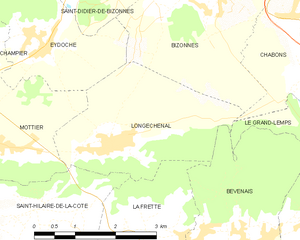
Longechenal
- commune in Isère, France
Hiking in Longechenal
Longechenal is a beautiful destination for hiking enthusiasts, located in the picturesque region of Auvergne-Rhône-Alpes in France. Known for its stunning landscapes, diverse terrain, and charming rural atmosphere, this area offers a variety of hiking trails that cater to different levels of experience....
- Country:
- Postal Code: 38690
- Coordinates: 45° 25' 8" N, 5° 20' 52" E
- GPS tracks (wikiloc): [Link]
- Area: 8.12 sq km
- Population: 565


Le Grand-Lemps
- commune in Isère, France
Hiking in Le Grand-Lemps
Le Grand-Lemps is a charming town located in the Isère department in southeastern France. It's an excellent base for hiking enthusiasts who want to explore the beautiful landscapes of the surrounding Vercors and Chartreuse mountain ranges. Here are some key points to consider when planning a hiking trip in Le Grand-Lemps:...
- Country:
- Postal Code: 38690
- Coordinates: 45° 23' 54" N, 5° 25' 11" E
- GPS tracks (wikiloc): [Link]
- Area: 12.9 sq km
- Population: 3082
- Web site: [Link]