La Frette (La Frette)

- commune in Isère, France
 Hiking in La Frette
La Frette, located in the Isère department of southeastern France, offers a variety of hiking opportunities that cater to different skill levels and preferences. Nestled in the picturesque landscape of the French Alps, La Frette is surrounded by stunning scenery, including mountains, forests, and rivers.
Hiking Trails
-
Local Trails: The region around La Frette features several marked trails suitable for day hikes, ranging from easy walks to more challenging ascents. You can often find paths that lead to viewpoints with breathtaking panoramas of the Alps.
-
Lac de Paladru: A short hike from La Frette leads you to Lac de Paladru, which is a beautiful lake surrounded by forested areas. The lakeside trails are perfect for leisurely walks, and you can also enjoy swimming or picnicking by the water.
-
Tour du Pays de la Verpillère: This is a longer hike that encircles the area and offers a mix of terrain, including fields, forests, and river valleys. It is well-marked and provides opportunities for birdwatching and enjoying the local flora.
-
Nearby Peaks: For more experienced hikers, there are trails that lead to higher elevations in the surrounding mountains. Exploring routes like the Grand Veymont or the Belledonne range can provide not only a good workout but also spectacular views once you reach the summits.
Seasonal Considerations
-
Spring and Summer: The best time for hiking in La Frette is during the warmer months when the weather is pleasant and trails are clear of snow. Wildflowers bloom, and the scenery is lush and vibrant.
-
Fall: Autumn offers beautiful foliage and milder temperatures. It's a great time for photography and enjoying the changing colors of the landscape.
-
Winter: Hiking can be more challenging in winter due to snow and ice. However, with proper gear and experience, winter hiking can be incredibly rewarding, showcasing a serene and less crowded environment.
Preparation Tips
- Maps: Always carry a detailed map of the area or a GPS device to stay on course.
- Gear: Wear appropriate hiking boots and layered clothing, as temperatures can change quickly in the mountains.
- Hydration: Bring enough water, especially on warmer days, as access to drinking water might be limited on some trails.
- Wildlife: Be aware of local wildlife and practice Leave No Trace principles to protect the natural habitat.
Conclusion
Hiking in La Frette can be a fantastic experience for nature lovers and adventure seekers alike, offering a blend of scenic beauty, diverse trails, and the opportunity to immerse yourself in the tranquil alpine environment. Be sure to check local resources for specific trail information and current conditions before you head out. Happy hiking!
- Country:

- Postal Code: 38260
- Coordinates: 45° 23' 26" N, 5° 21' 38" E


- GPS tracks (wikiloc): [Link]
- Area: 11.8 sq km
- Population: 1108
- Web site: http://www.lafrette.fr
- Wikipedia en: wiki(en)
- Wikipedia: wiki(fr)
- Wikidata storage: Wikidata: Q1060658
- Wikipedia Commons Category: [Link]
- Freebase ID: [/m/03nvjzl]
- GeoNames ID: Alt: [6455937]
- SIREN number: [213801749]
- BnF ID: [15257994k]
- Library of Congress authority ID: Alt: [n93095996]
- INSEE municipality code: 38174
Shares border with regions:


Bévenais
- commune in Isère, France
Hiking in Bévenais
Bévenais is a charming commune located in the Rhône department of France. It is situated near the foothills of the Massif Central, offering a picturesque landscape that is ideal for hiking enthusiasts. Here are some highlights about hiking in Bévenais:...
- Country:
- Postal Code: 38690
- Coordinates: 45° 23' 53" N, 5° 23' 22" E
- GPS tracks (wikiloc): [Link]
- Area: 14.08 sq km
- Population: 987
- Web site: [Link]

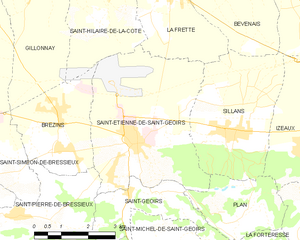
Saint-Étienne-de-Saint-Geoirs
- commune in Isère, France
Hiking in Saint-Étienne-de-Saint-Geoirs
Saint-Étienne-de-Saint-Geoirs, located in the Auvergne-Rhône-Alpes region of France, is surrounded by beautiful natural landscapes that are ideal for hiking enthusiasts. Here are some highlights and recommendations for hiking in this area:...
- Country:
- Postal Code: 38590
- Coordinates: 45° 20' 20" N, 5° 20' 43" E
- GPS tracks (wikiloc): [Link]
- Area: 18.62 sq km
- Population: 3259
- Web site: [Link]


Sillans
- commune in Isère, France
Hiking in Sillans
Sillans, nestled in the scenic Var department of Provence, France, is a beautiful destination for hiking enthusiasts. The area is known for its stunning natural landscapes, including lush forests, rolling hills, and picturesque waterfalls. Here are some highlights and information about hiking in Sillans:...
- Country:
- Postal Code: 38590
- Coordinates: 45° 20' 27" N, 5° 23' 20" E
- GPS tracks (wikiloc): [Link]
- Area: 12.61 sq km
- Population: 1885
- Web site: [Link]

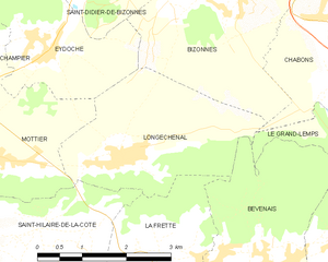
Longechenal
- commune in Isère, France
Hiking in Longechenal
Longechenal is a beautiful destination for hiking enthusiasts, located in the picturesque region of Auvergne-Rhône-Alpes in France. Known for its stunning landscapes, diverse terrain, and charming rural atmosphere, this area offers a variety of hiking trails that cater to different levels of experience....
- Country:
- Postal Code: 38690
- Coordinates: 45° 25' 8" N, 5° 20' 52" E
- GPS tracks (wikiloc): [Link]
- Area: 8.12 sq km
- Population: 565


Saint-Hilaire-de-la-Côte
- commune in Isère, France
Hiking in Saint-Hilaire-de-la-Côte
Saint-Hilaire-de-la-Côte is a picturesque mountain village located in the Isère department of the Auvergne-Rhône-Alpes region in southeastern France. It offers a variety of hiking opportunities, attracting both casual walkers and avid trekkers....
- Country:
- Postal Code: 38260
- Coordinates: 45° 23' 26" N, 5° 19' 38" E
- GPS tracks (wikiloc): [Link]
- Area: 13.75 sq km
- Population: 1431
- Web site: [Link]