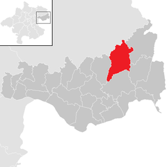
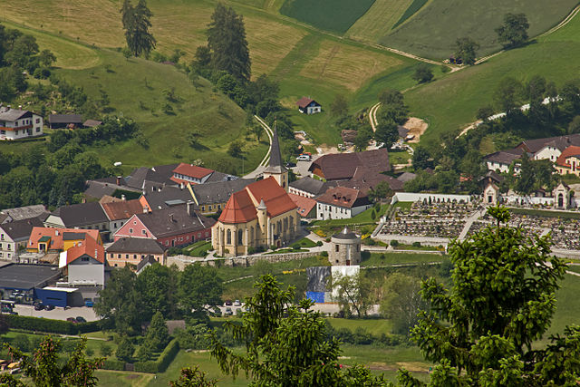
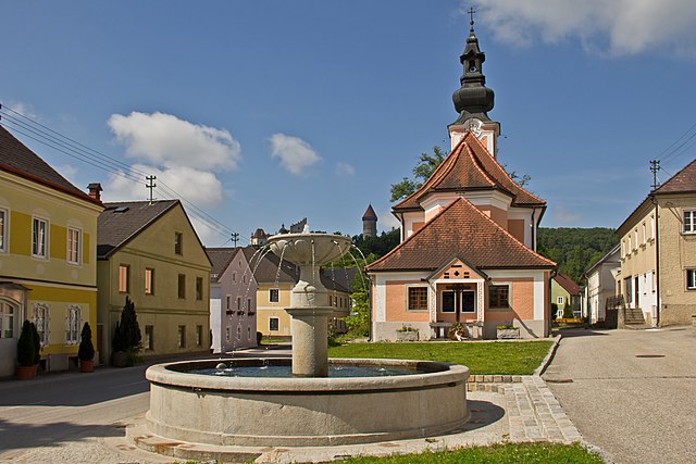
Bad Kreuzen (Bad Kreuzen)
- municipality in Austria
Bad Kreuzen is a picturesque village in Austria, located in the region of Upper Austria, which offers a variety of hiking opportunities suitable for all levels of experience. The area is characterized by its lush landscapes, rolling hills, and beautiful natural settings. Here are some key points to consider if you're planning to hike in Bad Kreuzen:
Hiking Trails
-
Variety of Trails: Bad Kreuzen features numerous hiking trails that range from easy walks to more challenging hikes. Trails often lead through scenic meadows, forests, and along rivers.
-
Marking and Signage: Many of the trails are well-marked, making it easy for hikers to navigate. Look for signposts indicating route difficulty and distance.
-
Popular Trails: Some popular routes include loops around the village and trails leading to viewpoints or nearby natural attractions.
Terrain and Scenery
-
The area is marked by varied terrain, including gentle slopes and more rugged paths. Expect to see a mix of deciduous and coniferous forests, along with stunning views of the surrounding hills.
-
The region is especially beautiful in spring and summer when the wildflowers bloom, and the lush greenery is at its peak.
Accessibility
- Bad Kreuzen can be accessed by public transportation from larger cities, and local trails are often reachable from the village center.
Amenities
- There are usually local amenities available, including accommodations, restaurants, and cafes where hikers can relax and enjoy local cuisine after a day on the trails.
Guiding and Safety
-
If you’re unfamiliar with the area, consider joining a guided hike or tour, as local guides can offer insights about the terrain and safety precautions.
-
Always bring plenty of water, wear suitable hiking shoes, and check weather conditions before heading out.
Conservation
- Respect the natural environment by sticking to marked trails and following local guidelines for wildlife protection and land conservation.
Hiking in Bad Kreuzen can be a rewarding experience, combining physical activity with the exploration of beautiful natural landscapes. Whether you’re a seasoned hiker or just looking for a peaceful stroll in nature, you’ll find plenty to enjoy in this charming Austrian village.
- Country:

- Postal Code: 4362
- Local Dialing Code: 07266
- Licence Plate Code: PE
- Coordinates: 48° 16' 0" N, 14° 48' 23" E


- GPS tracks (wikiloc): [Link]
- AboveSeaLevel: 474 м m
- Area: 39.9 sq km
- Population: 2266
- Web site: http://www.bad-kreuzen.at/
- Wikipedia en: wiki(en)
- Wikipedia: wiki(de)
- Wikidata storage: Wikidata: Q677399
- Wikipedia Commons Category: [Link]
- Wikipedia Commons Maps Category: [Link]
- Freebase ID: [/m/03gv760]
- GeoNames ID: Alt: [2773493]
- VIAF ID: Alt: [241881667]
- GND ID: Alt: [4725498-1]
- archINFORM location ID: [15850]
- Austrian municipality key: [41108]
Shares border with regions:


Grein
- municipality in Austria
Grein, Austria, is a picturesque town located along the Danube River in the Upper Austria region. It's known for its charming historic architecture and stunning natural surroundings, making it a great destination for hiking enthusiasts. Here are some highlights and considerations for hiking in and around Grein:...
- Country:

- Postal Code: 4360
- Local Dialing Code: 07268
- Licence Plate Code: PE
- Coordinates: 48° 13' 41" N, 14° 51' 2" E


- GPS tracks (wikiloc): [Link]
- AboveSeaLevel: 239 м m
- Area: 18.41 sq km
- Population: 2926
- Web site: [Link]


Pabneukirchen
- municipality in Austria
Pabneukirchen is a charming village located in Upper Austria, surrounded by picturesque landscapes ideal for hiking enthusiasts. The area boasts rolling hills, forests, and serene trails that cater to a variety of skill levels, from casual walkers to more experienced hikers....
- Country:

- Postal Code: 4363
- Local Dialing Code: 07265
- Licence Plate Code: PE
- Coordinates: 48° 19' 1" N, 14° 49' 1" E


- GPS tracks (wikiloc): [Link]
- AboveSeaLevel: 571 м m
- Area: 40.96 sq km
- Population: 1706
- Web site: [Link]

Sankt Nikola an der Donau
- municipality in Austria
 Hiking in Sankt Nikola an der Donau
Sankt Nikola an der Donau is a picturesque village located along the Danube River in Austria, surrounded by natural beauty and historical sites, making it a great destination for hiking enthusiasts. Here are some highlights for hiking in the area:...
- Country:

- Postal Code: 4381
- Local Dialing Code: 07268
- Licence Plate Code: PE
- Coordinates: 48° 14' 0" N, 14° 54' 24" E


- GPS tracks (wikiloc): [Link]
- AboveSeaLevel: 249 м m
- Area: 13.18 sq km
- Population: 798
- Web site: [Link]

Münzbach
- municipality in Austria
Münzbach, a picturesque village in Austria, offers a wonderful environment for hiking enthusiasts. Nestled in the foothills of the Alps, the region presents a range of trails that cater to various skill levels, from leisurely strolls to more challenging hikes....
- Country:

- Postal Code: 4323
- Local Dialing Code: 07264
- Licence Plate Code: PE
- Coordinates: 48° 16' 1" N, 14° 42' 56" E


- GPS tracks (wikiloc): [Link]
- AboveSeaLevel: 421 м m
- Area: 24.89 sq km
- Population: 1814
- Web site: [Link]

Waldhausen im Strudengau
- municipality in Austria
 Hiking in Waldhausen im Strudengau
Waldhausen im Strudengau is a picturesque village located in the heart of the Strudengau region of Austria, surrounded by the stunning landscape of the Danube River and the rolling hills of the Bohemian Forest. Hiking in this area offers a unique blend of natural beauty, historical sites, and cultural experiences....
- Country:

- Postal Code: 4391
- Local Dialing Code: 07260
- Licence Plate Code: PE
- Coordinates: 48° 16' 39" N, 14° 57' 0" E


- GPS tracks (wikiloc): [Link]
- AboveSeaLevel: 470 м m
- Area: 46.85 sq km
- Population: 2870
- Web site: [Link]

Sankt Thomas am Blasenstein
- municipality in Austria
 Hiking in Sankt Thomas am Blasenstein
Sankt Thomas am Blasenstein is a charming village located in the Austrian region of Upper Austria, surrounded by beautiful landscapes that are ideal for hiking enthusiasts. The area offers a variety of trails catering to different skill levels, making it a great destination for both beginners and experienced hikers....
- Country:

- Postal Code: 4364
- Local Dialing Code: 07265
- Licence Plate Code: PE
- Coordinates: 48° 18' 47" N, 14° 45' 49" E


- GPS tracks (wikiloc): [Link]
- AboveSeaLevel: 723 м m
- Area: 29.04 sq km
- Population: 927
- Web site: [Link]


Klam
- municipality in Austria
Klamath County, located in southern Oregon, is a fantastic area for hiking, offering diverse landscapes ranging from mountains and forests to lakes and rivers. Here are some highlights:...
- Country:

- Postal Code: 4352
- Local Dialing Code: 07269
- Licence Plate Code: PE
- Coordinates: 48° 13' 29" N, 14° 47' 0" E


- GPS tracks (wikiloc): [Link]
- AboveSeaLevel: 284 м m
- Area: 8.36 sq km
- Population: 918
- Web site: [Link]

Saxen
- municipality in Austria
Saxen is a picturesque area located in Austria, known for its stunning natural landscapes and outdoor recreational opportunities, including hiking. Here’s an overview of what you can expect when hiking in Saxen:...
- Country:

- Postal Code: 4351
- Local Dialing Code: 07269
- Licence Plate Code: PE
- Coordinates: 48° 12' 21" N, 14° 47' 29" E


- GPS tracks (wikiloc): [Link]
- AboveSeaLevel: 242 м m
- Area: 19.07 sq km
- Population: 1820
- Web site: [Link]
Dimbach
- municipality in Austria
Dimbach is a small yet picturesque village located in the province of Styria, Austria. It’s a wonderful place for hiking enthusiasts who appreciate nature and the tranquil beauty of the Austrian countryside....
- Country:

- Postal Code: 4371
- Local Dialing Code: 07260
- Licence Plate Code: PE
- Coordinates: 48° 18' 30" N, 14° 54' 37" E


- GPS tracks (wikiloc): [Link]
- AboveSeaLevel: 680 м m
- Area: 31.27 sq km
- Population: 1013
- Web site: [Link]