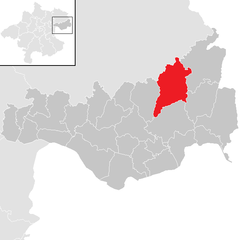
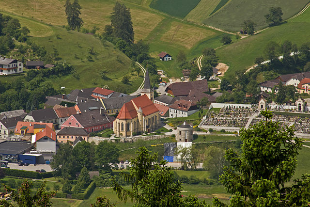
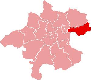
Perg District (Bezirk Perg)

- district of Austria
 Hiking in Perg District
The Perg District, located in the Upper Austria region, offers a variety of hiking opportunities characterized by scenic landscapes, rich cultural heritage, and varying difficulty levels suitable for all types of hikers.
Highlights of Hiking in Perg District:
-
Scenic Trails: The region is known for its lush greenery, rolling hills, and beautiful forests. You can find numerous trails that wind through these landscapes, providing stunning views of the surrounding countryside.
-
Hiking Routes:
- Kalkalpen National Park: This national park is nearby and offers some challenging trails through rugged terrain, showcasing the region's natural beauty and biodiversity.
- Mühlviertel Region: Known for its rolling hills and charming villages, the trails here provide a mix of nature and cultural experiences.
-
Flora and Fauna: The Perg District is home to diverse wildlife and plant species, making it a great destination for nature enthusiasts. Be on the lookout for various birds, deer, and other local wildlife along the trails.
-
Cultural Sites: While hiking, you can also encounter historical sites, such as old castles, churches, and traditional farms that tell the story of this region's rich history.
-
Best Times to Visit: The ideal time for hiking in the Perg District is during late spring to early autumn (May to October), when the weather is generally mild and the landscapes are at their most vibrant.
-
Local Tips:
- Trail Markings: The hiking trails are usually well-marked, but it's always a good idea to carry a map or use a hiking app for navigation.
- Hydration and Gear: Make sure to bring enough water and wear appropriate footwear for the terrain.
- Respect Nature: Follow Leave No Trace principles to help preserve the environment for future hikers.
-
Guided Tours: If you're unfamiliar with the area or want to learn more about the local ecology and history, consider opting for guided hiking tours available in the region.
Whether you’re looking for a leisurely walk or a challenging hike, the Perg District has something to offer for everyone. Enjoy your adventure!
- Country:

- Capital: Perg
- Licence Plate Code: PE
- Coordinates: 48° 16' 19" N, 14° 40' 59" E


- GPS tracks (wikiloc): [Link]
- AboveSeaLevel: 408 м m
- Area: 611.86 sq km
- Web site: http://www.bh-perg.gv.at/
- Wikipedia en: wiki(en)
- Wikipedia: wiki(de)
- Wikidata storage: Wikidata: Q660530
- Wikipedia Commons Category: [Link]
- Wikipedia Commons Maps Category: [Link]
- Freebase ID: [/m/0dy_ff]
- GeoNames ID: Alt: [2769104]
- VIAF ID: Alt: [147264321]
- GND ID: Alt: [4464426-7]
- archINFORM location ID: [14675]
- Library of Congress authority ID: Alt: [n88080959]
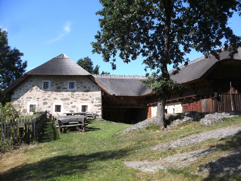
Includes regions:

Sankt Georgen an der Gusen
- municipality in Austria
Hiking in Sankt Georgen an der Gusen
Sankt Georgen an der Gusen is a picturesque town located in Austria, known for its historical significance and beautiful landscapes. While it may not be as popular as some other hiking destinations in the region, it offers a variety of trails and outdoor activities for hiking enthusiasts....
- Country:
- Local Dialing Code: 07237
- Licence Plate Code: PE
- Coordinates: 48° 16' 18" N, 14° 26' 54" E
- GPS tracks (wikiloc): [Link]
- AboveSeaLevel: 262 м m
- Area: 7.12 sq km
- Population: 4119
- Web site: [Link]

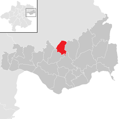
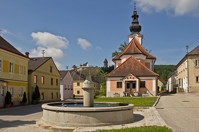
Perg
- municipality in Austria
Hiking in Perg
Hiking in Perg, Austria, is a delightful experience, offering a variety of trails that cater to different skill levels and interests. The region is characterized by its beautiful landscapes, including rolling hills, forests, and scenic vistas overlooking the Danube River....
- Country:
- Postal Code: 4320
- Local Dialing Code: 07262
- Licence Plate Code: PE
- Coordinates: 48° 15' 1" N, 14° 38' 1" E
- GPS tracks (wikiloc): [Link]
- AboveSeaLevel: 250 м m
- Area: 26.44 sq km
- Population: 8388
- Web site: [Link]


Grein
- municipality in Austria
Hiking in Grein
Grein, Austria, is a picturesque town located along the Danube River in the Upper Austria region. It's known for its charming historic architecture and stunning natural surroundings, making it a great destination for hiking enthusiasts. Here are some highlights and considerations for hiking in and around Grein:...
- Country:
- Postal Code: 4360
- Local Dialing Code: 07268
- Licence Plate Code: PE
- Coordinates: 48° 13' 41" N, 14° 51' 2" E
- GPS tracks (wikiloc): [Link]
- AboveSeaLevel: 239 м m
- Area: 18.41 sq km
- Population: 2926
- Web site: [Link]

Pabneukirchen
- municipality in Austria
Hiking in Pabneukirchen
Pabneukirchen is a charming village located in Upper Austria, surrounded by picturesque landscapes ideal for hiking enthusiasts. The area boasts rolling hills, forests, and serene trails that cater to a variety of skill levels, from casual walkers to more experienced hikers....
- Country:
- Postal Code: 4363
- Local Dialing Code: 07265
- Licence Plate Code: PE
- Coordinates: 48° 19' 1" N, 14° 49' 1" E
- GPS tracks (wikiloc): [Link]
- AboveSeaLevel: 571 м m
- Area: 40.96 sq km
- Population: 1706
- Web site: [Link]


Arbing
- municipality in Austria
Hiking in Arbing
Arbing, a small community located in Austria, is surrounded by beautiful natural landscapes, making it an interesting destination for hiking enthusiasts. While it may not be as well-known as larger hiking regions, there are still many opportunities to explore the outdoors in and around Arbing....
- Country:
- Postal Code: 4341
- Local Dialing Code: 07269
- Licence Plate Code: PE
- Coordinates: 48° 13' 39" N, 14° 42' 27" E
- GPS tracks (wikiloc): [Link]
- AboveSeaLevel: 278 м m
- Area: 12.02 sq km
- Population: 1446
- Web site: [Link]
Mauthausen
- municipality in Austria
Hiking in Mauthausen
Mauthausen, located in Austria, is best known for its historical significance due to the former concentration camp situated nearby. However, the region also offers beautiful hiking opportunities, particularly for those looking to explore the scenic landscapes of Upper Austria....
- Country:
- Postal Code: 4310
- Local Dialing Code: 07238
- Licence Plate Code: PE
- Coordinates: 48° 14' 31" N, 14° 31' 1" E
- GPS tracks (wikiloc): [Link]
- AboveSeaLevel: 265 м m
- Area: 14.03 sq km
- Population: 4936
- Web site: [Link]

Mitterkirchen im Machland
- municipality in Austria
Hiking in Mitterkirchen im Machland
Mitterkirchen im Machland, located in the Upper Austria region, is a beautiful area for hiking enthusiasts. The surrounding landscape features charming countryside, lush green fields, and rolling hills, making it an ideal spot for various hiking trails suitable for all levels....
- Country:
- Postal Code: 4343
- Local Dialing Code: 07269
- Licence Plate Code: PE
- Coordinates: 48° 11' 1" N, 14° 42' 34" E
- GPS tracks (wikiloc): [Link]
- AboveSeaLevel: 235 м m
- Area: 28.93 sq km
- Population: 1718
- Web site: [Link]

Naarn im Machlande
- municipality in Austria
Hiking in Naarn im Machlande
Naarn im Machlande, located in Austria, is not as widely known as some of the country's larger hiking destinations, but it offers a charming experience for those looking to explore the scenic beauty of the region. The area is characterized by its gentle rolling hills, lush fields, and picturesque landscapes, making it suitable for amateur and experienced hikers alike....
- Country:
- Postal Code: 4331
- Local Dialing Code: 07262
- Licence Plate Code: PE
- Coordinates: 48° 13' 36" N, 14° 36' 32" E
- GPS tracks (wikiloc): [Link]
- AboveSeaLevel: 245 м m
- Area: 35.17 sq km
- Population: 3690
- Web site: [Link]

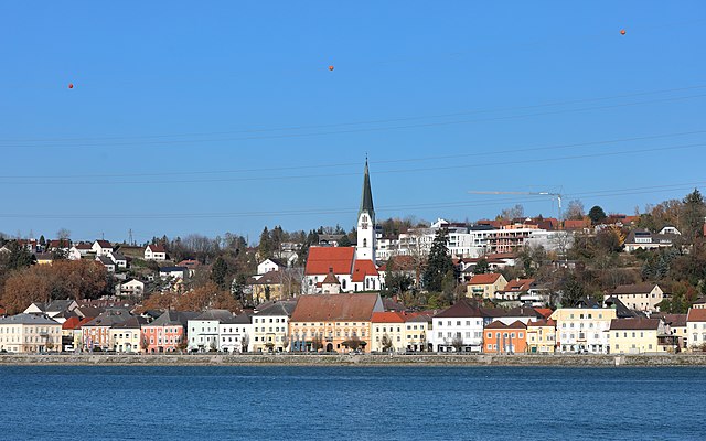
Sankt Nikola an der Donau
- municipality in Austria
Hiking in Sankt Nikola an der Donau
Sankt Nikola an der Donau is a picturesque village located along the Danube River in Austria, surrounded by natural beauty and historical sites, making it a great destination for hiking enthusiasts. Here are some highlights for hiking in the area:...
- Country:
- Postal Code: 4381
- Local Dialing Code: 07268
- Licence Plate Code: PE
- Coordinates: 48° 14' 0" N, 14° 54' 24" E
- GPS tracks (wikiloc): [Link]
- AboveSeaLevel: 249 м m
- Area: 13.18 sq km
- Population: 798
- Web site: [Link]


Schwertberg
- municipality in Austria
Hiking in Schwertberg
Schwertberg, located in Upper Austria, is a great destination for hiking enthusiasts. The region is characterized by picturesque landscapes, lush forests, and rolling hills, making it suitable for various levels of hikers....
- Country:
- Postal Code: 4311
- Local Dialing Code: 07262
- Licence Plate Code: PE
- Coordinates: 48° 16' 18" N, 14° 35' 0" E
- GPS tracks (wikiloc): [Link]
- AboveSeaLevel: 268 м m
- Area: 18.78 sq km
- Population: 5365
- Web site: [Link]
Rechberg
- municipality in Austria
Hiking in Rechberg
Rechberg is a beautiful hiking destination located in the Styria region of Austria. Known for its stunning landscapes, scenic views, and tranquil atmosphere, it offers various hiking trails suitable for different skill levels....
- Country:
- Postal Code: 4324
- Local Dialing Code: 07264
- Licence Plate Code: PE
- Coordinates: 48° 19' 19" N, 14° 42' 44" E
- GPS tracks (wikiloc): [Link]
- AboveSeaLevel: 576 м m
- Area: 13.8 sq km
- Population: 996
- Web site: [Link]

Katsdorf
- municipality in Austria
Hiking in Katsdorf
Katsdorf, located in the Upper Austria region, offers several charming hiking opportunities. The area is characterized by beautiful countryside, rolling hills, and scenic views, making it ideal for both beginners and experienced hikers....
- Country:
- Postal Code: 4223
- Local Dialing Code: 07235
- Licence Plate Code: PE
- Coordinates: 48° 19' 1" N, 14° 28' 27" E
- GPS tracks (wikiloc): [Link]
- AboveSeaLevel: 306 м m
- Area: 14.66 sq km
- Population: 3086
- Web site: [Link]

Bad Kreuzen
- municipality in Austria
Hiking in Bad Kreuzen
Bad Kreuzen is a picturesque village in Austria, located in the region of Upper Austria, which offers a variety of hiking opportunities suitable for all levels of experience. The area is characterized by its lush landscapes, rolling hills, and beautiful natural settings. Here are some key points to consider if you're planning to hike in Bad Kreuzen:...
- Country:
- Postal Code: 4362
- Local Dialing Code: 07266
- Licence Plate Code: PE
- Coordinates: 48° 16' 0" N, 14° 48' 23" E
- GPS tracks (wikiloc): [Link]
- AboveSeaLevel: 474 м m
- Area: 39.9 sq km
- Population: 2266
- Web site: [Link]

Allerheiligen im Mühlkreis
- municipality in Austria
Hiking in Allerheiligen im Mühlkreis
Allerheiligen im Mühlkreis is a charming village located in Upper Austria, surrounded by lush landscapes and offering a range of hiking opportunities. Here are some aspects to consider if you're planning to hike in this area:...
- Country:
- Postal Code: 4320
- Local Dialing Code: 07262
- Licence Plate Code: PE
- Coordinates: 48° 18' 1" N, 14° 38' 1" E
- GPS tracks (wikiloc): [Link]
- AboveSeaLevel: 568 м m
- Area: 20.2 sq km
- Population: 1261
- Web site: [Link]

Luftenberg an der Donau
- municipality in Austria
Hiking in Luftenberg an der Donau
Luftenberg an der Donau is a picturesque village located in Austria, along the beautiful Danube River. The area offers a variety of hiking opportunities, showcasing stunning landscapes, historical sites, and well-marked trails suited for various skill levels....
- Country:
- Postal Code: 4225
- Local Dialing Code: 07237
- Licence Plate Code: PE
- Coordinates: 48° 16' 32" N, 14° 25' 45" E
- GPS tracks (wikiloc): [Link]
- AboveSeaLevel: 295 м m
- Area: 16.86 sq km
- Population: 4057
- Web site: [Link]

Münzbach
- municipality in Austria
Hiking in Münzbach
Münzbach, a picturesque village in Austria, offers a wonderful environment for hiking enthusiasts. Nestled in the foothills of the Alps, the region presents a range of trails that cater to various skill levels, from leisurely strolls to more challenging hikes....
- Country:
- Postal Code: 4323
- Local Dialing Code: 07264
- Licence Plate Code: PE
- Coordinates: 48° 16' 1" N, 14° 42' 56" E
- GPS tracks (wikiloc): [Link]
- AboveSeaLevel: 421 м m
- Area: 24.89 sq km
- Population: 1814
- Web site: [Link]


Sankt Georgen am Walde
- municipality in Austria
Hiking in Sankt Georgen am Walde
Sankt Georgen am Walde is a lovely destination for hiking enthusiasts, located in the beautiful region of Upper Austria. Nestled in the foothills of the Alps, this area offers a variety of trails that cater to different skill levels, allowing both beginners and experienced hikers to enjoy the natural beauty of the landscape....
- Country:
- Postal Code: 4372
- Local Dialing Code: 07954
- Licence Plate Code: PE
- Coordinates: 48° 21' 39" N, 14° 53' 49" E
- GPS tracks (wikiloc): [Link]
- AboveSeaLevel: 787 м m
- Area: 53.55 sq km
- Population: 2006
- Web site: [Link]

Baumgartenberg
- municipality in Austria
Hiking in Baumgartenberg
Baumgartenberg, located in Austria, is a charming area that offers various hiking opportunities for all skill levels. Nestled in the beautiful landscape of Upper Austria, it features rolling hills, lush forests, and stunning views of the surrounding countryside....
- Country:
- Postal Code: 4342
- Local Dialing Code: 07269
- Licence Plate Code: PE
- Coordinates: 48° 12' 32" N, 14° 44' 39" E
- GPS tracks (wikiloc): [Link]
- AboveSeaLevel: 237 м m
- Area: 15.73 sq km
- Population: 1734
- Web site: [Link]
Waldhausen im Strudengau
- municipality in Austria
Hiking in Waldhausen im Strudengau
Waldhausen im Strudengau is a picturesque village located in the heart of the Strudengau region of Austria, surrounded by the stunning landscape of the Danube River and the rolling hills of the Bohemian Forest. Hiking in this area offers a unique blend of natural beauty, historical sites, and cultural experiences....
- Country:
- Postal Code: 4391
- Local Dialing Code: 07260
- Licence Plate Code: PE
- Coordinates: 48° 16' 39" N, 14° 57' 0" E
- GPS tracks (wikiloc): [Link]
- AboveSeaLevel: 470 м m
- Area: 46.85 sq km
- Population: 2870
- Web site: [Link]

Sankt Thomas am Blasenstein
- municipality in Austria
Hiking in Sankt Thomas am Blasenstein
Sankt Thomas am Blasenstein is a charming village located in the Austrian region of Upper Austria, surrounded by beautiful landscapes that are ideal for hiking enthusiasts. The area offers a variety of trails catering to different skill levels, making it a great destination for both beginners and experienced hikers....
- Country:
- Postal Code: 4364
- Local Dialing Code: 07265
- Licence Plate Code: PE
- Coordinates: 48° 18' 47" N, 14° 45' 49" E
- GPS tracks (wikiloc): [Link]
- AboveSeaLevel: 723 м m
- Area: 29.04 sq km
- Population: 927
- Web site: [Link]

Langenstein
- municipality in Austria
Hiking in Langenstein
Langenstein, a picturesque village in Austria, offers numerous opportunities for hiking enthusiasts. Nestled in the scenic landscapes of Styria, it provides access to lush forests, rolling hills, and stunning mountain views. Here’s a general overview of hiking in the area:...
- Country:
- Local Dialing Code: 07237
- Licence Plate Code: PE
- Coordinates: 48° 15' 31" N, 14° 27' 51" E
- GPS tracks (wikiloc): [Link]
- AboveSeaLevel: 245 м m
- Area: 12.36 sq km
- Population: 2534
- Web site: [Link]

Klam
- municipality in Austria
Hiking in Klam
Klamath County, located in southern Oregon, is a fantastic area for hiking, offering diverse landscapes ranging from mountains and forests to lakes and rivers. Here are some highlights:...
- Country:
- Postal Code: 4352
- Local Dialing Code: 07269
- Licence Plate Code: PE
- Coordinates: 48° 13' 29" N, 14° 47' 0" E
- GPS tracks (wikiloc): [Link]
- AboveSeaLevel: 284 м m
- Area: 8.36 sq km
- Population: 918
- Web site: [Link]
Ried in der Riedmark
- municipality in Austria
Hiking in Ried in der Riedmark
Ried in der Riedmark is a charming municipality located in Austria, nestled in the scenic landscape of Upper Austria. The area offers various hiking opportunities for both beginners and more experienced hikers, making it a great destination for outdoor enthusiasts....
- Country:
- Postal Code: 4312
- Local Dialing Code: 07238
- Licence Plate Code: PE
- Coordinates: 48° 16' 16" N, 14° 32' 44" E
- GPS tracks (wikiloc): [Link]
- AboveSeaLevel: 306 м m
- Area: 32.6 sq km
- Population: 4210
- Web site: [Link]

Windhaag bei Perg
- municipality in Austria
Hiking in Windhaag bei Perg
Windhaag bei Perg is a beautiful area in Austria that offers various hiking opportunities, ideal for outdoor enthusiasts. Nestled in the region of Upper Austria, this scenic locality is characterized by its rolling hills, forests, and charming landscapes....
- Country:
- Postal Code: 4322
- Local Dialing Code: 07264
- Licence Plate Code: PE
- Coordinates: 48° 17' 0" N, 14° 40' 49" E
- GPS tracks (wikiloc): [Link]
- AboveSeaLevel: 514 м m
- Area: 19.18 sq km
- Population: 1508
- Web site: [Link]

Saxen
- municipality in Austria
Hiking in Saxen
Saxen is a picturesque area located in Austria, known for its stunning natural landscapes and outdoor recreational opportunities, including hiking. Here’s an overview of what you can expect when hiking in Saxen:...
- Country:
- Postal Code: 4351
- Local Dialing Code: 07269
- Licence Plate Code: PE
- Coordinates: 48° 12' 21" N, 14° 47' 29" E
- GPS tracks (wikiloc): [Link]
- AboveSeaLevel: 242 м m
- Area: 19.07 sq km
- Population: 1820
- Web site: [Link]
Dimbach
- municipality in Austria
Hiking in Dimbach
Dimbach is a small yet picturesque village located in the province of Styria, Austria. It’s a wonderful place for hiking enthusiasts who appreciate nature and the tranquil beauty of the Austrian countryside....
- Country:
- Postal Code: 4371
- Local Dialing Code: 07260
- Licence Plate Code: PE
- Coordinates: 48° 18' 30" N, 14° 54' 37" E
- GPS tracks (wikiloc): [Link]
- AboveSeaLevel: 680 м m
- Area: 31.27 sq km
- Population: 1013
- Web site: [Link]