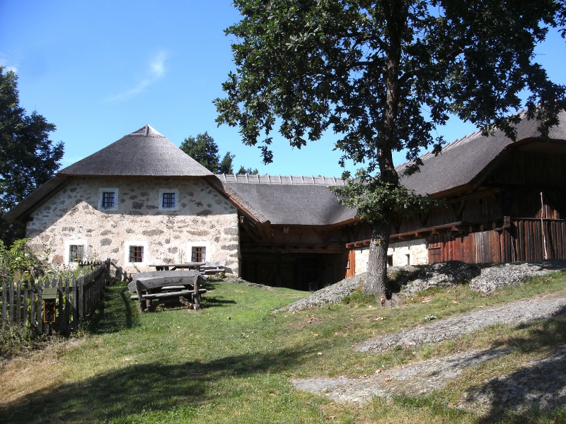
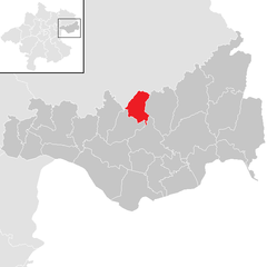
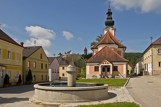
Münzbach (Münzbach)
- municipality in Austria
 Hiking in Münzbach
Münzbach, a picturesque village in Austria, offers a wonderful environment for hiking enthusiasts. Nestled in the foothills of the Alps, the region presents a range of trails that cater to various skill levels, from leisurely strolls to more challenging hikes.
Key Features of Hiking in Münzbach:
-
Scenic Trails: Münzbach is surrounded by stunning landscapes, including lush forests, rolling hills, and picturesque views of the surrounding mountains. Many trails lead through natural beauty, offering a mix of flora and fauna unique to the region.
-
Local Routes: There are several well-marked hiking paths in and around Münzbach. These trails often range from 5 to 15 kilometers, offering different communities the chance to explore. Popular routes may lead you to local landmarks, viewpoints, or through charming villages.
-
Family-Friendly Options: Many of the trails are suitable for families and those looking for a leisurely experience. Look for shorter loops or nature trails that allow for a relaxed outdoor experience.
-
Seasonal Hiking: Each season offers a different experience. Spring and summer bring vibrant greenery and blooming flowers, while autumn showcases stunning foliage. Winter might limit some trails but offers opportunities for snowshoeing and winter hiking.
-
Wildlife and Nature: Hiking in Münzbach provides opportunities to see local wildlife. Bring binoculars for bird watching or enjoy the tranquility of nature.
-
Accessibility: The region is accessible from larger towns and cities in Upper Austria, making it a convenient hiking destination.
-
Local Culture: While hiking, you might also run into traditional Austrian culture, including local cuisine, which you can enjoy in nearby inns or restaurants.
Before heading out, make sure to check local trail maps, weather conditions, and any necessary permits. Preparing properly will ensure you have a safe and enjoyable hiking experience in Münzbach. Happy hiking!
- Country:

- Postal Code: 4323
- Local Dialing Code: 07264
- Licence Plate Code: PE
- Coordinates: 48° 16' 1" N, 14° 42' 56" E


- GPS tracks (wikiloc): [Link]
- AboveSeaLevel: 421 м m
- Area: 24.89 sq km
- Population: 1814
- Web site: http://www.muenzbach.at/
- Wikipedia en: wiki(en)
- Wikipedia: wiki(de)
- Wikidata storage: Wikidata: Q677967
- Wikipedia Commons Category: [Link]
- Wikipedia Commons Maps Category: [Link]
- Freebase ID: [/m/03gv7gb]
- GeoNames ID: Alt: [7872069]
- VIAF ID: Alt: [244357374]
- GND ID: Alt: [7736925-7]
- Austrian municipality key: [41113]
Shares border with regions:

Perg
- municipality in Austria
Hiking in Perg
Hiking in Perg, Austria, is a delightful experience, offering a variety of trails that cater to different skill levels and interests. The region is characterized by its beautiful landscapes, including rolling hills, forests, and scenic vistas overlooking the Danube River....
- Country:
- Postal Code: 4320
- Local Dialing Code: 07262
- Licence Plate Code: PE
- Coordinates: 48° 15' 1" N, 14° 38' 1" E
- GPS tracks (wikiloc): [Link]
- AboveSeaLevel: 250 м m
- Area: 26.44 sq km
- Population: 8388
- Web site: [Link]


Arbing
- municipality in Austria
Hiking in Arbing
Arbing, a small community located in Austria, is surrounded by beautiful natural landscapes, making it an interesting destination for hiking enthusiasts. While it may not be as well-known as larger hiking regions, there are still many opportunities to explore the outdoors in and around Arbing....
- Country:
- Postal Code: 4341
- Local Dialing Code: 07269
- Licence Plate Code: PE
- Coordinates: 48° 13' 39" N, 14° 42' 27" E
- GPS tracks (wikiloc): [Link]
- AboveSeaLevel: 278 м m
- Area: 12.02 sq km
- Population: 1446
- Web site: [Link]
Rechberg
- municipality in Austria
Hiking in Rechberg
Rechberg is a beautiful hiking destination located in the Styria region of Austria. Known for its stunning landscapes, scenic views, and tranquil atmosphere, it offers various hiking trails suitable for different skill levels....
- Country:
- Postal Code: 4324
- Local Dialing Code: 07264
- Licence Plate Code: PE
- Coordinates: 48° 19' 19" N, 14° 42' 44" E
- GPS tracks (wikiloc): [Link]
- AboveSeaLevel: 576 м m
- Area: 13.8 sq km
- Population: 996
- Web site: [Link]

Bad Kreuzen
- municipality in Austria
Hiking in Bad Kreuzen
Bad Kreuzen is a picturesque village in Austria, located in the region of Upper Austria, which offers a variety of hiking opportunities suitable for all levels of experience. The area is characterized by its lush landscapes, rolling hills, and beautiful natural settings. Here are some key points to consider if you're planning to hike in Bad Kreuzen:...
- Country:
- Postal Code: 4362
- Local Dialing Code: 07266
- Licence Plate Code: PE
- Coordinates: 48° 16' 0" N, 14° 48' 23" E
- GPS tracks (wikiloc): [Link]
- AboveSeaLevel: 474 м m
- Area: 39.9 sq km
- Population: 2266
- Web site: [Link]

Baumgartenberg
- municipality in Austria
Hiking in Baumgartenberg
Baumgartenberg, located in Austria, is a charming area that offers various hiking opportunities for all skill levels. Nestled in the beautiful landscape of Upper Austria, it features rolling hills, lush forests, and stunning views of the surrounding countryside....
- Country:
- Postal Code: 4342
- Local Dialing Code: 07269
- Licence Plate Code: PE
- Coordinates: 48° 12' 32" N, 14° 44' 39" E
- GPS tracks (wikiloc): [Link]
- AboveSeaLevel: 237 м m
- Area: 15.73 sq km
- Population: 1734
- Web site: [Link]

Sankt Thomas am Blasenstein
- municipality in Austria
Hiking in Sankt Thomas am Blasenstein
Sankt Thomas am Blasenstein is a charming village located in the Austrian region of Upper Austria, surrounded by beautiful landscapes that are ideal for hiking enthusiasts. The area offers a variety of trails catering to different skill levels, making it a great destination for both beginners and experienced hikers....
- Country:
- Postal Code: 4364
- Local Dialing Code: 07265
- Licence Plate Code: PE
- Coordinates: 48° 18' 47" N, 14° 45' 49" E
- GPS tracks (wikiloc): [Link]
- AboveSeaLevel: 723 м m
- Area: 29.04 sq km
- Population: 927
- Web site: [Link]

Klam
- municipality in Austria
Hiking in Klam
Klamath County, located in southern Oregon, is a fantastic area for hiking, offering diverse landscapes ranging from mountains and forests to lakes and rivers. Here are some highlights:...
- Country:
- Postal Code: 4352
- Local Dialing Code: 07269
- Licence Plate Code: PE
- Coordinates: 48° 13' 29" N, 14° 47' 0" E
- GPS tracks (wikiloc): [Link]
- AboveSeaLevel: 284 м m
- Area: 8.36 sq km
- Population: 918
- Web site: [Link]

Windhaag bei Perg
- municipality in Austria
Hiking in Windhaag bei Perg
Windhaag bei Perg is a beautiful area in Austria that offers various hiking opportunities, ideal for outdoor enthusiasts. Nestled in the region of Upper Austria, this scenic locality is characterized by its rolling hills, forests, and charming landscapes....
- Country:
- Postal Code: 4322
- Local Dialing Code: 07264
- Licence Plate Code: PE
- Coordinates: 48° 17' 0" N, 14° 40' 49" E
- GPS tracks (wikiloc): [Link]
- AboveSeaLevel: 514 м m
- Area: 19.18 sq km
- Population: 1508
- Web site: [Link]