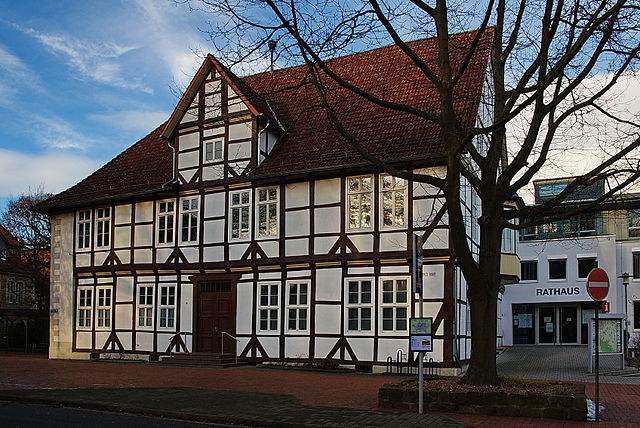
Bad Münder am Deister (Bad Münder am Deister)
- town in Hameln-Pyrmont District, in Lower Saxony, Germany
 Hiking in Bad Münder am Deister
Bad Münder, located in Lower Saxony, Germany, is a charming town situated near the foothills of the renowned Deister mountain range. It offers a variety of hiking opportunities that cater to different skill levels and interests. Here are some highlights of hiking in and around Bad Münder:
Trails and Nature
-
Deister Hills: Just a short distance from Bad Münder, the Deister hills offer numerous hiking trails with varying difficulty levels. These wooded areas provide beautiful scenery and panoramic views.
-
Wellness Trails: Bad Münder is known for its wellness tourism, and there are designated wellness hiking trails that combine nature walks with relaxing spots, often featuring areas to stop and enjoy the tranquility of the woods.
-
Historical Routes: Some trails lead you through historical sites and charming villages, showcasing the region’s rich history and culture. Look for markers and signs that tell the story of the area.
Accessibility
- The trails around Bad Münder are generally accessible, with paths suitable for beginners and families. More experienced hikers can also find challenging routes in the nearby Deister range.
Nature Observations
- The region is rich in biodiversity, offering opportunities for birdwatching and wildlife observation. Bring your binoculars for a chance to see species common to the area.
Facilities
- Bad Münder has amenities such as cafes, restaurants, and accommodations, making it a convenient base for hikers. After a long day on the trails, you can enjoy some local cuisine and a good night's rest.
Tips for Hikers
- Weather Preparation: Always check the weather forecast before heading out, as conditions can change rapidly.
- Footwear: Wear sturdy hiking boots suitable for varied terrain.
- Navigation: Consider using a map or a hiking app for navigation, as trail signs can sometimes be limited.
Events and Guided Tours
- During the hiking season, Bad Münder may have organized guided hikes and events that can provide an enriched experience through expert local knowledge.
Whether you're looking for leisurely walks or more challenging hikes, Bad Münder serves as an excellent starting point for exploring the beautiful landscapes of the Lower Saxony region. Enjoy your adventure!
- Country:

- Postal Code: 31848
- Local Dialing Code: 05042
- Licence Plate Code: HM
- Coordinates: 52° 11' 57" N, 9° 27' 55" E


- GPS tracks (wikiloc): [Link]
- AboveSeaLevel: 119 м m
- Area: 107.69 sq km
- Population: 17356
- Web site: http://www.bad-muender.de/
- Wikipedia en: wiki(en)
- Wikipedia: wiki(de)
- Wikidata storage: Wikidata: Q39779
- Wikipedia Commons Category: [Link]
- Freebase ID: [/m/0c71m0]
- GeoNames ID: Alt: [2953400]
- VIAF ID: Alt: [124378001]
- OSM relation ID: [367045]
- GND ID: Alt: [4040597-7]
- archINFORM location ID: [239]
- Library of Congress authority ID: Alt: [n83226340]
- MusicBrainz area ID: [60e6b366-5f6a-47f3-a8f3-5f6b9a388842]
- WOEID: [636466]
- German municipality key: 03252002
Shares border with regions:


Barsinghausen
- town in Lower Saxony, Germany
Barsinghausen is a town in Lower Saxony, Germany, that is surrounded by beautiful landscapes, making it an excellent location for hiking enthusiasts. Here are some highlights and details regarding hiking in and around Barsinghausen:...
- Country:

- Postal Code: 30890
- Local Dialing Code: 05108; 05035; 05105
- Licence Plate Code: H
- Coordinates: 52° 18' 0" N, 9° 28' 52" E


- GPS tracks (wikiloc): [Link]
- AboveSeaLevel: 142 м m
- Area: 102.65 sq km
- Population: 33922
- Web site: [Link]


Coppenbrügge
- municipality of Germany
Coppenbrügge, located in Lower Saxony, Germany, offers a charming backdrop for hiking enthusiasts. The region is characterized by picturesque landscapes, including rolling hills, lush forests, and scenic views. Here are some highlights and tips for hiking in and around Coppenbrügge:...
- Country:

- Postal Code: 31863
- Local Dialing Code: 05159; 05156
- Licence Plate Code: HM
- Coordinates: 52° 7' 14" N, 9° 32' 56" E


- GPS tracks (wikiloc): [Link]
- AboveSeaLevel: 131 м m
- Area: 89.81 sq km
- Population: 6998
- Web site: [Link]


Springe
- municipality of Germany
Springe is located in Lower Saxony, Germany, and is surrounded by beautiful natural landscapes, making it a fantastic destination for hiking enthusiasts. Here are some highlights and tips for hiking in Springe:...
- Country:

- Postal Code: 31832
- Local Dialing Code: 05045; 05044; 05041
- Licence Plate Code: H
- Coordinates: 52° 13' 0" N, 9° 33' 0" E


- GPS tracks (wikiloc): [Link]
- AboveSeaLevel: 107 м m
- Area: 159.78 sq km
- Population: 28918
- Web site: [Link]

