Bad Pirawarth (Bad Pirawarth)
- municipality in Austria
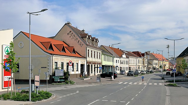
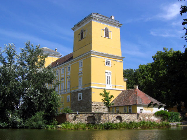
Bad Pirawarth, located in the northeastern part of Austria, is a quaint village known for its scenic landscapes and outdoor activities, including hiking. The region offers a mix of extensive trails that cater to various skill levels, making it a great destination for both novice and experienced hikers.
Key Features of Hiking in Bad Pirawarth:
-
Scenic Trails: The area around Bad Pirawarth boasts numerous hiking paths that wind through picturesque landscapes, including fields, forests, and rolling hills. Many trails provide beautiful views of the surrounding countryside.
-
Accessibility: The trails are generally well-marked, making it easy for hikers to navigate and explore. Access to the hiking routes is typically straightforward, with many beginning from the village itself or nearby parking areas.
-
Variability: Hikes can range from short, leisurely walks to more challenging routes. Some paths may lead to elevation changes, allowing for rewarding views from the top.
-
Nature and Wildlife: As you hike, keep an eye out for local wildlife and enjoy the diverse flora found in the region. Spring and summer are particularly beautiful times to hike, as the area blooms with wildflowers.
-
Local Amenities: After your hike, you can enjoy the amenities in Bad Pirawarth, which may include local eateries or wellness centers. It's a great way to relax and recharge after a day in nature.
Tips for Hiking in Bad Pirawarth:
- Check Route Conditions: Always check the local weather and trail conditions before setting out, especially in changing weather conditions.
- Plan Your Route: Familiarize yourself with trail maps and choose paths that suit your fitness level.
- Stay Hydrated and Prepared: Bring enough water and snacks, especially for longer hikes. Proper footwear and clothing for the weather are crucial.
- Respect Nature: Follow Leave No Trace principles by keeping trails clean and respecting wildlife.
Overall, hiking in Bad Pirawarth can be a delightful experience for nature lovers and anyone looking to enjoy the serene landscapes of Austria.
- Country:

- Postal Code: 2222
- Local Dialing Code: 02574
- Licence Plate Code: GF
- Coordinates: 48° 27' 7" N, 16° 35' 57" E


- GPS tracks (wikiloc): [Link]
- AboveSeaLevel: 177 м m
- Area: 25.42 sq km
- Population: 1671
- Web site: http://www.badpirawarth.at
- Wikipedia en: wiki(en)
- Wikipedia: wiki(de)
- Wikidata storage: Wikidata: Q668639
- Wikipedia Commons Category: [Link]
- Freebase ID: [/m/02qt89g]
- GeoNames ID: Alt: [2771868]
- VIAF ID: Alt: [242282452]
- GND ID: Alt: [4495672-1]
- PACTOLS thesaurus ID: [pcrtco4ZpM4uqK]
- WOEID: [542760]
- Austrian municipality key: [30805]
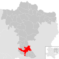
Shares border with regions:

Hochleithen
- municipality in Austria
Hochleithen is a picturesque area that offers various hiking opportunities, nestled in the scenic landscapes of Austria. Here’s a brief overview for anyone considering a hiking trip in Hochleithen:...
- Country:

- Postal Code: 2123
- Local Dialing Code: 02245
- Licence Plate Code: MI
- Coordinates: 48° 27' 0" N, 16° 31' 0" E


- GPS tracks (wikiloc): [Link]
- AboveSeaLevel: 226 м m
- Area: 19.91 sq km
- Population: 1166
- Web site: [Link]

Gaweinstal
- municipality in Austria
Gaweinstal is a small village located in the Lower Austria region of Austria, known for its beautiful landscapes and proximity to the natural beauty of the country. While not a major hiking destination like some larger national parks or mountainous areas, Gaweinstal offers several opportunities for outdoor enthusiasts to explore the surrounding countryside. Here’s what you can expect when hiking in this area:...
- Country:

- Postal Code: 2191
- Local Dialing Code: 02574
- Licence Plate Code: MI
- Coordinates: 48° 28' 41" N, 16° 35' 21" E


- GPS tracks (wikiloc): [Link]
- AboveSeaLevel: 199 м m
- Area: 51.71 sq km
- Population: 3947
- Web site: [Link]

Groß-Schweinbarth
- municipality in Austria
Groß-Schweinbarth, located in Lower Austria, offers a charming landscape for hiking enthusiasts. The area is characterized by its gentle hills, scenic vineyards, and picturesque countryside, making it a delightful destination for both casual walks and more challenging hikes....
- Country:

- Postal Code: 2221
- Local Dialing Code: 02289
- Licence Plate Code: GF
- Coordinates: 48° 25' 0" N, 16° 38' 0" E


- GPS tracks (wikiloc): [Link]
- AboveSeaLevel: 182 м m
- Area: 24.92 sq km
- Population: 1245
- Web site: [Link]
Matzen-Raggendorf
- municipality in Austria
Matzen-Raggendorf, located in Lower Austria, is a beautiful area for hiking, surrounded by picturesque landscapes, rolling hills, and lush forests. Here’s what you need to know about hiking in this region:...
- Country:

- Postal Code: 2243
- Local Dialing Code: 02289
- Licence Plate Code: GF
- Coordinates: 48° 24' 0" N, 16° 42' 0" E


- GPS tracks (wikiloc): [Link]
- AboveSeaLevel: 189 м m
- Area: 35.59 sq km
- Population: 2794
- Web site: [Link]


Wolkersdorf im Weinviertel
- municipality in Austria
 Hiking in Wolkersdorf im Weinviertel
Wolkersdorf im Weinviertel, located in the Lower Austria region, offers several charming hiking opportunities that showcase the beautiful landscapes of the Weinviertel wine region. Here are some key highlights and tips for hiking in this area:...
- Country:

- Postal Code: 2120
- Local Dialing Code: 02245
- Licence Plate Code: MI
- Coordinates: 48° 22' 0" N, 16° 31' 0" E


- GPS tracks (wikiloc): [Link]
- AboveSeaLevel: 178 м m
- Area: 44.38 sq km
- Population: 7201
- Web site: [Link]