Gänserndorf District (Bezirk Gänserndorf)
- district of Austria
 Hiking in Gänserndorf District
Gänserndorf District, located in the northeastern part of Austria, offers a variety of hiking opportunities that showcase its scenic beauty and rich natural landscapes. Here are some aspects to consider when planning a hiking trip in this area:
Hiking Trails
- Nature Trails: The region features several well-marked trails that traverse forests, fields, and riverbanks, allowing hikers to experience the area's diverse ecosystems.
- Danube River Path: This popular long-distance hiking trail follows the Danube River, offering stunning views and the chance to explore quaint villages along the way.
- Local Hiking Routes: Smaller routes are available that typically start in towns like Gänserndorf or surrounding villages, providing a more intimate experience of the local landscape.
Natural Attractions
- Parks and Reserves: The district has several parks and natural reserves, such as the Donau-Auen National Park, which is home to unique flora and fauna and offers various hiking paths.
- Scenic Views: Hikers can enjoy the rolling hills, vineyards, and farmlands, as well as views of the nearby Vienna Woods.
Suitable for All Levels
- The hiking trails in Gänserndorf cater to all skill levels, from easy walks suitable for families to more challenging hikes for experienced trekkers.
Best Times to Hike
- Spring and Autumn: These seasons are particularly pleasant for hiking due to mild temperatures and beautiful foliage.
- Summer: While summer offers longer daylight hours, it can be hot, so it’s advisable to start hikes early in the day.
Preparation Tips
- Footwear: Sturdy hiking boots are recommended, especially if you're going off the beaten path.
- Water and Snacks: Ensure you carry enough water and snacks, as some trails may be remote.
- Navigation: While trails are generally well-marked, it’s a good idea to have a map or a GPS device, especially for longer hikes.
Local Amenities
- Small towns and villages often provide amenities such as shops, cafes, and accommodations, making it convenient for multi-day hiking trips.
Respect for Nature
- As always, practice Leave No Trace principles—stay on marked trails, respect wildlife, and take all trash with you.
If you're planning a hiking trip to Gänserndorf District, you'll be able to enjoy an enjoyable and enriching outdoor experience surrounded by beautiful landscapes!
- Country:

- Licence Plate Code: GF
- Coordinates: 48° 20' 28" N, 16° 43' 5" E


- GPS tracks (wikiloc): [Link]
- AboveSeaLevel: 173 м m
- Area: 1271.31 sq km
- Web site: http://www.noel.gv.at/service/bh/gf/bhgf.htm
- Wikipedia en: wiki(en)
- Wikipedia: wiki(de)
- Wikidata storage: Wikidata: Q694442
- Wikipedia Commons Category: [Link]
- Freebase ID: [/m/0dm8f8]
- GeoNames ID: Alt: [2778876]
- VIAF ID: Alt: [139295998]
- OSM relation ID: [104072]
- GND ID: Alt: [4408747-0]
- archINFORM location ID: [14626]
- Library of Congress authority ID: Alt: [nr98024516]
Includes regions:

Zistersdorf
- municipality in Austria
Zistersdorf is a charming town located in Lower Austria, surrounded by beautiful natural landscapes that are perfect for hiking enthusiasts. The area offers a variety of hiking trails that cater to different skill levels, making it accessible for both beginners and more experienced hikers....
- Country:

- Postal Code: 2225
- Local Dialing Code: +43 2532
- Licence Plate Code: GF
- Coordinates: 48° 31' 0" N, 16° 45' 0" E


- GPS tracks (wikiloc): [Link]
- AboveSeaLevel: 199 м m
- Area: 88.75 sq km
- Population: 5391
- Web site: [Link]

Gänserndorf
- city in Lower Austria
Gänserndorf, located in Lower Austria, offers a variety of hiking opportunities that allow you to experience the beautiful landscapes of the region. While it may not be as well-known as some larger national parks or mountainous areas, there are still plenty of trails and natural sights to explore in and around Gänserndorf....
- Country:

- Postal Code: 2230
- Local Dialing Code: 02282
- Licence Plate Code: GF
- Coordinates: 48° 20' 26" N, 16° 43' 3" E


- GPS tracks (wikiloc): [Link]
- AboveSeaLevel: 167 м m
- Area: 30.56 sq km
- Population: 11404
- Web site: [Link]

Aderklaa
- municipality in Austria
Aderklaa is a small municipality located near Vienna, Austria. While it's not as widely known for hiking as some of the larger national parks or mountain ranges in the region, it can still offer some pleasant walking and hiking opportunities, especially for those looking to explore the picturesque countryside and local trails....
- Country:

- Postal Code: 2232
- Local Dialing Code: 02247
- Licence Plate Code: GF
- Coordinates: 48° 17' 6" N, 16° 32' 13" E


- GPS tracks (wikiloc): [Link]
- AboveSeaLevel: 157 м m
- Area: 8.62 sq km
- Population: 207

Hohenruppersdorf
- municipality in Austria
Hohenruppersdorf is a charming village located in Austria, specifically in the state of Lower Austria. While it may not be a globally recognized hiking destination, it offers a peaceful natural environment that is great for outdoor enthusiasts who enjoy exploring rural landscapes....
- Country:

- Postal Code: 2223
- Local Dialing Code: 02574
- Licence Plate Code: GF
- Coordinates: 48° 27' 0" N, 16° 39' 0" E


- GPS tracks (wikiloc): [Link]
- AboveSeaLevel: 244 м m
- Area: 21.37 sq km
- Population: 910
- Web site: [Link]


Andlersdorf
- municipality in Austria
Andlersdorf is located in Austria, near the region of Lower Austria. While it may not be as widely recognized as some major hiking destinations, it offers beautiful landscapes and trails that can appeal to hiking enthusiasts....
- Country:

- Postal Code: 2301
- Local Dialing Code: 02215
- Licence Plate Code: GF
- Coordinates: 48° 10' 48" N, 16° 40' 0" E


- GPS tracks (wikiloc): [Link]
- AboveSeaLevel: 152 м m
- Area: 5.9 sq km
- Population: 137


Angern an der March
- municipality in Austria
Angern an der March is a charming town located in Lower Austria, close to the border with Slovakia, and offers a wealth of natural beauty and opportunities for hiking. While the town itself is small, the surrounding countryside features picturesque landscapes, making it an appealing destination for outdoor enthusiasts. Here are some key points to consider for hiking in and around Angern an der March:...
- Country:

- Postal Code: 2261
- Local Dialing Code: 02283
- Licence Plate Code: GF
- Coordinates: 48° 23' 0" N, 16° 50' 0" E


- GPS tracks (wikiloc): [Link]
- AboveSeaLevel: 154 м m
- Area: 38.13 sq km
- Population: 3384
- Web site: [Link]
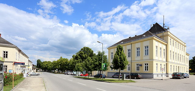
Marchegg
- municipality in Austria
Marchegg, located in Austria near the borders with Slovakia and Hungary, is an excellent destination for hiking enthusiasts, offering beautiful landscapes and diverse natural environments. Here’s what you can expect while hiking in the area:...
- Country:

- Local Dialing Code: 02285
- Licence Plate Code: GF
- Coordinates: 48° 16' 37" N, 16° 54' 25" E


- GPS tracks (wikiloc): [Link]
- AboveSeaLevel: 143 м m
- Area: 45.52 sq km
- Population: 2960
- Web site: [Link]

Engelhartstetten
- municipality in Austria
Engelhartstetten is a small village located in Austria, specifically in the state of Lower Austria. Nestled within the scenic landscapes and gently rolling hills of the region, Engelhartstetten offers a variety of outdoor activities, including hiking....
- Country:

- Postal Code: 2292
- Local Dialing Code: 02214
- Licence Plate Code: GF
- Coordinates: 48° 11' 0" N, 16° 53' 0" E


- GPS tracks (wikiloc): [Link]
- AboveSeaLevel: 143 м m
- Area: 65.66 sq km
- Population: 1979
- Web site: [Link]

Ebenthal, Lower Austria
- municipality in Austria
 Hiking in Ebenthal, Lower Austria
Ebenthal, located in Lower Austria, offers a variety of hiking opportunities that showcase the region's natural beauty. The landscape features rolling hills, vineyards, and some forested areas, making it an excellent destination for both casual walkers and more experienced hikers....
- Country:

- Postal Code: 2251
- Local Dialing Code: 02538
- Licence Plate Code: GF
- Coordinates: 48° 26' 0" N, 16° 47' 0" E


- GPS tracks (wikiloc): [Link]
- AboveSeaLevel: 176 м m
- Area: 18.14 sq km
- Population: 923
- Web site: [Link]
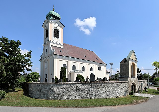
Untersiebenbrunn
- municipality in Austria
Untersiebenbrunn is a charming village located in Austria, specifically in the Lower Austria region. While it may not be as widely known as other hiking destinations, it provides a variety of opportunities for outdoor enthusiasts to enjoy nature and the local landscape....
- Country:

- Postal Code: 2284
- Local Dialing Code: 02286
- Licence Plate Code: GF
- Coordinates: 48° 15' 0" N, 16° 45' 0" E


- GPS tracks (wikiloc): [Link]
- AboveSeaLevel: 158 м m
- Area: 30.49 sq km
- Population: 1736
- Web site: [Link]

Hohenau an der March
- municipality in Austria
 Hiking in Hohenau an der March
Hohenau an der March, situated in the northeastern part of Austria near the border with Slovakia and Hungary, offers scenic hiking opportunities in a beautiful, natural setting. The region is characterized by lush greenery, rolling hills, and nearby wetlands, making it an ideal location for outdoor enthusiasts....
- Country:

- Postal Code: 2273
- Local Dialing Code: 02535
- Licence Plate Code: GF
- Coordinates: 48° 36' 20" N, 16° 54' 20" E


- GPS tracks (wikiloc): [Link]
- AboveSeaLevel: 155 м m
- Area: 23.37 sq km
- Population: 2738
- Web site: [Link]

Dürnkrut
- municipality in Austria
Dürnkrut, a small village located in Austria, offers scenic hiking opportunities that showcase the natural beauty and cultural heritage of the region. While Dürnkrut itself may not be known as a major hiking destination, it is situated near the Danube River and surrounded by picturesque landscapes, making it an excellent starting point for exploring the area....
- Country:

- Postal Code: 2263
- Local Dialing Code: 02538
- Licence Plate Code: GF
- Coordinates: 48° 28' 16" N, 16° 51' 9" E


- GPS tracks (wikiloc): [Link]
- AboveSeaLevel: 161 м m
- Area: 30.4 sq km
- Population: 2267
- Web site: [Link]

Deutsch-Wagram
- municipality in Austria
Deutsch-Wagram is a charming town located in Lower Austria, just northeast of Vienna. While it may not be as widely known for hiking as some of the larger national parks or mountainous regions in Austria, there are still opportunities for hiking and enjoying the natural surroundings....
- Country:

- Postal Code: 2232
- Local Dialing Code: 02247
- Licence Plate Code: GF
- Coordinates: 48° 17' 58" N, 16° 33' 52" E


- GPS tracks (wikiloc): [Link]
- AboveSeaLevel: 159 м m
- Area: 30.61 sq km
- Population: 8651
- Web site: [Link]
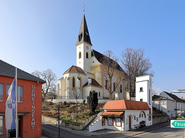
Auersthal
- municipality in Austria
Auersthal, located in Lower Austria, offers a quaint setting for outdoor enthusiasts who enjoy hiking. The region is nestled amidst beautiful landscapes, featuring rolling hills, vineyards, and picturesque views that are characteristic of the broader area....
- Country:

- Postal Code: 2214
- Local Dialing Code: 02288
- Licence Plate Code: GF
- Coordinates: 48° 22' 27" N, 16° 38' 10" E


- GPS tracks (wikiloc): [Link]
- AboveSeaLevel: 178 м m
- Area: 15.18 sq km
- Population: 1932
- Web site: [Link]
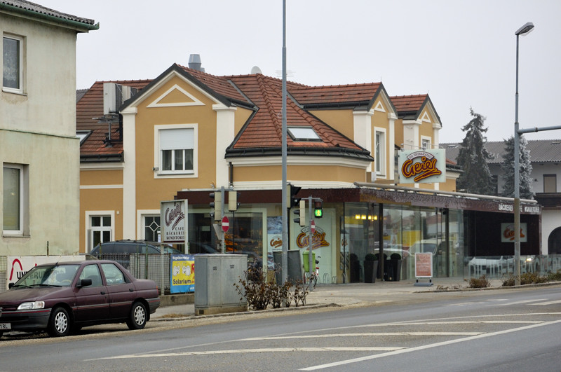
Strasshof an der Nordbahn
- municipality in Austria
 Hiking in Strasshof an der Nordbahn
Strasshof an der Nordbahn is a small town located north of Vienna, Austria, and while it may not be as famous as other hiking destinations, there is still potential for enjoyable outdoor activities in the surrounding areas....
- Country:

- Postal Code: 2231
- Local Dialing Code: 02587
- Licence Plate Code: GF
- Coordinates: 48° 19' 10" N, 16° 38' 51" E


- GPS tracks (wikiloc): [Link]
- AboveSeaLevel: 165 м m
- Area: 11.63 sq km
- Population: 10009
- Web site: [Link]

Groß-Schweinbarth
- municipality in Austria
Groß-Schweinbarth, located in Lower Austria, offers a charming landscape for hiking enthusiasts. The area is characterized by its gentle hills, scenic vineyards, and picturesque countryside, making it a delightful destination for both casual walks and more challenging hikes....
- Country:

- Postal Code: 2221
- Local Dialing Code: 02289
- Licence Plate Code: GF
- Coordinates: 48° 25' 0" N, 16° 38' 0" E


- GPS tracks (wikiloc): [Link]
- AboveSeaLevel: 182 м m
- Area: 24.92 sq km
- Population: 1245
- Web site: [Link]

Palterndorf-Dobermannsdorf
- municipality in Austria
 Hiking in Palterndorf-Dobermannsdorf
Palterndorf-Dobermannsdorf is a small municipality in Lower Austria, known for its picturesque countryside and tranquil landscapes, which can provide some pleasant hiking opportunities. While it may not be as well-known for extensive hiking trails as other regions in Austria, it offers a serene environment suitable for nature walks and easy hikes....
- Country:

- Postal Code: 2181
- Local Dialing Code: 02533
- Licence Plate Code: GF
- Coordinates: 48° 35' 27" N, 16° 49' 0" E


- GPS tracks (wikiloc): [Link]
- AboveSeaLevel: 164 м m
- Area: 18.64 sq km
- Population: 1333
- Web site: [Link]

Eckartsau
- municipality in Austria
Eckartsau is a charming area located in the northeastern part of Austria, known for its scenic landscapes and rich natural surroundings. Situated near the Danube River, it offers various hiking opportunities that cater to all levels of hikers, from beginners to experienced trekkers....
- Country:

- Postal Code: 2305
- Local Dialing Code: 02214
- Licence Plate Code: GF
- Coordinates: 48° 8' 43" N, 16° 47' 51" E


- GPS tracks (wikiloc): [Link]
- AboveSeaLevel: 147 м m
- Area: 48.97 sq km
- Population: 1283
- Web site: [Link]


Neusiedl an der Zaya
- municipality in Austria
 Hiking in Neusiedl an der Zaya
Neusiedl an der Zaya is a charming village in the northeastern part of Austria, located near the border with the Czech Republic. While it may not be as well-known for hiking as some of the alpine regions in Austria, the area around Neusiedl an der Zaya offers some lovely opportunities for nature walks and hiking, particularly for those who enjoy scenic countryside and flat terrain....
- Country:

- Postal Code: 2183
- Local Dialing Code: 02533
- Licence Plate Code: GF
- Coordinates: 48° 36' 5" N, 16° 47' 11" E


- GPS tracks (wikiloc): [Link]
- AboveSeaLevel: 175 м m
- Area: 17.58 sq km
- Population: 1252
- Web site: [Link]

Schönkirchen-Reyersdorf
- municipality in Austria
 Hiking in Schönkirchen-Reyersdorf
Schönkirchen-Reyersdorf, located near Vienna, Austria, offers various opportunities for outdoor enthusiasts, including hiking. While it's a small district, its proximity to the scenic landscapes of the region provides hikers with beautiful trails and natural scenery....
- Country:

- Postal Code: 2241
- Local Dialing Code: 02282
- Licence Plate Code: GF
- Coordinates: 48° 21' 0" N, 16° 42' 0" E


- GPS tracks (wikiloc): [Link]
- AboveSeaLevel: 161 м m
- Area: 17.88 sq km
- Population: 1963
- Web site: [Link]

Bad Pirawarth
- municipality in Austria
Bad Pirawarth, located in the northeastern part of Austria, is a quaint village known for its scenic landscapes and outdoor activities, including hiking. The region offers a mix of extensive trails that cater to various skill levels, making it a great destination for both novice and experienced hikers....
- Country:

- Postal Code: 2222
- Local Dialing Code: 02574
- Licence Plate Code: GF
- Coordinates: 48° 27' 7" N, 16° 35' 57" E


- GPS tracks (wikiloc): [Link]
- AboveSeaLevel: 177 м m
- Area: 25.42 sq km
- Population: 1671
- Web site: [Link]

Ringelsdorf-Niederabsdorf
- municipality in Austria
 Hiking in Ringelsdorf-Niederabsdorf
Ringelsdorf-Niederabsdorf is a small municipality located in Lower Austria, near Vienna. The area is characterized by its beautiful natural landscapes, rural charm, and access to various natural trails that can be enjoyed year-round. While it may not be as well-known as some other hiking destinations, it offers a great opportunity for those looking to escape into nature....
- Country:

- Postal Code: 2272
- Local Dialing Code: 02536
- Licence Plate Code: GF
- Coordinates: 48° 34' 0" N, 16° 52' 0" E


- GPS tracks (wikiloc): [Link]
- AboveSeaLevel: 170 м m
- Area: 32.46 sq km
- Population: 1260
- Web site: [Link]

Sulz im Weinviertel
- municipality in Austria
Sulz im Weinviertel, located in the picturesque Weinviertel region of Austria, offers a variety of hiking opportunities that showcase the beauty of its rolling landscapes, vineyards, and charming villages. Here's what you can expect when hiking in this part of Austria:...
- Country:

- Postal Code: 2224
- Local Dialing Code: 02534
- Licence Plate Code: GF
- Coordinates: 48° 29' 0" N, 16° 40' 0" E


- GPS tracks (wikiloc): [Link]
- AboveSeaLevel: 227 м m
- Area: 31.37 sq km
- Population: 1189
- Web site: [Link]

Weiden an der March
- municipality in Austria
Weiden an der March is a charming village located in Austria, near the border with Slovakia. It is surrounded by beautiful natural landscapes that offer great opportunities for hiking and outdoor activities. Here are some highlights for hiking in and around Weiden an der March:...
- Country:

- Postal Code: 2295
- Local Dialing Code: 02284
- Licence Plate Code: GF
- Coordinates: 48° 18' 0" N, 16° 49' 0" E


- GPS tracks (wikiloc): [Link]
- AboveSeaLevel: 162 м m
- Area: 55.8 sq km
- Population: 991
- Web site: [Link]

Leopoldsdorf im Marchfelde
- municipality in Austria
 Hiking in Leopoldsdorf im Marchfelde
Leopoldsdorf im Marchfelde is a small village located in Lower Austria, known for its scenic landscapes and proximity to nature. Hiking in this area can be a wonderful experience, especially during the spring months like March when nature starts to awaken....
- Country:

- Postal Code: 2285
- Local Dialing Code: 02216
- Licence Plate Code: GF
- Coordinates: 48° 13' 27" N, 16° 41' 23" E


- GPS tracks (wikiloc): [Link]
- AboveSeaLevel: 151 м m
- Area: 28.95 sq km
- Population: 2848
- Web site: [Link]

Drösing
- municipality in Austria
Drösing is a village located in Austria, near the borders of the municipality of surrounding areas, making it a picturesque and tranquil spot for hiking enthusiasts. While Drösing itself might not have extensive hiking trails, the surrounding region offers several opportunities for outdoor adventures....
- Country:

- Postal Code: 2265
- Local Dialing Code: 02536
- Licence Plate Code: GF
- Coordinates: 48° 32' 26" N, 16° 54' 8" E


- GPS tracks (wikiloc): [Link]
- AboveSeaLevel: 158 м m
- Area: 29.49 sq km
- Population: 1132
- Web site: [Link]

Spannberg
- municipality in Austria
Spannberg, located in Lower Austria, is a great destination for hiking enthusiasts. The area is characterized by its picturesque landscapes, rolling hills, and lush greenery, making it perfect for outdoor activities....
- Country:

- Postal Code: 2244
- Local Dialing Code: 02538
- Licence Plate Code: GF
- Coordinates: 48° 27' 0" N, 16° 43' 0" E


- GPS tracks (wikiloc): [Link]
- AboveSeaLevel: 186 м m
- Area: 19.51 sq km
- Population: 1010
- Web site: [Link]

Hauskirchen
- municipality in Austria
Hauskirchen is a small village located in Upper Austria, nestled amidst beautiful landscapes that are perfect for hiking enthusiasts. Although it may not be a well-known hiking destination, the surrounding areas offer a variety of trails that showcase the region's natural beauty, including rolling hills, dense forests, and picturesque views of the countryside....
- Country:

- Postal Code: 2184
- Local Dialing Code: 02533
- Licence Plate Code: GF
- Coordinates: 48° 36' 46" N, 16° 45' 28" E


- GPS tracks (wikiloc): [Link]
- AboveSeaLevel: 182 м m
- Area: 22.04 sq km
- Population: 1248
- Web site: [Link]

Prottes
- municipality in Austria
Prottes, a quaint village located in the northeastern part of Austria, offers a range of charming hiking opportunities amidst picturesque landscapes. While not as widely known as other hiking destinations, it provides a unique experience for those looking to explore the natural beauty of the region....
- Country:

- Postal Code: 2242
- Local Dialing Code: 02282
- Licence Plate Code: GF
- Coordinates: 48° 23' 0" N, 16° 44' 0" E


- GPS tracks (wikiloc): [Link]
- AboveSeaLevel: 162 м m
- Area: 13.7 sq km
- Population: 1436
- Web site: [Link]
Jedenspeigen
- municipality in Austria
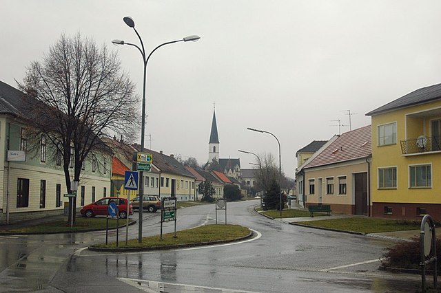
Jedenspeigen is a picturesque village located in the Lower Austria region of Austria, near the banks of the Danube River. While it might not be as widely known as other hiking destinations, it does offer some beautiful natural landscapes and opportunities for outdoor activities, particularly hiking and cycling....
- Country:

- Postal Code: 2264
- Local Dialing Code: 02536
- Licence Plate Code: GF
- Coordinates: 48° 30' 0" N, 16° 52' 0" E


- GPS tracks (wikiloc): [Link]
- AboveSeaLevel: 158 м m
- Area: 23.22 sq km
- Population: 1064
- Web site: [Link]

Velm-Götzendorf
- municipality in Austria
Velm-Götzendorf, located in Austria, is a charming area that offers numerous opportunities for hiking amidst picturesque landscapes. The region is characterized by rolling hills, lush forests, and expansive fields, making it a great destination for both beginners and experienced hikers....
- Country:

- Postal Code: 2245
- Local Dialing Code: 02538
- Licence Plate Code: GF
- Coordinates: 48° 28' 0" N, 16° 47' 0" E


- GPS tracks (wikiloc): [Link]
- AboveSeaLevel: 183 м m
- Area: 17.7 sq km
- Population: 735
- Web site: [Link]

Glinzendorf
- municipality in Austria
Glinzendorf is a small village located in the Lower Austria region of Austria. While it may not be as widely recognized as some of the more popular hiking destinations, it offers a tranquil environment and picturesque landscapes that can be quite enjoyable for hikers looking for a peaceful experience away from the busier trails....
- Country:

- Postal Code: 2282
- Local Dialing Code: 02248
- Licence Plate Code: GF
- Coordinates: 48° 14' 47" N, 16° 38' 25" E


- GPS tracks (wikiloc): [Link]
- AboveSeaLevel: 152 м m
- Area: 10.43 sq km
- Population: 295


Haringsee
- municipality in Austria
Haringsee, located in Austria, is a charming area with several opportunities for hiking and enjoying the natural landscape. Although it's not as widely known as some major hiking destinations, it offers a variety of trails that cater to different skill levels and preferences....
- Country:

- Postal Code: 2286
- Local Dialing Code: 0 22 14
- Licence Plate Code: GF
- Coordinates: 48° 11' 0" N, 16° 47' 0" E


- GPS tracks (wikiloc): [Link]
- AboveSeaLevel: 147 м m
- Area: 27.11 sq km
- Population: 1179
- Web site: [Link]

Großhofen
- municipality in Austria
Großhofen, located in the scenic region of southern Germany, offers various hiking opportunities that cater to both novice and experienced hikers. The area's landscape features rolling hills, lush forests, and picturesque views of the countryside....
- Country:

- Postal Code: 2282
- Local Dialing Code: 02248
- Licence Plate Code: GF
- Coordinates: 48° 15' 0" N, 16° 37' 0" E


- GPS tracks (wikiloc): [Link]
- AboveSeaLevel: 153 м m
- Area: 6.18 sq km
- Population: 98

Weikendorf
- municipality in Austria
Weikendorf, located in Lower Austria, offers a variety of landscapes and hiking opportunities for outdoor enthusiasts. The area is characterized by its picturesque countryside, rolling hills, and lush greenery, making it a great destination for both novice and experienced hikers. Here are some highlights and tips for hiking in Weikendorf:...
- Country:

- Postal Code: 2253
- Local Dialing Code: 02282
- Licence Plate Code: GF
- Coordinates: 48° 21' 0" N, 16° 46' 0" E


- GPS tracks (wikiloc): [Link]
- AboveSeaLevel: 152 м m
- Area: 46.3 sq km
- Population: 2029
- Web site: [Link]

Obersiebenbrunn
- municipality in Austria
Obersiebenbrunn is a small village in Austria, located in the northeastern part of the country, close to the border with Hungary. While it may not be a major hiking destination like some of Austria's more famous alpine regions, it offers some opportunities for outdoor enthusiasts looking for a more tranquil experience away from crowded tourist areas....
- Country:

- Postal Code: 2283
- Local Dialing Code: 02286
- Licence Plate Code: GF
- Coordinates: 48° 15' 54" N, 16° 42' 27" E


- GPS tracks (wikiloc): [Link]
- AboveSeaLevel: 151 м m
- Area: 26.93 sq km
- Population: 1708
- Web site: [Link]

Parbasdorf
- municipality in Austria
Parbasdorf is a small locality located near Vienna in Austria, primarily known for its residential areas and proximity to larger green spaces and the Vienna Woods. While it may not be a major hiking destination itself, it serves as a good starting point for exploring nearby natural areas....
- Country:

- Postal Code: 2232
- Local Dialing Code: 02247
- Licence Plate Code: GF
- Coordinates: 48° 16' 44" N, 16° 35' 22" E


- GPS tracks (wikiloc): [Link]
- AboveSeaLevel: 156 м m
- Area: 10.23 sq km
- Population: 169
- Web site: [Link]
Matzen-Raggendorf
- municipality in Austria
Matzen-Raggendorf, located in Lower Austria, is a beautiful area for hiking, surrounded by picturesque landscapes, rolling hills, and lush forests. Here’s what you need to know about hiking in this region:...
- Country:

- Postal Code: 2243
- Local Dialing Code: 02289
- Licence Plate Code: GF
- Coordinates: 48° 24' 0" N, 16° 42' 0" E


- GPS tracks (wikiloc): [Link]
- AboveSeaLevel: 189 м m
- Area: 35.59 sq km
- Population: 2794
- Web site: [Link]

Markgrafneusiedl
- municipality in Austria
Markgrafneusiedl, a small village in Austria situated in the Burgenland region, offers a unique and enjoyable setting for hiking enthusiasts, especially those looking for a rural and tranquil experience. The region is characterized by its scenic landscapes, including rolling hills, expansive fields, and proximity to the Neusiedler See, which is a UNESCO World Heritage Site....
- Country:

- Postal Code: 2282
- Local Dialing Code: 0 22 48
- Licence Plate Code: GF
- Coordinates: 48° 16' 1" N, 16° 37' 55" E


- GPS tracks (wikiloc): [Link]
- AboveSeaLevel: 154 м m
- Area: 19.82 sq km
- Population: 832
- Web site: [Link]
Mannsdorf an der Donau
- municipality in Austria
 Hiking in Mannsdorf an der Donau
Mannsdorf an der Donau is a picturesque village located in Austria, near the Danube River. It's surrounded by beautiful landscapes, making it an appealing destination for hikers and nature enthusiasts. Here are some highlights and tips for hiking in the area:...
- Country:

- Postal Code: 2304
- Local Dialing Code: 02212
- Licence Plate Code: GF
- Coordinates: 48° 9' 8" N, 16° 39' 48" E


- GPS tracks (wikiloc): [Link]
- AboveSeaLevel: 151 м m
- Area: 10.31 sq km
- Population: 342
- Web site: [Link]

Lassee
- municipality in Austria
Lassee is a charming village located in Lower Austria, close to the border with the city of Vienna. While primarily known for its agricultural landscape and proximity to urban areas, Lassee and its surroundings offer a variety of hiking opportunities that cater to different skill levels....
- Country:

- Postal Code: 2291
- Local Dialing Code: 02213
- Licence Plate Code: GF
- Coordinates: 48° 13' 32" N, 16° 49' 23" E


- GPS tracks (wikiloc): [Link]
- AboveSeaLevel: 148 м m
- Area: 55.62 sq km
- Population: 2765
- Web site: [Link]


Raasdorf
- municipality in Austria
Raasdorf is a charming small village located in Austria, near the border with Slovakia, and close to the capital city of Vienna. While it's not a major hiking destination on its own, the surrounding area offers some attractive opportunities for outdoor enthusiasts....
- Country:

- Postal Code: 2281
- Local Dialing Code: 0 2249
- Licence Plate Code: GF
- Coordinates: 48° 14' 48" N, 16° 33' 52" E


- GPS tracks (wikiloc): [Link]
- AboveSeaLevel: 156 м m
- Area: 13.21 sq km
- Population: 645
- Web site: [Link]

Groß-Enzersdorf
- municipality in Austria
Groß-Enzersdorf, located in Lower Austria, is a great destination for hiking enthusiasts. The area is known for its beautiful natural landscapes, charming villages, and various walking trails that cater to different skill levels. Here are some highlights and tips for hiking in Groß-Enzersdorf:...
- Country:

- Postal Code: 2301
- Licence Plate Code: GF
- Coordinates: 48° 12' 0" N, 16° 33' 0" E


- GPS tracks (wikiloc): [Link]
- AboveSeaLevel: 156 м m
- Area: 83.91 sq km
- Population: 11206
- Web site: [Link]

Orth an der Donau
- municipality in Austria
Orth an der Donau is a charming village located in Austria, nestled along the banks of the Danube River. The region offers a variety of hiking opportunities that can be enjoyed by all levels of hikers....
- Country:

- Postal Code: 2304
- Local Dialing Code: 02212
- Licence Plate Code: GF
- Coordinates: 48° 8' 40" N, 16° 42' 5" E


- GPS tracks (wikiloc): [Link]
- AboveSeaLevel: 150 м m
- Area: 33.41 sq km
- Population: 2086
- Web site: [Link]
Shares border with regions:


Vienna
- capital and one of nine States of Austria
As a hiking instructor, I'd be happy to tell you about hiking opportunities in Vienna! While Vienna is primarily known for its rich history, art, and culture, it also offers beautiful natural spaces perfect for hiking. Here are some of the top spots:...
- Country:

- Postal Code: 1901; 1810; 1600–1601; 1502–1503; 1500; 1423; 1421; 1300–1301; 1251–1255; 1402; 1400; 1000–1239
- Local Dialing Code: 01
- Licence Plate Code: W
- Coordinates: 48° 12' 30" N, 16° 22' 23" E


- GPS tracks (wikiloc): [Link]
- AboveSeaLevel: 542 м m
- Area: 414.87 sq km
- Population: 1840573
- Web site: [Link]

Mistelbach District
- district of Austria
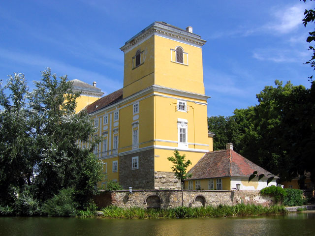
Mistelbach District, located in the northeastern part of Austria, offers a variety of beautiful hiking opportunities amidst its picturesque landscapes. The region is characterized by rolling hills, vineyards, and scenic views, making it a great destination for hikers of all levels....
- Country:

- Licence Plate Code: MI
- Coordinates: 48° 38' 38" N, 16° 30' 7" E


- GPS tracks (wikiloc): [Link]
- AboveSeaLevel: 220 м m
- Area: 1291.30 sq km
- Web site: [Link]


Wien-Umgebung District
- former district of the state of Lower Austria in Austria
 Hiking in Wien-Umgebung District
Wien-Umgebung, or the Vienna Surroundings District, offers a variety of beautiful hiking opportunities right outside the bustling capital of Austria. Here are some highlights and features of hiking in this region:...
- Country:

- Capital: Klosterneuburg
- Licence Plate Code: WU
- Coordinates: 48° 18' 0" N, 16° 19' 0" E


- GPS tracks (wikiloc): [Link]
- AboveSeaLevel: 346 м m
- Area: 484.48 sq km
- Web site: [Link]


Bruck an der Leitha
- district in Austria
Bruck an der Leitha District, located in Austria near the borders with Slovakia and Hungary, offers a variety of hiking opportunities that showcase its natural beauty and historical significance. Here are some key features to consider when hiking in this area:...
- Country:

- Coordinates: 48° 4' 1" N, 16° 46' 44" E


- GPS tracks (wikiloc): [Link]
- AboveSeaLevel: 201 м m
- Area: 494.95 sq km
- Population: 44969
- Web site: [Link]
