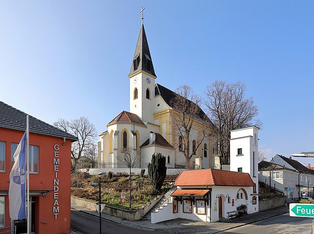
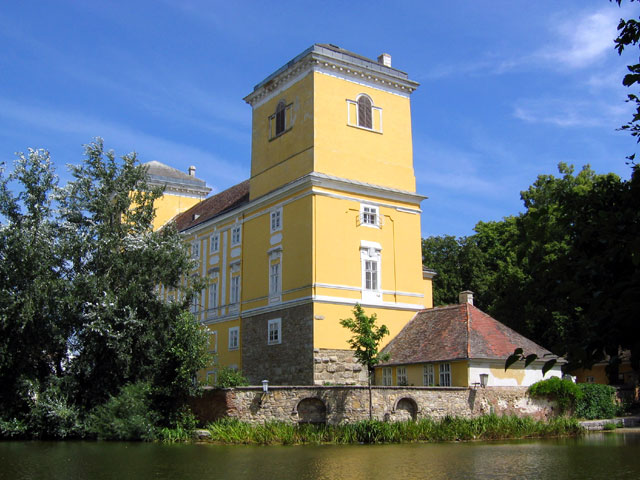
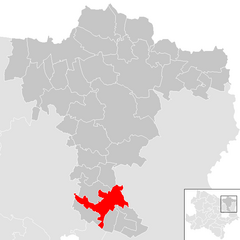
Groß-Schweinbarth (Groß-Schweinbarth)
- municipality in Austria
 Hiking in Groß-Schweinbarth
Groß-Schweinbarth, located in Lower Austria, offers a charming landscape for hiking enthusiasts. The area is characterized by its gentle hills, scenic vineyards, and picturesque countryside, making it a delightful destination for both casual walks and more challenging hikes.
Hiking Trails
- Local Trails: There are various well-marked trails that cater to different skill levels. The routes often lead through vineyards, forests, and fields, allowing hikers to enjoy the natural beauty and perhaps even stop for some local wine sampling.
- Surrounding Nature Parks: The nearby nature parks provide more extensive hiking opportunities, where you can explore diverse flora and fauna.
Tips for Hiking in Groß-Schweinbarth
- Best Time to Visit: Spring and autumn are ideal times for hiking, as the weather is mild and the countryside is particularly beautiful during these seasons.
- Local Amenities: Ensure to have access to water and snacks, as while there may be some local eateries, options might be limited in more remote areas.
- Prepare for Weather Changes: The weather can change quickly, so it's wise to check the forecast and be prepared for different conditions.
- Respect Nature: Follow marked trails and practice Leave No Trace principles to help preserve the natural beauty of the area.
Highlights
- Scenic Views: Many trails offer panoramic views of the surrounding landscape, especially from elevated points.
- Cultural Sites: You may encounter charming villages, local churches, and historical landmarks along your hikes, making it a great way to blend nature and culture.
Overall, Groß-Schweinbarth presents a peaceful retreat for hikers looking to enjoy the serene countryside of Austria while experiencing its rich agricultural heritage. Whether you're out for a day hike or a longer trek, you’re sure to find joy and beauty in this idyllic area.
- Country:

- Postal Code: 2221
- Local Dialing Code: 02289
- Licence Plate Code: GF
- Coordinates: 48° 25' 0" N, 16° 38' 0" E


- GPS tracks (wikiloc): [Link]
- AboveSeaLevel: 182 м m
- Area: 24.92 sq km
- Population: 1245
- Web site: http://www.gross-schweinbarth.at
- Wikipedia en: wiki(en)
- Wikipedia: wiki(de)
- Wikidata storage: Wikidata: Q667723
- Wikipedia Commons Category: [Link]
- Freebase ID: [/m/02qtshs]
- GeoNames ID: Alt: [2777593]
- GND ID: Alt: [4280425-5]
- Austrian municipality key: [30824]
Shares border with regions:
Auersthal
- municipality in Austria
Hiking in Auersthal
Auersthal, located in Lower Austria, offers a quaint setting for outdoor enthusiasts who enjoy hiking. The region is nestled amidst beautiful landscapes, featuring rolling hills, vineyards, and picturesque views that are characteristic of the broader area....
- Country:
- Postal Code: 2214
- Local Dialing Code: 02288
- Licence Plate Code: GF
- Coordinates: 48° 22' 27" N, 16° 38' 10" E
- GPS tracks (wikiloc): [Link]
- AboveSeaLevel: 178 м m
- Area: 15.18 sq km
- Population: 1932
- Web site: [Link]

Bad Pirawarth
- municipality in Austria
Hiking in Bad Pirawarth
Bad Pirawarth, located in the northeastern part of Austria, is a quaint village known for its scenic landscapes and outdoor activities, including hiking. The region offers a mix of extensive trails that cater to various skill levels, making it a great destination for both novice and experienced hikers....
- Country:
- Postal Code: 2222
- Local Dialing Code: 02574
- Licence Plate Code: GF
- Coordinates: 48° 27' 7" N, 16° 35' 57" E
- GPS tracks (wikiloc): [Link]
- AboveSeaLevel: 177 м m
- Area: 25.42 sq km
- Population: 1671
- Web site: [Link]

Matzen-Raggendorf
- municipality in Austria
Hiking in Matzen-Raggendorf
Matzen-Raggendorf, located in Lower Austria, is a beautiful area for hiking, surrounded by picturesque landscapes, rolling hills, and lush forests. Here’s what you need to know about hiking in this region:...
- Country:
- Postal Code: 2243
- Local Dialing Code: 02289
- Licence Plate Code: GF
- Coordinates: 48° 24' 0" N, 16° 42' 0" E
- GPS tracks (wikiloc): [Link]
- AboveSeaLevel: 189 м m
- Area: 35.59 sq km
- Population: 2794
- Web site: [Link]
Wolkersdorf im Weinviertel
- municipality in Austria
Hiking in Wolkersdorf im Weinviertel
Wolkersdorf im Weinviertel, located in the Lower Austria region, offers several charming hiking opportunities that showcase the beautiful landscapes of the Weinviertel wine region. Here are some key highlights and tips for hiking in this area:...
- Country:
- Postal Code: 2120
- Local Dialing Code: 02245
- Licence Plate Code: MI
- Coordinates: 48° 22' 0" N, 16° 31' 0" E
- GPS tracks (wikiloc): [Link]
- AboveSeaLevel: 178 м m
- Area: 44.38 sq km
- Population: 7201
- Web site: [Link]