Bains-les-Bains (Bains-les-Bains)

- former commune in Vosges, France
- Country:

- Postal Code: 88240
- Coordinates: 48° 0' 9" N, 6° 15' 49" E


- GPS tracks (wikiloc): [Link]
- AboveSeaLevel: 325 м m
- Area: 25.37 sq km
- Population: 1208
- Web site: http://www.bainslesbains.fr
- Wikipedia en: wiki(en)
- Wikipedia: wiki(fr)
- Wikidata storage: Wikidata: Q768030
- Wikipedia Commons Category: [Link]
- Freebase ID: [/m/03qgv17]
- Freebase ID: [/m/03qgv17]
- GeoNames ID: Alt: [6451764]
- GeoNames ID: Alt: [6451764]
- BnF ID: [15278958c]
- BnF ID: [15278958c]
- VIAF ID: Alt: [128776110]
- VIAF ID: Alt: [128776110]
- GND ID: Alt: [4249060-1]
- GND ID: Alt: [4249060-1]
- Library of Congress authority ID: Alt: [no2012019825]
- Library of Congress authority ID: Alt: [no2012019825]
- Digital Atlas of the Roman Empire ID: [20760]
- Digital Atlas of the Roman Empire ID: [20760]
- INSEE municipality code: 88029
- INSEE municipality code: 88029
Shares border with regions:


Hautmougey
- former commune in Vosges, France
- Country:
- Postal Code: 88240
- Coordinates: 48° 1' 42" N, 6° 13' 57" E
- GPS tracks (wikiloc): [Link]
- Area: 7.87 sq km
- Population: 134


Le Clerjus
- commune in Vosges, France
- Country:
- Postal Code: 88240
- Coordinates: 47° 57' 34" N, 6° 19' 17" E
- GPS tracks (wikiloc): [Link]
- Area: 32.93 sq km
- Population: 561


Fontenoy-le-Château
- former commune in Vosges, France
- Country:
- Postal Code: 88240
- Coordinates: 47° 58' 25" N, 6° 11' 57" E
- GPS tracks (wikiloc): [Link]
- Area: 34.6 sq km
- Population: 586


Trémonzey
- commune in Vosges, France
- Country:
- Postal Code: 88240
- Coordinates: 47° 58' 24" N, 6° 14' 12" E
- GPS tracks (wikiloc): [Link]
- Area: 9.07 sq km
- Population: 237


La Chapelle-aux-Bois
- commune in Vosges, France
- Country:
- Postal Code: 88240
- Coordinates: 48° 2' 13" N, 6° 19' 56" E
- GPS tracks (wikiloc): [Link]
- Area: 30.65 sq km
- Population: 666
- Web site: [Link]

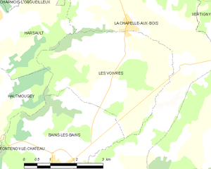
Les Voivres
- commune in Vosges, France
- Country:
- Postal Code: 88240
- Coordinates: 48° 1' 52" N, 6° 17' 41" E
- GPS tracks (wikiloc): [Link]
- Area: 12.81 sq km
- Population: 320