Balagny-sur-Thérain (Balagny-sur-Thérain)

- commune in Oise, France
- Country:

- Postal Code: 60250
- Coordinates: 49° 17' 43" N, 2° 20' 11" E


- GPS tracks (wikiloc): [Link]
- Area: 6.8 sq km
- Population: 1690
- Web site: http://www.mairie-balagnysurtherain.fr/
- Wikipedia en: wiki(en)
- Wikipedia: wiki(fr)
- Wikidata storage: Wikidata: Q1098975
- Wikipedia Commons Category: [Link]
- Freebase ID: [/m/03qfv96]
- GeoNames ID: Alt: [3035286]
- SIREN number: [216000430]
- BnF ID: [152672836]
- VIAF ID: Alt: [124509680]
- Library of Congress authority ID: Alt: [n97081409]
- EMLO location ID: [1533adcd-eb58-4563-a2be-d8ae5cdee7e3]
- INSEE municipality code: 60044
Shares border with regions:

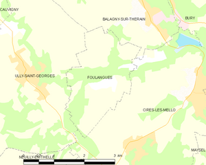
Foulangues
- commune in Oise, France
- Country:
- Postal Code: 60250
- Coordinates: 49° 16' 29" N, 2° 18' 50" E
- GPS tracks (wikiloc): [Link]
- Area: 5.13 sq km
- Population: 198


Cires-lès-Mello
- commune in Oise, France
- Country:
- Postal Code: 60660
- Coordinates: 49° 16' 23" N, 2° 21' 24" E
- GPS tracks (wikiloc): [Link]
- Area: 16.73 sq km
- Population: 3928
- Web site: [Link]


Bury
- commune in Oise, France
- Country:
- Postal Code: 60250
- Coordinates: 49° 18' 50" N, 2° 20' 36" E
- GPS tracks (wikiloc): [Link]
- Area: 17.05 sq km
- Population: 2992
- Web site: [Link]


Ully-Saint-Georges
- commune in Oise, France
- Country:
- Postal Code: 60730
- Coordinates: 49° 16' 40" N, 2° 16' 49" E
- GPS tracks (wikiloc): [Link]
- Area: 18.71 sq km
- Population: 1866
- Web site: [Link]


Mouy
- commune in Oise, France
- Country:
- Postal Code: 60250
- Coordinates: 49° 18' 57" N, 2° 19' 10" E
- GPS tracks (wikiloc): [Link]
- Area: 9.87 sq km
- Population: 5280
- Web site: [Link]