Ully-Saint-Georges (Ully-Saint-Georges)

- commune in Oise, France
- Country:

- Postal Code: 60730
- Coordinates: 49° 16' 40" N, 2° 16' 49" E


- GPS tracks (wikiloc): [Link]
- Area: 18.71 sq km
- Population: 1866
- Web site: http://www.ullysaintgeorges.fr
- Wikipedia en: wiki(en)
- Wikipedia: wiki(fr)
- Wikidata storage: Wikidata: Q750669
- Wikipedia Commons Category: [Link]
- Freebase ID: [/m/03qg6xf]
- GeoNames ID: Alt: [2971386]
- SIREN number: [216006429]
- BnF ID: [152678846]
- INSEE municipality code: 60651
Shares border with regions:

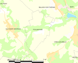
Foulangues
- commune in Oise, France
- Country:
- Postal Code: 60250
- Coordinates: 49° 16' 29" N, 2° 18' 50" E
- GPS tracks (wikiloc): [Link]
- Area: 5.13 sq km
- Population: 198

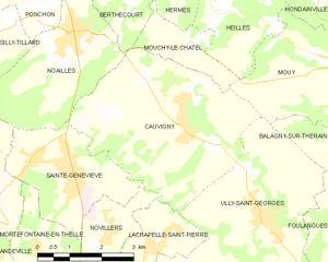
Cauvigny
- commune in Oise, France
- Country:
- Postal Code: 60730
- Coordinates: 49° 18' 3" N, 2° 14' 55" E
- GPS tracks (wikiloc): [Link]
- Area: 17.5 sq km
- Population: 1610
- Web site: [Link]


Cires-lès-Mello
- commune in Oise, France
- Country:
- Postal Code: 60660
- Coordinates: 49° 16' 23" N, 2° 21' 24" E
- GPS tracks (wikiloc): [Link]
- Area: 16.73 sq km
- Population: 3928
- Web site: [Link]


Balagny-sur-Thérain
- commune in Oise, France
- Country:
- Postal Code: 60250
- Coordinates: 49° 17' 43" N, 2° 20' 11" E
- GPS tracks (wikiloc): [Link]
- Area: 6.8 sq km
- Population: 1690
- Web site: [Link]


Lachapelle-Saint-Pierre
- commune in Oise, France
- Country:
- Postal Code: 60730
- Coordinates: 49° 16' 10" N, 2° 14' 9" E
- GPS tracks (wikiloc): [Link]
- Area: 4.22 sq km
- Population: 911
- Web site: [Link]


Dieudonné
- commune in Oise, France
- Country:
- Postal Code: 60530
- Coordinates: 49° 13' 50" N, 2° 14' 52" E
- GPS tracks (wikiloc): [Link]
- Area: 10.38 sq km
- Population: 821
- Web site: [Link]


Mouy
- commune in Oise, France
- Country:
- Postal Code: 60250
- Coordinates: 49° 18' 57" N, 2° 19' 10" E
- GPS tracks (wikiloc): [Link]
- Area: 9.87 sq km
- Population: 5280
- Web site: [Link]


Neuilly-en-Thelle
- commune in Oise, France
- Country:
- Postal Code: 60530
- Coordinates: 49° 13' 25" N, 2° 17' 7" E
- GPS tracks (wikiloc): [Link]
- Area: 15.73 sq km
- Population: 3378
- Web site: [Link]