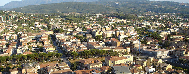
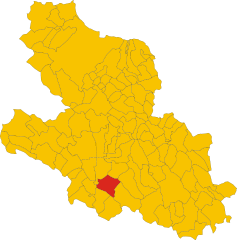
Balsorano (Balsorano)
.svg)
- Italian comune
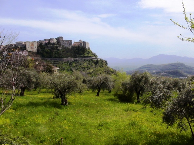
 Hiking in Balsorano
Balsorano, located in the Abruzzo region of Italy, is a charming destination that offers a variety of hiking opportunities amid scenic landscapes. The area is characterized by its mountainous terrain, dense forests, and picturesque valleys, making it a great spot for outdoor enthusiasts.
Key Hiking Trails and Areas:
-
Gran Sasso and Monti della Laga National Park: Although Balsorano is not directly within this national park, it is near its borders, allowing access to some of its stunning trails. The park offers breathtaking views, diverse flora and fauna, and varying difficulty levels for hikers.
-
Local Trails: Balsorano and its surroundings have several local trails that allow you to explore the countryside. Look for trails that lead to panoramic viewpoints, ancient ruins, or through the rich forests that characterize the region.
-
Civita d'Antino: A nearby historical village that is accessible via hiking trails. The paths here offer opportunities to witness the natural beauty along with cultural heritage.
Tips for Hiking in Balsorano:
-
Check Weather Conditions: Weather can change rapidly in mountainous areas. Make sure to check forecasts before heading out and be prepared for sudden changes.
-
Gear Up Appropriately: Wear sturdy hiking boots and bring layers, as temperatures can vary throughout the day. A backpack with water, snacks, and a basic first-aid kit is always essential.
-
Respect Nature: Stick to marked trails and follow local guidelines to preserve the environment and ensure safety.
-
Stay Hydrated: Carry enough water, especially during warmer months, as some trails may not have nearby water sources.
-
Navigation: Use a reliable map, GPS device, or hiking app, as some trails can be less frequently maintained or marked.
-
Check Local Resources: For detailed trail maps and specific recommendations, consider reaching out to local tourist information centers or hiking clubs.
Hiking in Balsorano can be a rewarding experience, offering both quiet moments in nature and stunning views, along with the chance to immerse yourself in the rich cultural heritage of the region.
- Country:

- Postal Code: 67052
- Local Dialing Code: 0863
- Licence Plate Code: AQ
- Coordinates: 41° 48' 35" N, 13° 33' 35" E


- GPS tracks (wikiloc): [Link]
- AboveSeaLevel: 340 м m
- Area: 58.85 sq km
- Population: 3455
- Web site: http://www.comune.balsorano.aq.it
- Wikipedia en: wiki(en)
- Wikipedia: wiki(it)
- Wikidata storage: Wikidata: Q49878
- Wikipedia Commons Category: [Link]
- Freebase ID: [/m/0fg45_]
- GeoNames ID: Alt: [3182443]
- VIAF ID: Alt: [25147783816768100645]
- OSM relation ID: [41543]
- GND ID: Alt: [1116977850]
- Google Maps Customer ID: [290851176775805200]
- ISTAT ID: 066007
- Italian cadastre code: A603
Shares border with regions:
Pescosolido
- Italian comune
Hiking in Pescosolido
Pescosolido is a small town located in the province of Frosinone in the Lazio region of Italy. Nestled in the Apennine Mountains, it offers beautiful landscapes and opportunities for hiking enthusiasts. Here’s some information to consider if you’re planning to hike in the area:...
- Country:
- Postal Code: 03030
- Local Dialing Code: 0776
- Licence Plate Code: FR
- Coordinates: 41° 44' 57" N, 13° 39' 27" E
- GPS tracks (wikiloc): [Link]
- AboveSeaLevel: 630 м m
- Area: 44.9 sq km
- Population: 1518
- Web site: [Link]

Sora, Lazio
- Italian comune
Hiking in Sora, Lazio
Sora, located in the Lazio region of Italy, is a wonderful destination for hikers and nature enthusiasts. Nestled in the Valle di Comino and surrounded by the Apennine Mountains, Sora offers various trails that cater to different skill levels, all set against stunning landscapes featuring lush forests, rivers, and picturesque views....
- Country:
- Postal Code: 03039
- Local Dialing Code: 0776
- Licence Plate Code: FR
- Coordinates: 41° 43' 0" N, 13° 37' 0" E
- GPS tracks (wikiloc): [Link]
- AboveSeaLevel: 300 м m
- Area: 72.13 sq km
- Population: 25972
- Web site: [Link]

Veroli
- Italian comune
Hiking in Veroli
Veroli, a charming town situated in the province of Frosinone in the Lazio region of Italy, offers excellent opportunities for hiking enthusiasts. Nestled in the beautiful hills of the Ciociaria area, Veroli boasts stunning landscapes, rich history, and a variety of trails suitable for different experience levels....
- Country:
- Postal Code: 03029
- Local Dialing Code: 0775
- Licence Plate Code: FR
- Coordinates: 41° 41' 0" N, 13° 25' 0" E
- GPS tracks (wikiloc): [Link]
- AboveSeaLevel: 594 м m
- Area: 119.65 sq km
- Population: 20414
- Web site: [Link]

Collelongo
- Italian comune
Hiking in Collelongo
Collelongo is a charming town located in the province of L'Aquila in the Abruzzo region of Italy, surrounded by the stunning landscapes of the Apennine Mountains. The area is ideal for hiking enthusiasts, thanks to its diverse terrains and natural beauty....
- Country:
- Postal Code: 67050
- Local Dialing Code: 0863
- Licence Plate Code: AQ
- Coordinates: 41° 53' 16" N, 13° 35' 9" E
- GPS tracks (wikiloc): [Link]
- AboveSeaLevel: 915 м m
- Area: 54.02 sq km
- Population: 1190
- Web site: [Link]


San Vincenzo Valle Roveto
- Italian comune
Hiking in San Vincenzo Valle Roveto
San Vincenzo Valle Roveto, located in the Abruzzo region of Italy, is a beautiful destination for hiking enthusiasts. The area is known for its stunning landscapes, rich biodiversity, and historical significance....
- Country:
- Postal Code: 67050
- Local Dialing Code: 0863
- Licence Plate Code: AQ
- Coordinates: 41° 50' 40" N, 13° 32' 8" E
- GPS tracks (wikiloc): [Link]
- AboveSeaLevel: 388 м m
- Area: 46.04 sq km
- Population: 2299
- Web site: [Link]


Villavallelonga
- Italian comune
Hiking in Villavallelonga
Villavallelonga is a charming village located in the Abruzzo region of Italy, nestled within the scenic landscape of the Apennine Mountains. Known for its natural beauty, Villavallelonga offers a variety of hiking opportunities suitable for all levels of experience....
- Country:
- Postal Code: 67050
- Local Dialing Code: 0863
- Licence Plate Code: AQ
- Coordinates: 41° 52' 21" N, 13° 37' 20" E
- GPS tracks (wikiloc): [Link]
- AboveSeaLevel: 1005 м m
- Area: 73.74 sq km
- Population: 879
- Web site: [Link]