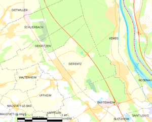
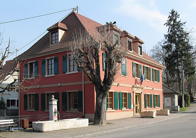
Bartenheim (Bartenheim)

- commune in Haut-Rhin, France
 Hiking in Bartenheim
Bartenheim is a small commune located in the Alsace region of France, near the borders with Germany and Switzerland. While it may not be widely known for extensive hiking trails, there are several options available for outdoor enthusiasts in the surrounding areas.
Local Hiking Options
-
Nature Walks: The area around Bartenheim features gentle hills and agricultural landscapes, making for pleasant walking routes. You can explore local paths that meander through fields and forests.
-
Regional Parks: The nearby Parc Naturel Régional des Ballons des Vosges offers more structured hiking routes. This regional park is known for its stunning vistas, diverse flora and fauna, and various trails that cater to different skill levels.
-
Rhine River Trails: The banks of the Rhine River provide a scenic backdrop for hiking and cycling. There are dedicated paths that allow you to enjoy the river's beauty while observing local wildlife.
Trail Recommendations
-
Schweizerische Nationalpark (Swiss National Park): Although it's a bit of a drive from Bartenheim, this national park offers some of the best hiking opportunities in the area, with numerous trails ranging from easy to challenging.
-
Alsace Wine Route: For those who enjoy a little history and culture with their hiking, following parts of the Alsace Wine Route allows you to experience the beautiful vineyards and charming villages.
Hiking Tips
-
Weather: Always check the weather conditions before heading out, as they can change rapidly, especially in mountainous areas.
-
Gear: Make sure to wear appropriate footwear and bring plenty of water, snacks, and a first-aid kit.
-
Navigational Tools: Using a GPS device, map, or a hiking app can help keep you on track, especially in less marked areas.
Conclusion
While Bartenheim itself may not be a hiking hub, it provides access to beautiful natural landscapes and trails nearby. Whether you're looking for a leisurely stroll or a more intense hike, the surrounding regions in Alsace and the larger area of the Vosges mountains offer a variety of options for outdoor adventures.
- Country:

- Postal Code: 68870
- Coordinates: 47° 38' 5" N, 7° 28' 33" E


- GPS tracks (wikiloc): [Link]
- Area: 12.86 sq km
- Population: 3848
- Web site: http://www.bartenheim.fr
- Wikipedia en: wiki(en)
- Wikipedia: wiki(fr)
- Wikidata storage: Wikidata: Q320293
- Wikipedia Commons Category: [Link]
- Freebase ID: [/m/0278vhs]
- Freebase ID: [/m/0278vhs]
- GeoNames ID: Alt: [6450646]
- GeoNames ID: Alt: [6450646]
- SIREN number: [216800219]
- SIREN number: [216800219]
- BnF ID: [152717255]
- BnF ID: [152717255]
- VIAF ID: Alt: [233880693]
- VIAF ID: Alt: [233880693]
- WOEID: [578270]
- WOEID: [578270]
- INSEE municipality code: 68021
- INSEE municipality code: 68021
Shares border with regions:


Brinckheim
- commune in Haut-Rhin, France
Hiking in Brinckheim
Brinckheim, a small town located in the Grand Est region of France near the border with Germany, offers a fantastic hiking experience for outdoor enthusiasts. While Brinckheim itself may not have extensive hiking trails, the surrounding areas provide ample opportunities for hiking and exploring nature....
- Country:
- Postal Code: 68870
- Coordinates: 47° 37' 36" N, 7° 27' 33" E
- GPS tracks (wikiloc): [Link]
- Area: 3.41 sq km
- Population: 364


Saint-Louis
- commune in Haut-Rhin, France
Hiking in Saint-Louis
Saint-Louis, located in the Haut-Rhin department of the Alsace region in northeastern France, offers a unique blend of natural beauty and cultural experiences, making it an interesting spot for hikers....
- Country:
- Postal Code: 68300
- Coordinates: 47° 35' 7" N, 7° 33' 54" E
- GPS tracks (wikiloc): [Link]
- AboveSeaLevel: 254 м m
- Area: 16.85 sq km
- Population: 20401
- Web site: [Link]


Blotzheim
- commune in Haut-Rhin, France
Hiking in Blotzheim
Blotzheim, located in the Alsace region of France near the Swiss border, might not be as commonly recognized as a hiking destination compared to larger nearby areas like the Vosges mountains or the Jura range. However, it offers pleasant walking and hiking opportunities, especially for those looking for more gentle and scenic routes....
- Country:
- Postal Code: 68730
- Coordinates: 47° 36' 6" N, 7° 29' 43" E
- GPS tracks (wikiloc): [Link]
- Area: 14.6 sq km
- Population: 4466
- Web site: [Link]

Sierentz
- commune in Haut-Rhin, France
Hiking in Sierentz
Sierentz is a charming commune located in the Alsace region of northeastern France, near the border with Switzerland and Germany. While it may not be as widely known as some larger hiking destinations, it offers opportunities to explore the beautiful Alsace countryside and its scenic landscapes....
- Country:
- Postal Code: 68510
- Coordinates: 47° 39' 20" N, 7° 27' 21" E
- GPS tracks (wikiloc): [Link]
- Area: 13.22 sq km
- Population: 3578
- Web site: [Link]

Uffheim
- commune in Haut-Rhin, France
Hiking in Uffheim
Uffheim, located in the Grand Est region of France, is a small commune that offers a quaint setting for outdoor activities, including hiking. While the area does not boast well-known or extensive hiking trails like some larger national parks, it provides opportunities to explore the beautiful French countryside and local landscapes....
- Country:
- Postal Code: 68510
- Coordinates: 47° 38' 59" N, 7° 26' 37" E
- GPS tracks (wikiloc): [Link]
- Area: 4.36 sq km
- Population: 867
- Web site: [Link]


Kembs
- commune in Haut-Rhin, France
Hiking in Kembs
Kembs is located in the Alsace region of France, near the borders of Germany and Switzerland. The area offers a rich blend of natural beauty and cultural heritage, making it an interesting destination for hikers....
- Country:
- Postal Code: 68680
- Coordinates: 47° 41' 20" N, 7° 30' 13" E
- GPS tracks (wikiloc): [Link]
- Area: 16.45 sq km
- Population: 5106
- Web site: [Link]