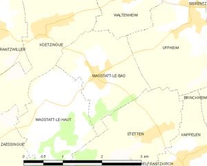
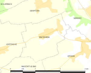
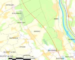
Uffheim (Uffheim)
- commune in Haut-Rhin, France
Uffheim, located in the Grand Est region of France, is a small commune that offers a quaint setting for outdoor activities, including hiking. While the area does not boast well-known or extensive hiking trails like some larger national parks, it provides opportunities to explore the beautiful French countryside and local landscapes.
Hiking Options in Uffheim:
-
Local Paths and Trails: The region around Uffheim has several small paths and trails that you can explore. These might not be heavily marked, but they are great for a leisurely walk or hike, allowing you to enjoy the natural beauty and tranquility of rural France.
-
Nearby Natural Areas: Considering Uffheim's proximity to the regional parks like Parc Naturel Régional des Ballons des Vosges, you can venture out to explore more significant hiking options. This park offers a variety of trails suitable for different skill levels, from easy walks to more challenging hikes.
-
Scenic Views: Hiking around Uffheim can offer scenic views of the Alsace region's vineyards and rolling hills. Be sure to take your time and enjoy the picturesque landscapes.
-
Best Time to Hike: Spring (April to June) and fall (September to October) are generally the best times to hike in this region, as the weather is mild, and the landscapes are particularly beautiful during these seasons.
Tips for Hiking in Uffheim:
- Check Local Maps: Before heading out, it’s advisable to check local maps or ask for recommendations from locals to find the best hiking routes.
- Pack Essentials: Bring water, snacks, and appropriate hiking gear. While some paths might be easy, others could be more rugged.
- Respect Nature: Follow Leave No Trace principles to keep the area beautiful for everyone.
While the hiking opportunities might be more limited directly in Uffheim, the charm of the area and the options nearby make it a delightful place for outdoor enthusiasts to explore. Enjoy your hiking adventure!
- Country:

- Postal Code: 68510
- Coordinates: 47° 38' 59" N, 7° 26' 37" E


- GPS tracks (wikiloc): [Link]
- Area: 4.36 sq km
- Population: 867
- Web site: http://www.uffheim.fr
- Wikipedia en: wiki(en)
- Wikipedia: wiki(fr)
- Wikidata storage: Wikidata: Q635239
- Wikipedia Commons Category: [Link]
- Freebase ID: [/m/03nsv22]
- Freebase ID: [/m/03nsv22]
- GeoNames ID: Alt: [6441648]
- GeoNames ID: Alt: [6441648]
- SIREN number: [216803411]
- SIREN number: [216803411]
- BnF ID: [15272043d]
- BnF ID: [15272043d]
- VIAF ID: Alt: [235226192]
- VIAF ID: Alt: [235226192]
- INSEE municipality code: 68341
- INSEE municipality code: 68341
Shares border with regions:


Magstatt-le-Bas
- commune in Haut-Rhin, France
Magstatt-le-Bas, a charming commune in the Alsace region of France, offers an array of hiking opportunities that cater to various skill levels. The region is characterized by its picturesque landscapes, vineyards, and nearby forests, making it an ideal location for outdoor enthusiasts....
- Country:

- Postal Code: 68510
- Coordinates: 47° 38' 19" N, 7° 24' 33" E


- GPS tracks (wikiloc): [Link]
- Area: 3.35 sq km
- Population: 476


Bartenheim
- commune in Haut-Rhin, France
Bartenheim is a small commune located in the Alsace region of France, near the borders with Germany and Switzerland. While it may not be widely known for extensive hiking trails, there are several options available for outdoor enthusiasts in the surrounding areas....
- Country:

- Postal Code: 68870
- Coordinates: 47° 38' 5" N, 7° 28' 33" E


- GPS tracks (wikiloc): [Link]
- Area: 12.86 sq km
- Population: 3848
- Web site: [Link]


Brinckheim
- commune in Haut-Rhin, France
Brinckheim, a small town located in the Grand Est region of France near the border with Germany, offers a fantastic hiking experience for outdoor enthusiasts. While Brinckheim itself may not have extensive hiking trails, the surrounding areas provide ample opportunities for hiking and exploring nature....
- Country:

- Postal Code: 68870
- Coordinates: 47° 37' 36" N, 7° 27' 33" E


- GPS tracks (wikiloc): [Link]
- Area: 3.41 sq km
- Population: 364


Waltenheim
- commune in Haut-Rhin, France
Waltenheim, a charming village situated in the Alsace region of France, offers a variety of hiking opportunities suitable for all skill levels. The surrounding landscape is characterized by rolling hills, lush forests, and scenic vineyards, making it a picturesque destination for outdoor enthusiasts....
- Country:

- Postal Code: 68510
- Coordinates: 47° 39' 25" N, 7° 25' 32" E


- GPS tracks (wikiloc): [Link]
- Area: 2.32 sq km
- Population: 546


Sierentz
- commune in Haut-Rhin, France
Sierentz is a charming commune located in the Alsace region of northeastern France, near the border with Switzerland and Germany. While it may not be as widely known as some larger hiking destinations, it offers opportunities to explore the beautiful Alsace countryside and its scenic landscapes....
- Country:

- Postal Code: 68510
- Coordinates: 47° 39' 20" N, 7° 27' 21" E


- GPS tracks (wikiloc): [Link]
- Area: 13.22 sq km
- Population: 3578
- Web site: [Link]


Stetten
- commune in Haut-Rhin, France
Stetten is a charming village located in the Haut-Rhin department in the Alsace region of France. The area is known for its picturesque landscapes, rich vineyard culture, and proximity to the Vosges Mountains, making it a great spot for hiking enthusiasts....
- Country:

- Postal Code: 68510
- Coordinates: 47° 37' 27" N, 7° 25' 33" E


- GPS tracks (wikiloc): [Link]
- Area: 4.32 sq km
- Population: 343


Kappelen
- commune in Haut-Rhin, France
Kappelen, located in the Haut-Rhin department of France, is surrounded by picturesque landscapes and charming trails, offering a great opportunity for hiking enthusiasts. While Kappelen itself is a small village, it is in proximity to various trails that explore the natural beauty of the Alsatian region....
- Country:

- Postal Code: 68510
- Coordinates: 47° 37' 5" N, 7° 26' 17" E


- GPS tracks (wikiloc): [Link]
- Area: 5.15 sq km
- Population: 575
- Web site: [Link]

