
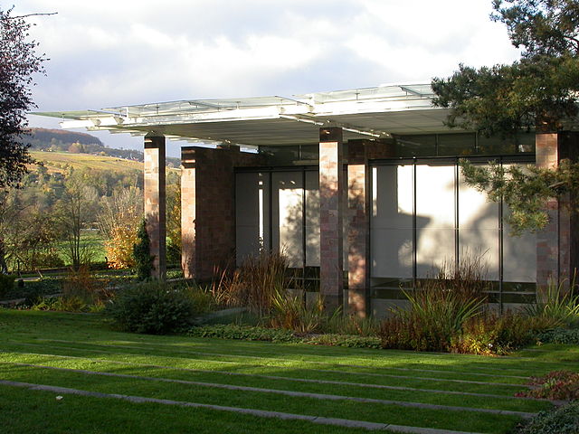
Basel (Basel)


- city on the Rhine, in Switzerland
 Hiking in Basel
Hiking around Basel offers a unique blend of scenic views, cultural landmarks, and accessible trails. While Basel itself is an urban area, it's ideally located near various natural landscapes and hiking opportunities. Here are some key aspects you might find interesting:
1. Nearby Hiking Areas:
- Black Forest: Just a short drive across the border into Germany, the Black Forest offers numerous trails ranging from leisurely walks to challenging hikes. Popular trails include the Schluchsee and Titisee areas.
- Jura Mountains: Located to the northwest of Basel, the Jura Mountains have a range of hiking paths that provide stunning views over the Rhine Valley and the Alps on clear days.
- Kaiserstuhl: This extinct volcanic range in Germany, located southeast of Basel, has gentle rolling hills, vineyards, and excellent trails for all levels.
2. Local Trails:
- Basel City Trails: For a mix of city exploring and nature, there are several routes around the city that include parks and riverfront paths along the Rhine. The Basel Riverbank path is especially scenic.
3. Nature Conservation Areas:
- Riehen and the Rehberger-Wald: This area offers several trails through forested regions, making it an excellent spot for a short hike near the city.
- Birsigtal Nature Reserve: A little further east, this area provides trails along the Birsig River, making for a tranquil hiking experience amidst nature.
4. Hiking Tips:
- Best Time to Hike: Spring and fall are ideal for hiking around Basel due to mild temperatures and less crowded trails. Summer can also be enjoyable, but it may get warmer in the valleys.
- Trail Information: Be sure to check out local resources, such as the Basel Tourist Office, for maps and suggested trails, which can range in difficulty.
- Equipment: While many of the trails are accessible with regular walking shoes, good hiking boots are recommended for rougher terrains.
5. Cultural Aspects:
Hiking in this region can also include visits to local vineyards, castles, and historical sites. Some trails run through vineyards where you can enjoy local wine tasting.
Overall, hiking near Basel offers a rich combination of natural beauty and cultural experiences, making it a pleasurable activity for residents and visitors alike. Happy hiking!
- Country:

- Postal Code: 4000
- Local Dialing Code: 061
- Licence Plate Code: BS
- Coordinates: 47° 33' 2" N, 7° 35' 28" E


- GPS tracks (wikiloc): [Link]
- AboveSeaLevel: 247 м m
- Area: 23.85 sq km
- Population: 177595
- Web site: http://www.bs.ch/
- Wikipedia en: wiki(en)
- Wikipedia: wiki(de)
- Wikidata storage: Wikidata: Q78
- Wikipedia Commons Gallery: [Link]
- Wikipedia Commons Category: [Link]
- Wikipedia Commons Maps Category: [Link]
- Freebase ID: [/m/01k4f]
- GeoNames ID: Alt: [7285161]
- BnF ID: [11865939n]
- VIAF ID: Alt: [130173038]
- OSM relation ID: [1683619]
- GND ID: Alt: [4004617-5]
- archINFORM location ID: [1486]
- Library of Congress authority ID: Alt: [n79062979]
- MusicBrainz area ID: [264779d6-59a8-4fb6-8c43-5f39ce67ccd1]
- WOEID: [12682721]
- Quora topic ID: [Basel-Switzerland]
- TGN ID: [7007269]
- SUDOC authorities ID: [026406268]
- Encyclopædia Britannica Online ID: [place/Basel-Switzerland]
- Gran Enciclopèdia Catalana ID: [0008110]
- Encyclopædia Universalis ID: [bale]
- HDS ID: [7478]
- EMLO location ID: [3254f805-77ac-4ee3-acc8-6f8803794012]
- Facebook Places ID: [108671032497097]
- Great Russian Encyclopedia Online ID: [1845520]
- Swiss municipality code: [2701]
- National Library of Israel ID: [000975632]
- Klexikon article ID: [Basel]
- BabelNet ID: [00008093n]
- Brockhaus Enzyklopädie online ID: [basel-20]
- NDL Auth ID: [01099869]
- STW Thesaurus for Economics ID: [16958-2]
- SELIBR ID: [140531]
- TripAdvisor ID: [Tourism-g188049]
- US National Archives Identifier: 10045346
Shares border with regions:


Saint-Louis
- commune in Haut-Rhin, France
Hiking in Saint-Louis
Saint-Louis, located in the Haut-Rhin department of the Alsace region in northeastern France, offers a unique blend of natural beauty and cultural experiences, making it an interesting spot for hikers....
- Country:

- Postal Code: 68300
- Coordinates: 47° 35' 7" N, 7° 33' 54" E
- GPS tracks (wikiloc): [Link]
- AboveSeaLevel: 254 м m
- Area: 16.85 sq km
- Population: 20401
- Web site: [Link]

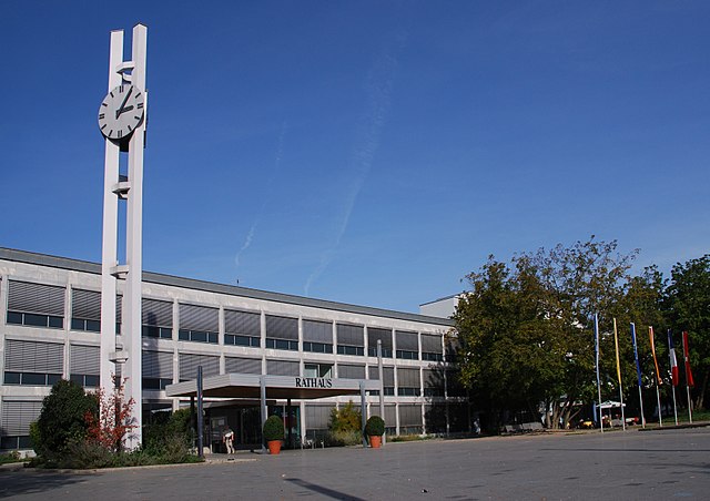
Riehen
- municipality in the canton of Basel-Stadt in Switzerland
Hiking in Riehen
Riehen, located in the northwestern part of Switzerland near the border with Germany, offers a blend of beautiful landscapes, cultural sites, and access to nature. While Riehen itself is an urban area, it provides opportunities for hiking in the surrounding landscapes....
- Country:
- Postal Code: 4125
- Local Dialing Code: 061
- Licence Plate Code: BS
- Coordinates: 47° 34' 46" N, 7° 39' 4" E
- GPS tracks (wikiloc): [Link]
- AboveSeaLevel: 295 м m
- Area: 10.87 sq km
- Population: 21448
- Web site: [Link]

Weil am Rhein
- municipality in Germany
Hiking in Weil am Rhein
Weil am Rhein, located in the border region where Germany, France, and Switzerland meet, offers a variety of hiking opportunities that showcase beautiful landscapes, cultural sights, and diverse ecosystems. Here are some insights about hiking in this area:...
- Country:

- Postal Code: 79546–79576
- Local Dialing Code: 07621
- Coordinates: 47° 35' 41" N, 7° 36' 39" E
- GPS tracks (wikiloc): [Link]
- AboveSeaLevel: 281 м m
- Area: 19.46 sq km
- Population: 29683
- Web site: [Link]


Birsfelden
- municipality in Switzerland
Hiking in Birsfelden
Birsfelden is a charming area in the Basel region of Switzerland, located along the banks of the River Birs. While it may not be as famous as some of the larger hiking destinations in Switzerland, it offers a number of scenic trails that can be enjoyed by both beginners and more experienced hikers....
- Country:
- Postal Code: 4127
- Local Dialing Code: 061
- Licence Plate Code: BL
- Coordinates: 47° 33' 13" N, 7° 37' 47" E
- GPS tracks (wikiloc): [Link]
- AboveSeaLevel: 261 м m
- Area: 2.52 sq km
- Population: 10410
- Web site: [Link]


Allschwil
- municipality in Switzerland
Hiking in Allschwil
Allschwil, located in the canton of Basel-Landschaft in Switzerland, is a charming area offering a range of hiking options. While Allschwil itself is primarily a residential area, it's conveniently located close to the borders of both Basel and the beautiful natural landscapes of the Jura Mountains and the Rhine river....
- Country:
- Postal Code: 4123
- Local Dialing Code: 061
- Licence Plate Code: BL
- Coordinates: 47° 33' 3" N, 7° 32' 9" E
- GPS tracks (wikiloc): [Link]
- AboveSeaLevel: 323 м m
- Area: 8.92 sq km
- Population: 20913
- Web site: [Link]


Muttenz
- municipality in Switzerland
Hiking in Muttenz
Muttenz is a charming municipality located near Basel in Switzerland, surrounded by lush landscapes and diverse trails, making it a great destination for hiking enthusiasts. Here are some key aspects of hiking in Muttenz:...
- Country:
- Postal Code: 4132
- Local Dialing Code: 061
- Licence Plate Code: BL
- Coordinates: 47° 31' 29" N, 7° 38' 57" E
- GPS tracks (wikiloc): [Link]
- AboveSeaLevel: 287 м m
- Area: 16.64 sq km
- Population: 17805
- Web site: [Link]

Münchenstein
- municipality in Switzerland
Hiking in Münchenstein
Münchenstein is a beautiful suburb located near Basel in Switzerland, offering a vibrant mix of urban and natural landscapes. While it may not be the first place that comes to mind for hiking, there are plenty of opportunities to explore the nearby trails and enjoy the stunning scenery of the surrounding region....
- Country:
- Postal Code: 4142
- Local Dialing Code: 061
- Licence Plate Code: BL
- Coordinates: 47° 31' 7" N, 7° 37' 3" E
- GPS tracks (wikiloc): [Link]
- AboveSeaLevel: 269 м m
- Area: 7.18 sq km
- Population: 12203
- Web site: [Link]


Binningen
- municipality in Switzerland
Hiking in Binningen
Binningen, a charming municipality located just a few kilometers southwest of Basel in Switzerland, offers a variety of hiking opportunities that cater to both beginners and experienced hikers. The region is characterized by its picturesque landscapes, rolling hills, and rich nature, making it an appealing destination for outdoor enthusiasts....
- Country:
- Postal Code: 4102
- Local Dialing Code: 061
- Licence Plate Code: BL
- Coordinates: 47° 32' 0" N, 7° 34' 0" E
- GPS tracks (wikiloc): [Link]
- AboveSeaLevel: 296 м m
- Area: 4.43 sq km
- Population: 15580
- Web site: [Link]


Reinach
- municipality in the canton of Basel-Country, Switzerland
Hiking in Reinach
Reinach, located in the Basel-Landschaft region of Switzerland, is a great starting point for hiking enthusiasts looking to explore the beautiful landscapes of the area. Here are some highlights and tips for hiking in and around Reinach:...
- Country:
- Postal Code: 4153
- Local Dialing Code: 061
- Licence Plate Code: BL
- Coordinates: 47° 29' 51" N, 7° 35' 28" E
- GPS tracks (wikiloc): [Link]
- AboveSeaLevel: 301 м m
- Area: 7 sq km
- Population: 19144
- Web site: [Link]


Bottmingen
- municipality in Switzerland
Hiking in Bottmingen
Bottmingen is a beautiful area located near Basel, Switzerland. While it may not be as widely known for extensive hiking trails as some of the mountainous regions in Switzerland, it offers a lovely setting for outdoor enthusiasts to enjoy nature. Here’s some information about hiking in Bottmingen and its surroundings:...
- Country:
- Postal Code: 4103
- Local Dialing Code: 061
- Licence Plate Code: BL
- Coordinates: 47° 31' 19" N, 7° 34' 35" E
- GPS tracks (wikiloc): [Link]
- AboveSeaLevel: 314 м m
- Area: 2.99 sq km
- Population: 6593
- Web site: [Link]

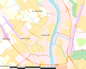
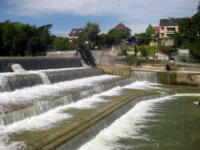
Huningue
- commune in Haut-Rhin, France
Hiking in Huningue
Huningue, located in the Alsace region of France, near the borders of Switzerland and Germany, offers a unique blend of natural beauty and cultural experiences. While Huningue itself is a small town, it provides access to several hiking opportunities in the surrounding areas....
- Country:
- Postal Code: 68330
- Coordinates: 47° 35' 29" N, 7° 34' 59" E
- GPS tracks (wikiloc): [Link]
- Area: 2.86 sq km
- Population: 7143
- Web site: [Link]