Birsfelden (Birsfelden)

- municipality in Switzerland
 Hiking in Birsfelden
Birsfelden is a charming area in the Basel region of Switzerland, located along the banks of the River Birs. While it may not be as famous as some of the larger hiking destinations in Switzerland, it offers a number of scenic trails that can be enjoyed by both beginners and more experienced hikers.
Hiking Trails
-
Birs Trail: One of the most popular options for hiking in the area is the Birs Trail, which follows the river and showcases beautiful landscapes. The trail is relatively flat and suitable for all skill levels. Hikers can enjoy the serene environment, lush greenery, and occasional wildlife sightings.
-
Surrounding Nature Reserves: The areas around Birsfelden have several nature reserves and parks, which are great for enjoying a mix of hiking and nature observation. Trails often wind through forests and fields, providing a peaceful retreat from urban life.
-
Nearby Hiking Regions: Birsfelden is also ideally located for easy access to the Jura Mountains and the Pfyn-Finges Nature Park, which feature more challenging hikes, breathtaking views, and diverse terrains.
Tips for Hiking in Birsfelden
-
Weather Considerations: Always check the weather forecast before heading out, as conditions can change quickly in the region.
-
Footwear: Wear appropriate hiking boots to provide good support and traction, especially if you plan to venture on more rugged trails.
-
Water and Snacks: Bring plenty of water and some snacks to keep you energized during your hike.
-
Maps and Navigation: While many trails are well-marked, it's good practice to carry a map or have a navigation app on your phone, especially if you plan to explore more remote areas.
-
Respect Nature: Always follow the principles of Leave No Trace to preserve the natural beauty of the area.
Though Birsfelden may not be a large hiking hub, it offers lovely trails suitable for leisurely hikes, nature walks, and easy access to more challenging hikes in the nearby regions, making it a pleasant destination for outdoor enthusiasts.
- Country:

- Postal Code: 4127
- Local Dialing Code: 061
- Licence Plate Code: BL
- Coordinates: 47° 33' 13" N, 7° 37' 47" E


- GPS tracks (wikiloc): [Link]
- AboveSeaLevel: 261 м m
- Area: 2.52 sq km
- Population: 10410
- Web site: http://www.birsfelden.ch
- Wikipedia en: wiki(en)
- Wikipedia: wiki(de)
- Wikidata storage: Wikidata: Q64665
- Wikipedia Commons Category: [Link]
- Freebase ID: [/m/0g77qb]
- GeoNames ID: Alt: [7285259]
- VIAF ID: Alt: [239012270]
- OSM relation ID: [1683626]
- GND ID: Alt: [4088366-8]
- archINFORM location ID: [1488]
- MusicBrainz area ID: [9bc01560-af97-4d25-8c42-6a5a0b5c3ab2]
- HDS ID: [1194]
- Swiss municipality code: [2766]
- Digital Atlas of the Roman Empire ID: [38799]
Shares border with regions:


Muttenz
- municipality in Switzerland
Hiking in Muttenz
Muttenz is a charming municipality located near Basel in Switzerland, surrounded by lush landscapes and diverse trails, making it a great destination for hiking enthusiasts. Here are some key aspects of hiking in Muttenz:...
- Country:
- Postal Code: 4132
- Local Dialing Code: 061
- Licence Plate Code: BL
- Coordinates: 47° 31' 29" N, 7° 38' 57" E
- GPS tracks (wikiloc): [Link]
- AboveSeaLevel: 287 м m
- Area: 16.64 sq km
- Population: 17805
- Web site: [Link]
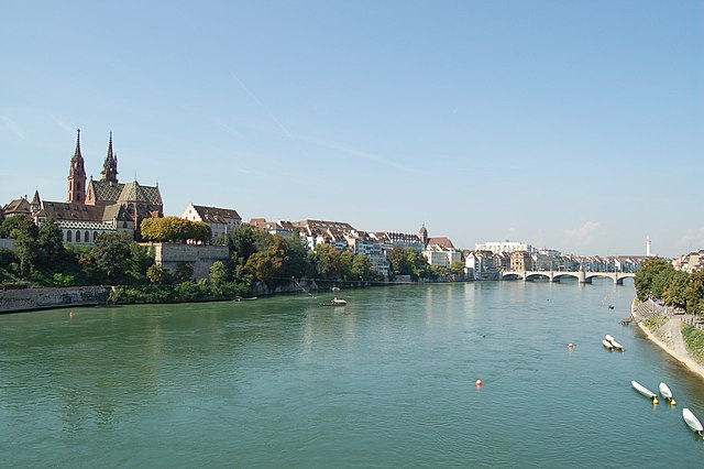

Basel
- city on the Rhine, in Switzerland
Hiking in Basel
Hiking around Basel offers a unique blend of scenic views, cultural landmarks, and accessible trails. While Basel itself is an urban area, it's ideally located near various natural landscapes and hiking opportunities. Here are some key aspects you might find interesting:...
- Country:
- Postal Code: 4000
- Local Dialing Code: 061
- Licence Plate Code: BS
- Coordinates: 47° 33' 2" N, 7° 35' 28" E
- GPS tracks (wikiloc): [Link]
- AboveSeaLevel: 247 м m
- Area: 23.85 sq km
- Population: 177595
- Web site: [Link]