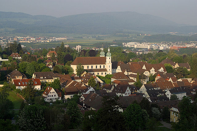
Muttenz (Muttenz)

- municipality in Switzerland
 Hiking in Muttenz
Muttenz is a charming municipality located near Basel in Switzerland, surrounded by lush landscapes and diverse trails, making it a great destination for hiking enthusiasts. Here are some key aspects of hiking in Muttenz:
Hiking Trails
-
Rohrenbach Valley: This scenic valley features gentle trails that follow the Rohrenbach creek through picturesque forests and meadows. It’s great for a peaceful hike, suitable for families.
-
Gempen Mountain: Just a short hike from Muttenz, reaching Gempen Mountain offers rewarding views of the surrounding area, including Basel and the Rhine River. The trail can be a bit steep in parts but is well-marked.
-
Basel Region Trails: Muttenz is part of a larger network of trails in the Basel region, including sections of the Swiss national hiking network. You can explore various short and long-distance hikes connecting to nearby locations.
-
Birsig Valley: Head south to discover the beautiful Birsig Valley. There are trails that follow the valley's river, perfect for enjoying nature and spotting local wildlife.
Wildlife and Flora
The hiking paths around Muttenz are rich in biodiversity. The forests are home to various species of trees, and if you're lucky, you might spot deer, foxes, or a variety of birds. Spring and summer hikes reveal colorful wildflowers, making the experience even more enriching.
Practical Tips
- Season: Spring and autumn are ideal for hiking in this region, offering mild weather and stunning foliage.
- Maps and Guides: It’s wise to carry a map or use a GPS app. Many trails are well-marked, but having a backup is always good.
- Gear: Wear comfortable hiking shoes and pack essentials like water, snacks, and weather-appropriate clothing.
- Local Dining: After a hike, consider visiting a local café or restaurant in Muttenz to enjoy some Swiss cuisine.
Accessibility
Muttenz is easily accessible from Basel via public transport, making it a convenient spot for both local and visiting hikers.
Conclusion
With its blend of natural beauty, well-maintained trails, and proximity to urban amenities, Muttenz offers an enjoyable hiking experience for all levels. Whether you're looking for a leisurely walk or a more challenging hike, you'll find something that suits your preferences in this picturesque part of Switzerland.
- Country:

- Postal Code: 4132
- Local Dialing Code: 061
- Licence Plate Code: BL
- Coordinates: 47° 31' 29" N, 7° 38' 57" E


- GPS tracks (wikiloc): [Link]
- AboveSeaLevel: 287 м m
- Area: 16.64 sq km
- Population: 17805
- Web site: http://www.Muttenz.ch
- Wikipedia en: wiki(en)
- Wikipedia: wiki(de)
- Wikidata storage: Wikidata: Q66191
- Wikipedia Commons Category: [Link]
- Freebase ID: [/m/0ct1qy]
- GeoNames ID: Alt: [7286607]
- VIAF ID: Alt: [159624872]
- OSM relation ID: [1683677]
- GND ID: Alt: [4256381-1]
- archINFORM location ID: [1489]
- MusicBrainz area ID: [b9c94d07-0a8e-43cb-a1fa-5917345e0173]
- HDS ID: [1197]
- Swiss municipality code: [2770]
- Digital Atlas of the Roman Empire ID: [38801]
Shares border with regions:

Arlesheim
- municipality in Switzerland
Hiking in Arlesheim
Arlesheim, located in the Basel-Landschaft region of Switzerland, offers a variety of hiking opportunities set against a backdrop of beautiful landscapes, historical sites, and diverse flora and fauna. Here are some key aspects to consider when planning a hiking experience in and around Arlesheim:...
- Country:
- Postal Code: 4144
- Local Dialing Code: 061
- Licence Plate Code: BL
- Coordinates: 47° 29' 32" N, 7° 37' 13" E
- GPS tracks (wikiloc): [Link]
- AboveSeaLevel: 461 м m
- Area: 6.94 sq km
- Population: 9202
- Web site: [Link]


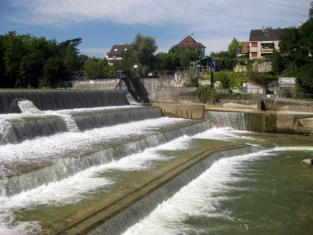
Birsfelden
- municipality in Switzerland
Hiking in Birsfelden
Birsfelden is a charming area in the Basel region of Switzerland, located along the banks of the River Birs. While it may not be as famous as some of the larger hiking destinations in Switzerland, it offers a number of scenic trails that can be enjoyed by both beginners and more experienced hikers....
- Country:
- Postal Code: 4127
- Local Dialing Code: 061
- Licence Plate Code: BL
- Coordinates: 47° 33' 13" N, 7° 37' 47" E
- GPS tracks (wikiloc): [Link]
- AboveSeaLevel: 261 м m
- Area: 2.52 sq km
- Population: 10410
- Web site: [Link]

Pratteln
- municipality in Switzerland
Hiking in Pratteln
Pratteln, located in the Basel-Landschaft region of Switzerland, offers a variety of hiking opportunities that cater to different skill levels. The area is rich in natural beauty, featuring lush forests, rolling hills, and panoramic views of the surrounding landscape, including the nearby Jura Mountains....
- Country:
- Postal Code: 4133
- Local Dialing Code: 061
- Licence Plate Code: BL
- Coordinates: 47° 31' 7" N, 7° 41' 34" E
- GPS tracks (wikiloc): [Link]
- AboveSeaLevel: 292 м m
- Area: 10.70 sq km
- Population: 16388
- Web site: [Link]

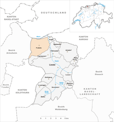
Frenkendorf
- municipality in Switzerland
Hiking in Frenkendorf
Frenkendorf is a charming municipality located in the Basel-Landschaft district of Switzerland, surrounded by scenic landscapes and rolling hills. Hiking in Frenkendorf offers a variety of trails that cater to different skill levels, making it a great destination for both novice and experienced hikers....
- Country:
- Postal Code: 4402
- Local Dialing Code: 061
- Licence Plate Code: BL
- Coordinates: 47° 30' 3" N, 7° 41' 49" E
- GPS tracks (wikiloc): [Link]
- AboveSeaLevel: 412 м m
- Area: 4.58 sq km
- Population: 6471
- Web site: [Link]

Münchenstein
- municipality in Switzerland
Hiking in Münchenstein
Münchenstein is a beautiful suburb located near Basel in Switzerland, offering a vibrant mix of urban and natural landscapes. While it may not be the first place that comes to mind for hiking, there are plenty of opportunities to explore the nearby trails and enjoy the stunning scenery of the surrounding region....
- Country:
- Postal Code: 4142
- Local Dialing Code: 061
- Licence Plate Code: BL
- Coordinates: 47° 31' 7" N, 7° 37' 3" E
- GPS tracks (wikiloc): [Link]
- AboveSeaLevel: 269 м m
- Area: 7.18 sq km
- Population: 12203
- Web site: [Link]
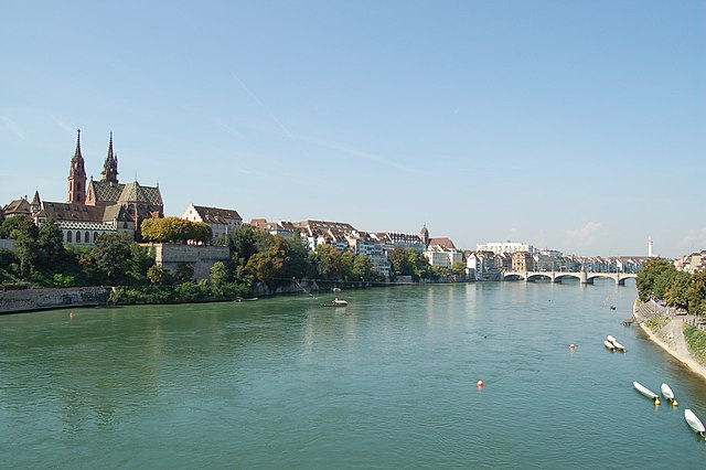

Basel
- city on the Rhine, in Switzerland
Hiking in Basel
Hiking around Basel offers a unique blend of scenic views, cultural landmarks, and accessible trails. While Basel itself is an urban area, it's ideally located near various natural landscapes and hiking opportunities. Here are some key aspects you might find interesting:...
- Country:
- Postal Code: 4000
- Local Dialing Code: 061
- Licence Plate Code: BS
- Coordinates: 47° 33' 2" N, 7° 35' 28" E
- GPS tracks (wikiloc): [Link]
- AboveSeaLevel: 247 м m
- Area: 23.85 sq km
- Population: 177595
- Web site: [Link]