Baselice (Baselice)
.svg)
- Italian comune
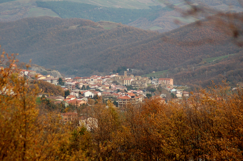
 Hiking in Baselice
Baselice, a charming town located in the province of Benevento in the Campania region of Italy, offers a variety of hiking opportunities, particularly for those who enjoy exploring the picturesque landscapes of southern Italy.
Hiking Trails and Areas
-
Natural Landscapes:
- The surrounding countryside features rolling hills, vineyards, and olive groves, providing a scenic backdrop for hikes. The landscape is characterized by its Mediterranean climate, which contributes to lush vegetation and diverse wildlife.
-
Local Trails:
- There are several local trails that range from easy walks to more challenging hikes. Many trails can lead you through the agricultural areas, showcasing the traditional farming practices of the region.
-
Regional Parks:
- Nearby parks and protected areas like the Parco Regionale del Taburno-Camposauro offer more rugged terrain and stunning views. This park is home to various trails that cater to different skill levels, with options for both leisurely walks and more strenuous hikes.
Key Considerations for Hiking in Baselice
-
Weather: The region can get quite warm in summer, so it's essential to hike early in the morning or later in the afternoon to avoid the heat. Spring and autumn are generally ideal times for hiking, with moderate temperatures and pleasant scenery.
-
Gear: Wear appropriate hiking shoes and bring plenty of water, snacks, and sun protection. The trails can vary in difficulty, so it's important to choose a trail that suits your skill level.
-
Navigation: While many trails may be well-marked, it's a good idea to have a map or a GPS device. Downloading local hiking apps can also be helpful for navigation.
-
Local Knowledge: Engaging with local hiking groups or guides can enhance your experience, providing insights into the flora, fauna, and cultural significance of the areas you’ll be exploring.
-
Safety: Always inform someone of your hiking plans, especially if you’re going out on less-trafficked trails. It’s also wise to hike with a buddy if possible.
Cultural Aspects
Hiking in Baselice allows you to experience not just the natural beauty of the area but also its rich cultural heritage. You may encounter local festivals, historical sites, and traditional cuisine, making your hiking experience more enriching.
Overall, hiking in and around Baselice can be a delightful experience, offering a combination of beautiful landscapes, a taste of local culture, and the opportunity for outdoor fitness. Whether you're a seasoned hiker or a casual walker, there's something for everyone to enjoy!
- Country:

- Postal Code: 82020
- Local Dialing Code: 0824
- Licence Plate Code: BN
- Coordinates: 41° 24' 0" N, 14° 58' 0" E


- GPS tracks (wikiloc): [Link]
- AboveSeaLevel: 620 м m
- Area: 47.82 sq km
- Population: 2313
- Web site: http://www.comune.baselice.bn.it/
- Wikipedia en: wiki(en)
- Wikipedia: wiki(it)
- Wikidata storage: Wikidata: Q55852
- Wikipedia Commons Category: [Link]
- Freebase ID: [/m/0gn10q]
- GeoNames ID: Alt: [6538735]
- BnF ID: [14512973z]
- VIAF ID: Alt: [125950247]
- OSM relation ID: [41257]
- Digital Atlas of the Roman Empire ID: [29182]
- ISTAT ID: 062007
- Italian cadastre code: A696
Shares border with regions:


Castelvetere in Val Fortore
- Italian comune
Hiking in Castelvetere in Val Fortore
Castelvetere in Val Fortore is a picturesque town located in the Campania region of southern Italy. Nestled in the Apennine mountains, it offers a variety of hiking opportunities for outdoor enthusiasts. Here are some key points to consider if you plan to hike in this area:...
- Country:
- Postal Code: 82023
- Local Dialing Code: 0824
- Licence Plate Code: BN
- Coordinates: 41° 27' 0" N, 14° 56' 0" E
- GPS tracks (wikiloc): [Link]
- AboveSeaLevel: 706 м m
- Area: 34.58 sq km
- Population: 1165
- Web site: [Link]
Colle Sannita
- Italian comune
Hiking in Colle Sannita
Colle Sannita is a quaint village located in the Campania region of Italy, nestled within the picturesque Sannio area. This region offers a blend of stunning natural beauty, local culture, and rich history, making it a great destination for hiking enthusiasts. Here’s what you can expect when hiking in and around Colle Sannita:...
- Country:
- Postal Code: 82024
- Local Dialing Code: 0824
- Licence Plate Code: BN
- Coordinates: 41° 22' 0" N, 14° 50' 0" E
- GPS tracks (wikiloc): [Link]
- AboveSeaLevel: 720 м m
- Area: 37.28 sq km
- Population: 2387
- Web site: [Link]

Foiano di Val Fortore
- Italian comune
Hiking in Foiano di Val Fortore
Foiano di Val Fortore is a charming village located in the province of Benevento in the Campania region of Italy. Surrounded by the beautiful mountainous landscapes of the Apennine range, it offers various hiking opportunities for outdoor enthusiasts....
- Country:
- Postal Code: 82020
- Local Dialing Code: 0824
- Licence Plate Code: BN
- Coordinates: 41° 21' 0" N, 14° 59' 0" E
- GPS tracks (wikiloc): [Link]
- AboveSeaLevel: 520 м m
- Area: 41.31 sq km
- Population: 1403
- Web site: [Link]


San Bartolomeo in Galdo
- Italian comune
Hiking in San Bartolomeo in Galdo
San Bartolomeo in Galdo, located in the Campania region of Italy, is a picturesque small town surrounded by beautiful natural landscapes, making it a great destination for hiking enthusiasts. The area features rolling hills, lush forests, and stunning views, providing numerous trails for various skill levels....
- Country:
- Postal Code: 82028
- Local Dialing Code: 0824
- Licence Plate Code: BN
- Coordinates: 41° 25' 0" N, 15° 1' 0" E
- GPS tracks (wikiloc): [Link]
- AboveSeaLevel: 597 м m
- Area: 82.67 sq km
- Population: 4743
- Web site: [Link]


San Marco dei Cavoti
- Italian comune
Hiking in San Marco dei Cavoti
San Marco dei Cavoti is a charming town located in the Campania region of Italy, known for its picturesque landscapes and rich history. The surrounding area offers a variety of hiking opportunities for both casual walkers and seasoned hikers....
- Country:
- Postal Code: 82029
- Local Dialing Code: 0824
- Licence Plate Code: BN
- Coordinates: 41° 18' 39" N, 14° 52' 50" E
- GPS tracks (wikiloc): [Link]
- AboveSeaLevel: 695 м m
- Area: 49.19 sq km
- Population: 3295
- Web site: [Link]