Baudres (Baudres)

- commune in Indre, France
- Country:

- Postal Code: 36110
- Coordinates: 47° 3' 28" N, 1° 34' 42" E


- GPS tracks (wikiloc): [Link]
- Area: 27.4 sq km
- Population: 450
- Wikipedia en: wiki(en)
- Wikipedia: wiki(fr)
- Wikidata storage: Wikidata: Q591290
- Wikipedia Commons Category: [Link]
- Freebase ID: [/m/03nv91l]
- GeoNames ID: Alt: [3034564]
- SIREN number: [213600133]
- BnF ID: [15257317g]
- INSEE municipality code: 36013
Shares border with regions:
Rouvres-les-Bois
- commune in Indre, France
- Country:
- Postal Code: 36110
- Coordinates: 47° 4' 19" N, 1° 39' 20" E
- GPS tracks (wikiloc): [Link]
- Area: 30.85 sq km
- Population: 297
- Web site: [Link]
Langé
- commune in Indre, France
- Country:
- Postal Code: 36600
- Coordinates: 47° 4' 26" N, 1° 30' 49" E
- GPS tracks (wikiloc): [Link]
- Area: 20.63 sq km
- Population: 295

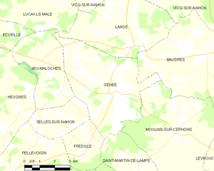
Gehée
- commune in Indre, France
- Country:
- Postal Code: 36240
- Coordinates: 47° 2' 48" N, 1° 30' 7" E
- GPS tracks (wikiloc): [Link]
- Area: 22.75 sq km
- Population: 261

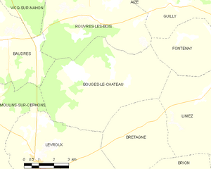
Bouges-le-Château
- commune in Indre, France
- Country:
- Postal Code: 36110
- Coordinates: 47° 2' 22" N, 1° 40' 24" E
- GPS tracks (wikiloc): [Link]
- Area: 34.77 sq km
- Population: 273
Moulins-sur-Céphons
- commune in Indre, France
- Country:
- Postal Code: 36110
- Coordinates: 47° 0' 37" N, 1° 33' 23" E
- GPS tracks (wikiloc): [Link]
- Area: 32.17 sq km
- Population: 303


Vicq-sur-Nahon
- commune in Indre, France
- Country:
- Postal Code: 36600
- Coordinates: 47° 6' 24" N, 1° 31' 52" E
- GPS tracks (wikiloc): [Link]
- Area: 49.08 sq km
- Population: 749