canton of Levroux (canton de Levroux)
- canton of France
- Country:

- Capital: Levroux
- Coordinates: 46° 58' 41" N, 1° 36' 49" E


- GPS tracks (wikiloc): [Link]
- Population: 17016
- Wikipedia en: wiki(en)
- Wikipedia: wiki(fr)
- Wikidata storage: Wikidata: Q971611
- Wikipedia Commons Category: [Link]
- INSEE canton code: [3610]
Includes regions:
Coings
- commune in Indre, France
- Country:

- Postal Code: 36130
- Coordinates: 46° 53' 11" N, 1° 42' 56" E


- GPS tracks (wikiloc): [Link]
- Area: 29.33 sq km
- Population: 822

Vineuil
- commune in Indre, France
- Country:

- Postal Code: 36110
- Coordinates: 46° 54' 3" N, 1° 38' 7" E


- GPS tracks (wikiloc): [Link]
- Area: 44.41 sq km
- Population: 1225


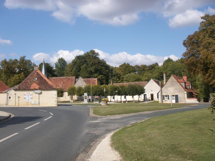
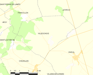
Villegongis
- commune in Indre, France
- Country:

- Postal Code: 36110
- Coordinates: 46° 54' 48" N, 1° 35' 44" E


- GPS tracks (wikiloc): [Link]
- Area: 18.15 sq km
- Population: 121
- Web site: [Link]


Saint-Pierre-de-Lamps
- commune in Indre, France
- Country:

- Postal Code: 36110
- Coordinates: 46° 58' 16" N, 1° 30' 45" E


- GPS tracks (wikiloc): [Link]
- Area: 10.28 sq km
- Population: 53
Rouvres-les-Bois
- commune in Indre, France
- Country:

- Postal Code: 36110
- Coordinates: 47° 4' 19" N, 1° 39' 20" E


- GPS tracks (wikiloc): [Link]
- Area: 30.85 sq km
- Population: 297
- Web site: [Link]

Saint-Martin-de-Lamps
- former commune in Indre, France
- Country:

- Postal Code: 36110
- Coordinates: 46° 59' 26" N, 1° 31' 29" E


- GPS tracks (wikiloc): [Link]
- Area: 15.61 sq km
- Population: 153

Bretagne
- commune in Indre, France
- Country:

- Postal Code: 36110
- Coordinates: 47° 0' 11" N, 1° 40' 50" E


- GPS tracks (wikiloc): [Link]
- Area: 18.36 sq km
- Population: 153
- Web site: [Link]


Brion
- commune in Indre, France
- Country:

- Postal Code: 36110
- Coordinates: 46° 57' 25" N, 1° 43' 40" E


- GPS tracks (wikiloc): [Link]
- Area: 44.2 sq km
- Population: 539


Baudres
- commune in Indre, France
- Country:

- Postal Code: 36110
- Coordinates: 47° 3' 28" N, 1° 34' 42" E


- GPS tracks (wikiloc): [Link]
- Area: 27.4 sq km
- Population: 450


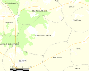
Bouges-le-Château
- commune in Indre, France
- Country:

- Postal Code: 36110
- Coordinates: 47° 2' 22" N, 1° 40' 24" E


- GPS tracks (wikiloc): [Link]
- Area: 34.77 sq km
- Population: 273


Levroux
- commune in Indre, France
- Country:

- Postal Code: 36110
- Coordinates: 46° 58' 37" N, 1° 36' 46" E


- GPS tracks (wikiloc): [Link]
- Area: 56.43 sq km
- Population: 2775
- Web site: [Link]
Moulins-sur-Céphons
- commune in Indre, France
- Country:

- Postal Code: 36110
- Coordinates: 47° 0' 37" N, 1° 33' 23" E


- GPS tracks (wikiloc): [Link]
- Area: 32.17 sq km
- Population: 303

Francillon
- commune in Indre, France
- Country:

- Postal Code: 36110
- Coordinates: 46° 56' 30" N, 1° 33' 43" E


- GPS tracks (wikiloc): [Link]
- Area: 10.27 sq km
- Population: 75
