Bayac (Bayac)

- commune in Dordogne, France
- Country:

- Postal Code: 24150
- Coordinates: 44° 48' 14" N, 0° 43' 34" E


- GPS tracks (wikiloc): [Link]
- Area: 10.23 sq km
- Population: 347
- Web site: http://www.bayac.fr
- Wikipedia en: wiki(en)
- Wikipedia: wiki(fr)
- Wikidata storage: Wikidata: Q1011999
- Wikipedia Commons Category: [Link]
- Freebase ID: [/m/03mfgrg]
- Freebase ID: [/m/03mfgrg]
- GeoNames ID: Alt: [3034499]
- GeoNames ID: Alt: [3034499]
- SIREN number: [212400279]
- SIREN number: [212400279]
- BnF ID: [152516782]
- BnF ID: [152516782]
- INSEE municipality code: 24027
- INSEE municipality code: 24027
Shares border with regions:


Bourniquel
- commune in Dordogne, France
- Country:
- Postal Code: 24150
- Coordinates: 44° 48' 34" N, 0° 46' 29" E
- GPS tracks (wikiloc): [Link]
- Area: 8.96 sq km
- Population: 66
- Web site: [Link]


Monsac
- commune in Dordogne, France
- Country:
- Postal Code: 24440
- Coordinates: 44° 46' 45" N, 0° 41' 49" E
- GPS tracks (wikiloc): [Link]
- Area: 10.74 sq km
- Population: 194
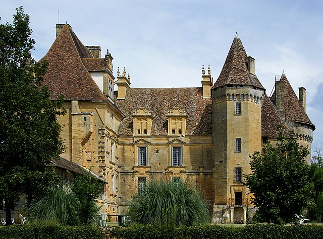
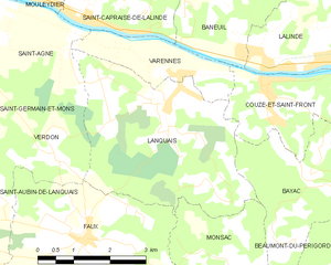
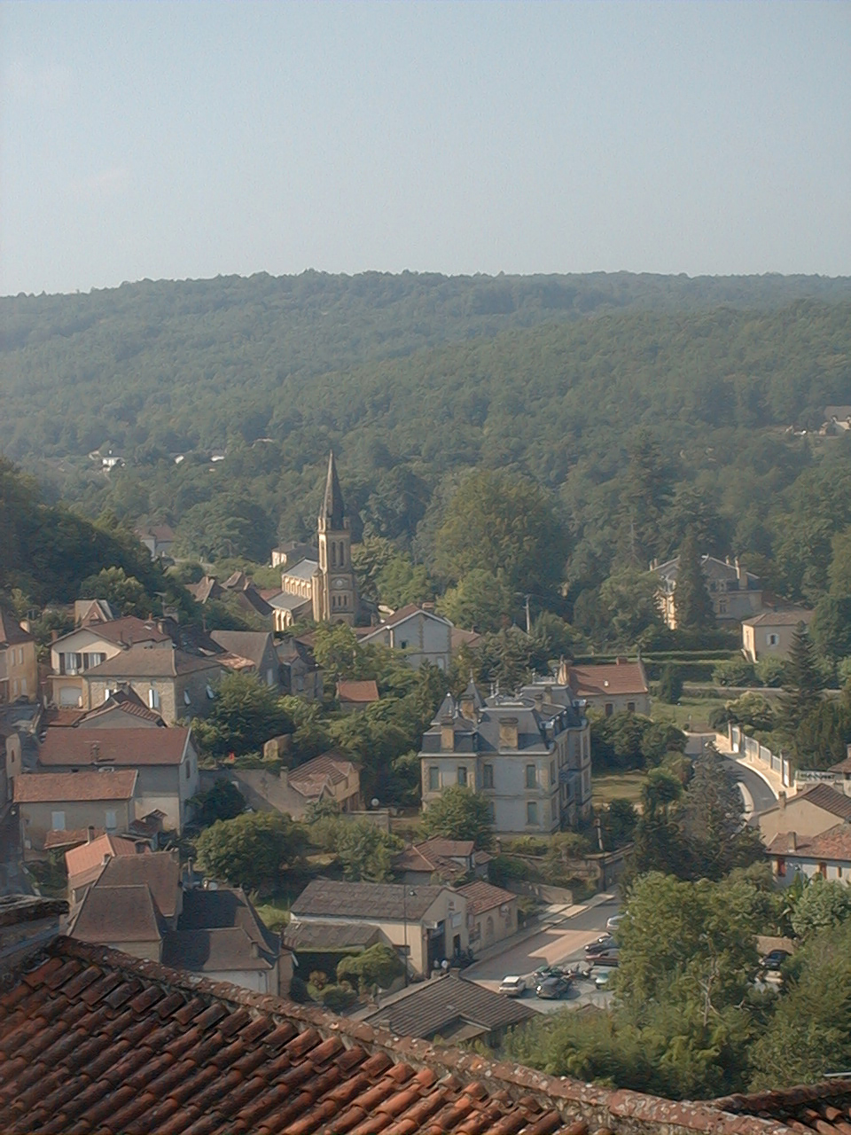
Lanquais
- commune in Dordogne, France
- Country:
- Postal Code: 24150
- Coordinates: 44° 49' 24" N, 0° 40' 12" E
- GPS tracks (wikiloc): [Link]
- Area: 14.48 sq km
- Population: 499

Couze-et-Saint-Front
- commune in Dordogne, France
- Country:
- Postal Code: 24150
- Coordinates: 44° 49' 38" N, 0° 42' 22" E
- GPS tracks (wikiloc): [Link]
- Area: 8.19 sq km
- Population: 726
- Web site: [Link]