Beauchamps (Beauchamps)

- commune in Manche, France
- Country:

- Postal Code: 50320
- Coordinates: 48° 49' 56" N, 1° 21' 32" E


- GPS tracks (wikiloc): [Link]
- Area: 4.1 sq km
- Population: 393
- Wikipedia en: wiki(en)
- Wikipedia: wiki(fr)
- Wikidata storage: Wikidata: Q1003581
- Wikipedia Commons Category: [Link]
- Freebase ID: [/m/03x_vl2]
- Freebase ID: [/m/03x_vl2]
- GeoNames ID: Alt: [6449464]
- GeoNames ID: Alt: [6449464]
- SIREN number: [215000381]
- SIREN number: [215000381]
- BnF ID: [15262017n]
- BnF ID: [15262017n]
- INSEE municipality code: 50038
- INSEE municipality code: 50038
Shares border with regions:


Le Mesnil-Villeman
- commune in Manche, France
- Country:
- Postal Code: 50450
- Coordinates: 48° 51' 52" N, 1° 19' 39" E
- GPS tracks (wikiloc): [Link]
- Area: 10.8 sq km
- Population: 240
- Web site: [Link]

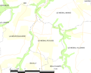
Le Mesnil-Rogues
- commune in Manche, France
- Country:
- Postal Code: 50450
- Coordinates: 48° 51' 46" N, 1° 22' 52" E
- GPS tracks (wikiloc): [Link]
- Area: 4.78 sq km
- Population: 155


Équilly
- commune in Manche, France
- Country:
- Postal Code: 50320
- Coordinates: 48° 50' 24" N, 1° 23' 13" E
- GPS tracks (wikiloc): [Link]
- Area: 5.65 sq km
- Population: 194


La Haye-Pesnel
- commune in Manche, France
- Country:
- Postal Code: 50320
- Coordinates: 48° 47' 44" N, 1° 23' 48" E
- GPS tracks (wikiloc): [Link]
- Area: 6.29 sq km
- Population: 1360


Champrepus
- commune in Manche, France
- Country:
- Postal Code: 50800
- Coordinates: 48° 50' 2" N, 1° 19' 16" E
- GPS tracks (wikiloc): [Link]
- Area: 9.12 sq km
- Population: 335