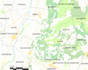
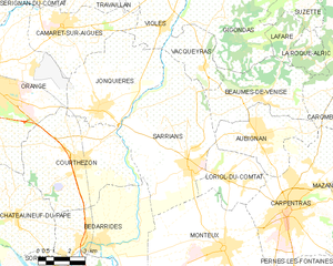
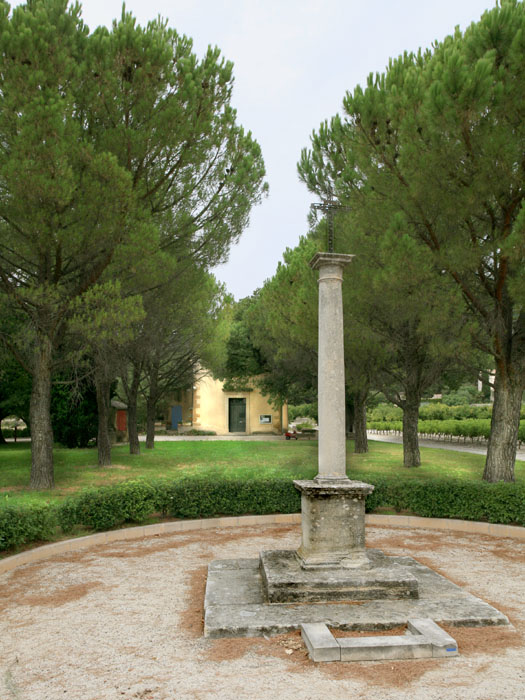
Beaumes-de-Venise (Beaumes-de-Venise)
- commune in Vaucluse, France
Beaumes-de-Venise is a picturesque village located in the Vaucluse department of the Provence-Alpes-Côte d'Azur region in France. The area is well-known for its stunning landscapes, vineyards, and proximity to the Dentelles de Montmirail mountain range, making it a great destination for hiking enthusiasts. Here are some key highlights about hiking in this region:
Trails and Landscapes
-
Varied Difficulty Levels: The trails in and around Beaumes-de-Venise offer a variety of difficulty levels, suitable for both novice and experienced hikers. You can find gentle paths through vineyards as well as more challenging routes that ascend into the hills.
-
Scenic Views: Many hiking trails provide breathtaking views of the surrounding vineyards, hills, and the iconic Mont Ventoux. The changing landscapes throughout the seasons add to the beauty of the hikes.
-
Dentelles de Montmirail: Just a short distance from Beaumes-de-Venise, the Dentelles de Montmirail offers numerous trails. The area is famous for its rugged limestone formations and striking ridge lines. Trails here can be more strenuous but reward you with stunning panoramas.
Recommendations
-
Trail Maps: Before you head out, it’s wise to acquire a good trail map. Local tourist offices can provide detailed maps and information about the trails, including their difficulty and length.
-
Local Guidance: Consider joining a guided hike if you're unfamiliar with the area. Local guides can enhance your experience by sharing insights about the natural environment and history.
-
Seasonal Considerations: Spring and fall are ideal for hiking, as temperatures are comfortable, and the landscapes are vibrant. Summer can get quite hot, so early morning or late afternoon hikes are advisable during that time.
-
Safety Tips: Always carry enough water, wear appropriate footwear, and check the weather forecast before you set out. Given the varying terrain, be prepared for changes in elevation.
Cultural Experience
In addition to stunning trails, the Beaumes-de-Venise area offers opportunities to enjoy local culture, including tasting the renowned Muscat wine produced in the region. Don’t miss the chance to explore the village itself, which features charming streets and historic architecture.
Conclusion
Whether you are looking for a leisurely stroll through vineyards or a more challenging hike with breathtaking views, Beaumes-de-Venise and its surroundings have something to offer every hiker. Enjoy your adventure in this beautiful part of France!
- Country:

- Postal Code: 84190
- Coordinates: 44° 7' 22" N, 5° 1' 50" E


- GPS tracks (wikiloc): [Link]
- Area: 18.89 sq km
- Population: 2387
- Web site: http://www.mairie-de-beaumes-de-venise.fr
- Wikipedia en: wiki(en)
- Wikipedia: wiki(fr)
- Wikidata storage: Wikidata: Q381313
- Wikipedia Commons Category: [Link]
- Freebase ID: [/m/0c3bfz]
- GeoNames ID: Alt: [3034218]
- SIREN number: [218400125]
- BnF ID: [152779929]
- VIAF ID: Alt: [127978674]
- GND ID: Alt: [4495995-3]
- archINFORM location ID: [8722]
- Library of Congress authority ID: Alt: [n91072909]
- PACTOLS thesaurus ID: [pcrtIoWEOtB4UG]
- INSEE municipality code: 84012
Shares border with regions:


Lafare
- commune in Vaucluse, France
It seems there might be a slight mix-up regarding the location you referred to as "Lafare." If you're referring to a specific place, it may not be widely recognized. However, if you are referring to a more popular hiking destination or a slight variation in the name (like “Lafayette” or “La Fer”?), please clarify....
- Country:

- Postal Code: 84190
- Coordinates: 44° 8' 50" N, 5° 3' 5" E


- GPS tracks (wikiloc): [Link]
- Area: 4.54 sq km
- Population: 126


Gigondas
- commune in Vaucluse, France
Gigondas is a charming village located in the Vaucluse department of the Provence-Alpes-Côte d'Azur region in southeastern France. Known primarily for its rich vineyards and stunning landscapes, Gigondas offers excellent opportunities for hiking enthusiasts. Here are some key points to consider when hiking in and around Gigondas:...
- Country:

- Postal Code: 84190
- Coordinates: 44° 9' 50" N, 5° 0' 17" E


- GPS tracks (wikiloc): [Link]
- Area: 27.14 sq km
- Population: 532
- Web site: [Link]


Sarrians
- commune in Vaucluse, France
Sarrians is a commune located in the Vaucluse department of the Provence-Alpes-Côte d'Azur region in southeastern France. Surrounded by the beauty of the Provençal countryside, Sarrians offers a variety of hiking opportunities that cater to different levels of experience and preferences....
- Country:

- Postal Code: 84260
- Coordinates: 44° 5' 0" N, 4° 58' 16" E


- GPS tracks (wikiloc): [Link]
- Area: 37.49 sq km
- Population: 5930
- Web site: [Link]


Vacqueyras
- commune in Vaucluse, France
Vacqueyras is a picturesque village located in the Vaucluse department of the Provence-Alpes-Côte d'Azur region in southeastern France. It's renowned for its stunning landscapes and wine production, particularly its Côtes du Rhône wines. Here are some insights into hiking in the Vacqueyras area:...
- Country:

- Postal Code: 84190
- Coordinates: 44° 8' 18" N, 4° 58' 56" E


- GPS tracks (wikiloc): [Link]
- Area: 8.97 sq km
- Population: 1260
- Web site: [Link]


La Roque-Alric
- commune in Vaucluse, France
La Roque-Alric is a charming village located in the Vaucluse department in the Provence-Alpes-Côte d'Azur region of France. It's set against a backdrop of stunning cliffs and vineyards, making it a scenic destination for hiking enthusiasts. Here are some points to consider if you’re planning to hike in and around La Roque-Alric:...
- Country:

- Postal Code: 84190
- Coordinates: 44° 8' 35" N, 5° 3' 51" E


- GPS tracks (wikiloc): [Link]
- Area: 4.87 sq km
- Population: 51


Aubignan
- commune in Vaucluse, France
Aubignan, located in the Vaucluse department in the Provence-Alpes-Côte d'Azur region of southern France, offers a picturesque setting for hiking enthusiasts. The area is characterized by its beautiful landscapes, vineyards, and the backdrop of the majestic Mont Ventoux....
- Country:

- Postal Code: 84810
- Coordinates: 44° 5' 59" N, 5° 1' 31" E


- GPS tracks (wikiloc): [Link]
- Area: 15.7 sq km
- Population: 5533
- Web site: [Link]


Saint-Hippolyte-le-Graveyron
- commune in Vaucluse, France
 Hiking in Saint-Hippolyte-le-Graveyron
Saint-Hippolyte-le-Graveyron is a charming commune located in the Vaucluse department of the Provence-Alpes-Côte d'Azur region in southeastern France. It is known for its beautiful landscapes, serene atmosphere, and proximity to several natural and cultural attractions, making it an appealing destination for hikers and outdoor enthusiasts....
- Country:

- Postal Code: 84330
- Coordinates: 44° 7' 22" N, 5° 4' 28" E


- GPS tracks (wikiloc): [Link]
- AboveSeaLevel: 170 м m
- Area: 4.94 sq km
- Population: 182
