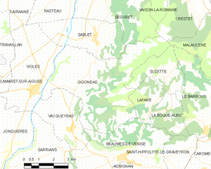
Gigondas (Gigondas)
- commune in Vaucluse, France
Gigondas is a charming village located in the Vaucluse department of the Provence-Alpes-Côte d'Azur region in southeastern France. Known primarily for its rich vineyards and stunning landscapes, Gigondas offers excellent opportunities for hiking enthusiasts. Here are some key points to consider when hiking in and around Gigondas:
Scenic Trails
-
Vineyard Trails: Many trails weave through the vineyards that produce the renowned Gigondas wine. These paths often provide breathtaking views of the surrounding countryside and the majestic Dentelles de Montmirail mountain range.
-
Dentelles de Montmirail: This mountain range offers some of the most spectacular hiking in the area. Popular trails include routes that lead to viewpoints where hikers can enjoy panoramic vistas of the vineyards and valleys below.
-
GR Trails: The Grande Randonnée (GR) network, which is a system of long-distance hiking trails in France, passes through this region. The GR4 and GR6 trails are nearby, providing more extensive hiking options for those looking to explore further.
Flora and Fauna
The area around Gigondas is rich in flora and fauna. Hikers can expect to see diverse plant life typical of Mediterranean regions, as well as potential wildlife sightings, including various bird species and small mammals.
Hiking Tips
-
Best Time to Hike: The ideal seasons for hiking in Gigondas are spring (April to June) and fall (September to November) when temperatures are milder, and the landscape is particularly beautiful.
-
Check Local Maps: Always pick up detailed hiking maps from local tourism offices or online resources to ensure that you have the most accurate information on trails.
-
Hydration and Snacks: Carry enough water and snacks, as some trails can be remote. In summer, temperatures can rise, making hydration particularly important.
-
Footwear: Wear sturdy hiking shoes that provide good ankle support, as some trails can be rocky or uneven.
-
Respect Nature: Stay on designated paths to protect local flora and fauna, and make sure to carry out any waste to keep the environment clean.
Local Attractions
After a day of hiking, take some time to explore the village of Gigondas. You can enjoy wine tasting at local vineyards, visit the charming churches and architecture, or relax in a café with a stunning view of the surrounding countryside.
Hiking in Gigondas combines the beauty of nature with the rich cultural heritage of Provence, making it a rewarding experience for adventurers and nature lovers.
- Country:

- Postal Code: 84190
- Coordinates: 44° 9' 50" N, 5° 0' 17" E


- GPS tracks (wikiloc): [Link]
- Area: 27.14 sq km
- Population: 532
- Web site: http://www.gigondas-dm.fr/officetourisme/indexoffice.asp
- Wikipedia en: wiki(en)
- Wikipedia: wiki(fr)
- Wikidata storage: Wikidata: Q334400
- Wikipedia Commons Category: [Link]
- Freebase ID: [/m/02vkhr6]
- GeoNames ID: Alt: [6451547]
- SIREN number: [218400497]
- BnF ID: [152780299]
- Quora topic ID: [Gigondas]
- INSEE municipality code: 84049
Shares border with regions:
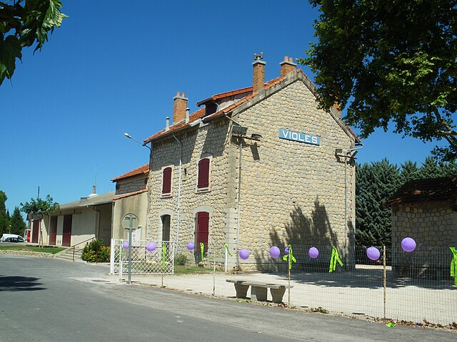

Violès
- commune in Vaucluse, France
Violès is a charming commune located in the Vaucluse department in the southeastern part of France. The area is known for its picturesque landscapes, vineyards, and proximity to the stunning natural beauty of the Provence region, making it an excellent destination for hiking enthusiasts....
- Country:

- Postal Code: 84150
- Coordinates: 44° 9' 43" N, 4° 57' 17" E


- GPS tracks (wikiloc): [Link]
- Area: 14.79 sq km
- Population: 1640
- Web site: [Link]


Lafare
- commune in Vaucluse, France
It seems there might be a slight mix-up regarding the location you referred to as "Lafare." If you're referring to a specific place, it may not be widely recognized. However, if you are referring to a more popular hiking destination or a slight variation in the name (like “Lafayette” or “La Fer”?), please clarify....
- Country:

- Postal Code: 84190
- Coordinates: 44° 8' 50" N, 5° 3' 5" E


- GPS tracks (wikiloc): [Link]
- Area: 4.54 sq km
- Population: 126


Suzette
- commune in Vaucluse, France
Suzette, located in the Vaucluse department of France, is a charming village nestled at the foot of the Dentelles de Montmirail mountain range. The area is known for its stunning landscapes, vineyards, and diverse hiking trails suitable for different skill levels....
- Country:

- Postal Code: 84190
- Coordinates: 44° 10' 5" N, 5° 4' 6" E


- GPS tracks (wikiloc): [Link]
- Area: 6.75 sq km
- Population: 126

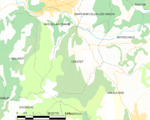
Crestet
- commune in Vaucluse, France
Crestet, located in the Vaucluse department of the Provence-Alpes-Côte d'Azur region in southeastern France, is a charming village that offers stunning views and beautiful hiking opportunities. Nestled at the foot of the Dentelles de Montmirail mountains, the area is characterized by its scenic landscapes, vineyards, and charming historical architecture....
- Country:

- Postal Code: 84110
- Coordinates: 44° 13' 4" N, 5° 5' 51" E


- GPS tracks (wikiloc): [Link]
- Area: 11.48 sq km
- Population: 408
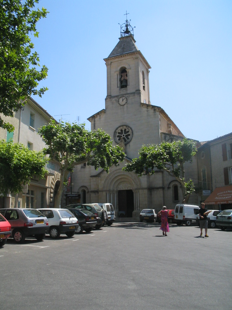

Beaumes-de-Venise
- commune in Vaucluse, France
Beaumes-de-Venise is a picturesque village located in the Vaucluse department of the Provence-Alpes-Côte d'Azur region in France. The area is well-known for its stunning landscapes, vineyards, and proximity to the Dentelles de Montmirail mountain range, making it a great destination for hiking enthusiasts. Here are some key highlights about hiking in this region:...
- Country:

- Postal Code: 84190
- Coordinates: 44° 7' 22" N, 5° 1' 50" E


- GPS tracks (wikiloc): [Link]
- Area: 18.89 sq km
- Population: 2387
- Web site: [Link]


Vacqueyras
- commune in Vaucluse, France
Vacqueyras is a picturesque village located in the Vaucluse department of the Provence-Alpes-Côte d'Azur region in southeastern France. It's renowned for its stunning landscapes and wine production, particularly its Côtes du Rhône wines. Here are some insights into hiking in the Vacqueyras area:...
- Country:

- Postal Code: 84190
- Coordinates: 44° 8' 18" N, 4° 58' 56" E


- GPS tracks (wikiloc): [Link]
- Area: 8.97 sq km
- Population: 1260
- Web site: [Link]

Malaucène
- commune in Vaucluse, France
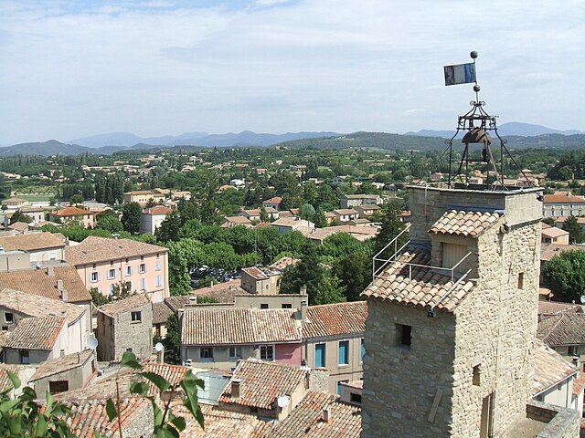
Malaucène is a charming village located in the Vaucluse department of the Provence-Alpes-Côte d'Azur region in southern France. It is nestled at the foot of Mont Ventoux, one of the most famous peaks in the region, which offers a wide range of hiking opportunities for both novice and experienced hikers....
- Country:

- Postal Code: 84340
- Coordinates: 44° 10' 27" N, 5° 7' 56" E


- GPS tracks (wikiloc): [Link]
- Area: 45.33 sq km
- Population: 2849
- Web site: [Link]


Sablet
- commune in Vaucluse, France
Sablet is a charming village located in the Vaucluse department in the Provence-Alpes-Côte d'Azur region of France. It’s known for its picturesque countryside, vineyards, and historical architecture. The area surrounding Sablet offers a variety of hiking opportunities that showcase the natural beauty and cultural heritage of the region....
- Country:

- Postal Code: 84110
- Coordinates: 44° 11' 33" N, 5° 0' 20" E


- GPS tracks (wikiloc): [Link]
- Area: 11.1 sq km
- Population: 1249


Séguret
- commune in Vaucluse, France
Séguret is a charming village located in the Provence region of southeastern France, known for its picturesque landscapes, rich history, and beautiful vineyards. Hiking in and around Séguret offers an opportunity to explore the stunning natural scenery, including rolling hills, terraced vineyards, and scenic views of the nearby Dentelles de Montmirail mountains....
- Country:

- Postal Code: 84110
- Coordinates: 44° 12' 22" N, 5° 1' 22" E


- GPS tracks (wikiloc): [Link]
- Area: 21.04 sq km
- Population: 847
