Bellou-le-Trichard (Bellou-le-Trichard)

- commune in Orne, France
- Country:

- Postal Code: 61130
- Coordinates: 48° 16' 4" N, 0° 32' 47" E


- GPS tracks (wikiloc): [Link]
- Area: 9.67 sq km
- Population: 222
- Web site: http://www.bellouletrichard.com
- Wikipedia en: wiki(en)
- Wikipedia: wiki(fr)
- Wikidata storage: Wikidata: Q1095786
- Wikipedia Commons Category: [Link]
- Freebase ID: [/m/03qcsc6]
- Freebase ID: [/m/03qcsc6]
- GeoNames ID: Alt: [6450186]
- GeoNames ID: Alt: [6450186]
- SIREN number: [216100412]
- SIREN number: [216100412]
- BnF ID: [15267976v]
- BnF ID: [15267976v]
- INSEE municipality code: 61041
- INSEE municipality code: 61041
Shares border with regions:


Nogent-le-Bernard
- commune in Sarthe, France
- Country:
- Postal Code: 72110
- Coordinates: 48° 14' 10" N, 0° 29' 21" E
- GPS tracks (wikiloc): [Link]
- Area: 30.26 sq km
- Population: 946

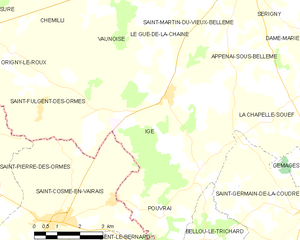
Igé
- commune in Orne, France
- Country:
- Postal Code: 61130
- Coordinates: 48° 19' 28" N, 0° 31' 17" E
- GPS tracks (wikiloc): [Link]
- Area: 27.86 sq km
- Population: 663


Saint-Germain-de-la-Coudre
- commune in Orne, France
- Country:
- Postal Code: 61130
- Coordinates: 48° 16' 50" N, 0° 36' 17" E
- GPS tracks (wikiloc): [Link]
- Area: 26.21 sq km
- Population: 772
- Web site: [Link]


Pouvrai
- commune in Orne, France
- Country:
- Postal Code: 61130
- Coordinates: 48° 16' 36" N, 0° 31' 4" E
- GPS tracks (wikiloc): [Link]
- Area: 6.8 sq km
- Population: 109


La Chapelle-du-Bois
- commune in Sarthe, France
- Country:
- Postal Code: 72400
- Coordinates: 48° 13' 15" N, 0° 35' 33" E
- GPS tracks (wikiloc): [Link]
- Area: 16.53 sq km
- Population: 883