La Chapelle-du-Bois (La Chapelle-du-Bois)
- commune in Sarthe, France
- Country:

- Postal Code: 72400
- Coordinates: 48° 13' 15" N, 0° 35' 33" E


- GPS tracks (wikiloc): [Link]
- Area: 16.53 sq km
- Population: 883
- Wikipedia en: wiki(en)
- Wikipedia: wiki(fr)
- Wikidata storage: Wikidata: Q674625
- Wikipedia Commons Category: [Link]
- Freebase ID: [/m/03qkzf5]
- GeoNames ID: Alt: [6457052]
- SIREN number: [217200625]
- BnF ID: [15273619f]
- VIAF ID: Alt: [130630774]
- Library of Congress authority ID: Alt: [nr95018258]
- INSEE municipality code: 72062
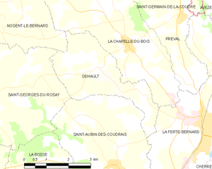
Shares border with regions:


Bellou-le-Trichard
- commune in Orne, France
- Country:

- Postal Code: 61130
- Coordinates: 48° 16' 4" N, 0° 32' 47" E


- GPS tracks (wikiloc): [Link]
- Area: 9.67 sq km
- Population: 222
- Web site: [Link]


Nogent-le-Bernard
- commune in Sarthe, France
- Country:

- Postal Code: 72110
- Coordinates: 48° 14' 10" N, 0° 29' 21" E


- GPS tracks (wikiloc): [Link]
- Area: 30.26 sq km
- Population: 946


Dehault
- commune in Sarthe, France
- Country:

- Postal Code: 72400
- Coordinates: 48° 12' 37" N, 0° 34' 12" E


- GPS tracks (wikiloc): [Link]
- Area: 8.94 sq km
- Population: 272


Saint-Germain-de-la-Coudre
- commune in Orne, France
- Country:

- Postal Code: 61130
- Coordinates: 48° 16' 50" N, 0° 36' 17" E


- GPS tracks (wikiloc): [Link]
- Area: 26.21 sq km
- Population: 772
- Web site: [Link]


Préval
- commune in Sarthe, France
- Country:

- Postal Code: 72400
- Coordinates: 48° 14' 5" N, 0° 37' 26" E


- GPS tracks (wikiloc): [Link]
- Area: 7.62 sq km
- Population: 685


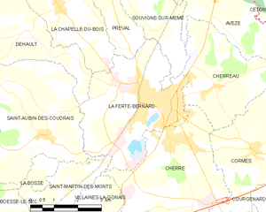
La Ferté-Bernard
- commune in Sarthe, France
- Country:

- Postal Code: 72400
- Coordinates: 48° 11' 12" N, 0° 39' 16" E


- GPS tracks (wikiloc): [Link]
- Area: 14.96 sq km
- Population: 8875
- Web site: [Link]
