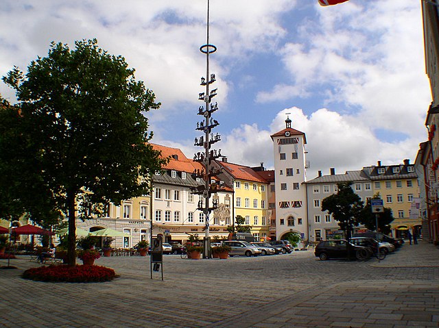
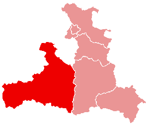
Berchtesgadener Land (Landkreis Berchtesgadener Land)

- district of Bavaria, Germany
 Hiking in Berchtesgadener Land
Berchtesgadener Land is a stunning region in Bavaria, Germany, known for its breathtaking landscapes, towering mountains, lush valleys, and crystal-clear lakes. It’s a hiker’s paradise with trails suitable for all levels of experience. Here are some highlights and tips for hiking in this beautiful area:
Key Features:
-
Scenic Trails:
- Watzmann: The third-highest mountain in Germany. The hike to Watzmannhaus offers stunning views, but it can be challenging. There are also routes suitable for less experienced hikers.
- Königssee: A picturesque lake surrounded by mountains. Various trails lead along the lake and up into the surrounding hills, providing spectacular views.
- Roßfeld Panorama Road: A scenic drive that also offers several hiking opportunities with panoramic views of the surrounding peaks.
-
National Park Berchtesgaden:
- This park offers well-marked hiking trails, visitor centers, and a chance to see wildlife such as chamois, marmots, and eagles. Trails range from easy walks to challenging climbs.
- The park also features eco-friendly hiking options with detailed information on the local flora and fauna.
-
Alpine Huts: Traditional huts along hiking trails serve local cuisine and provide rest spots. This is a great chance to sample Bavarian specialties while enjoying the mountain views.
-
Seasonal Hiking:
- Hiking is popular from spring to autumn, but winter offers opportunities for snowshoe hiking and other snow-related activities. Be sure to check trail conditions, especially in the shoulder seasons.
Tips for Hiking in Berchtesgadener Land:
-
Preparation:
- Always check the weather forecast and trail conditions before heading out. The weather can change rapidly in the mountains.
- Carry adequate supplies: water, snacks, first-aid kit, and a map or GPS device.
-
Safety:
- Stick to marked trails and follow signage. Some paths can be steep or rugged.
- Ensure you have suitable footwear and clothing for the terrain.
-
Respect Nature:
- Wildlife is abundant, so keep your distance and do not feed animals. Please follow Leave No Trace principles to preserve the pristine environment.
-
Local Guidance:
- If you are unsure about your abilities or wish to explore more challenging areas, consider hiring a local guide who can provide insights and enhance your experience.
Conclusion
Hiking in Berchtesgadener Land is an unforgettable experience that combines stunning natural beauty with rich cultural heritage. Whether you are looking for a leisurely stroll or a challenging mountain trek, this region has something to offer every outdoor enthusiast. Just remember to prepare adequately and respect the natural environment!
- Country:

- Capital: Bad Reichenhall
- Licence Plate Code: BGL
- Coordinates: 47° 44' 0" N, 12° 53' 0" E


- GPS tracks (wikiloc): [Link]
- AboveSeaLevel: 465 м m
- Area: 840.00 sq km
- Population: 90689
- Web site: http://www.berchtesgadener-land.de/
- Wikipedia en: wiki(en)
- Wikipedia: wiki(de)
- Wikidata storage: Wikidata: Q10530
- Wikipedia Commons Gallery: [Link]
- Wikipedia Commons Category: [Link]
- Wikipedia Commons Maps Category: [Link]
- Freebase ID: [/m/01dljb]
- GeoNames ID: Alt: [2950877]
- VIAF ID: Alt: [133712219]
- OSM relation ID: [62712]
- GND ID: Alt: [4005577-2]
- archINFORM location ID: [2335]
- Library of Congress authority ID: Alt: [n82063681]
- Bavarikon ID: [ODB_A00000932]
- NUTS code: [DE215]
- BabelNet ID: [01356055n]
- German district key: 09172
Includes regions:


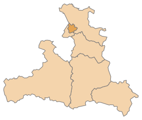
Marktschellenberg
- municipality of Germany
Hiking in Marktschellenberg
Marktschellenberg, located in Bavaria, Germany, offers a beautiful hiking experience with stunning landscapes and a variety of trails suited for different skill levels. Nestled near the Berchtesgaden National Park, it's an excellent location for both casual hikers and serious trekkers....
- Country:
- Postal Code: 83487
- Local Dialing Code: 08650
- Licence Plate Code: BGL
- Coordinates: 47° 41' 42" N, 13° 2' 48" E
- GPS tracks (wikiloc): [Link]
- AboveSeaLevel: 503 м m
- Area: 17.66 sq km
- Population: 1785
- Web site: [Link]


Eck im Landkreis Berchtesgadener Land
- unincorporated area in Germany
Hiking in Eck im Landkreis Berchtesgadener Land
Eck, located in the German state of Bavaria, is known for its beautiful landscapes and outdoor activities, including hiking. Though it's a gemeindefreies Gebiet (a district free of municipalities), it has several trails and natural features that make it appealing to hikers....
- Country:
- Coordinates: 47° 37' 27" N, 13° 4' 39" E
- GPS tracks (wikiloc): [Link]
- AboveSeaLevel: 1421 м m


Laufen, Germany
- town in Bavaria, Germany
Hiking in Laufen, Germany
Laufen, Germany, located in the scenic district of Berchtesgadener Land, offers a variety of hiking opportunities for both beginners and experienced hikers. The region is known for its beautiful landscapes, ranging from rolling hills to more rugged mountain terrain. Here are some key highlights about hiking in and around Laufen:...
- Country:
- Postal Code: 83410
- Local Dialing Code: 08682
- Coordinates: 47° 56' 0" N, 12° 56' 0" E
- GPS tracks (wikiloc): [Link]
- AboveSeaLevel: 423 м m
- Area: 35.31 sq km
- Population: 6954
- Web site: [Link]

Ramsau bei Berchtesgaden
- municipality of Germany
Hiking in Ramsau bei Berchtesgaden
Ramsau bei Berchtesgaden is a stunning location for hiking, situated in Bavaria, Germany, near the Berchtesgaden National Park. The area is known for its breathtaking landscapes, which include mountains, alpine meadows, and pristine lakes. Here are some highlights and tips for hiking in Ramsau:...
- Country:
- Postal Code: 83486
- Local Dialing Code: 08657
- Licence Plate Code: BGL
- Coordinates: 47° 37' 0" N, 12° 54' 0" E
- GPS tracks (wikiloc): [Link]
- AboveSeaLevel: 670 м m
- Area: 129.18 sq km
- Population: 1696
- Web site: [Link]


Schneizlreuth
- municipality of Germany
Hiking in Schneizlreuth
Schneizlreuth is a picturesque village located in Bavaria, Germany, near the border with Austria. It’s part of the Berchtesgadener Land district and is known for its beautiful natural scenery, making it a great location for hiking enthusiasts. Here are some highlights and tips for hiking in and around Schneizlreuth:...
- Country:
- Postal Code: 83458
- Local Dialing Code: 08651
- Licence Plate Code: BGL
- Coordinates: 47° 41' 0" N, 12° 48' 0" E
- GPS tracks (wikiloc): [Link]
- AboveSeaLevel: 511 м m
- Area: 107.28 sq km
- Population: 1264
- Web site: [Link]

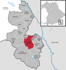
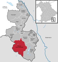
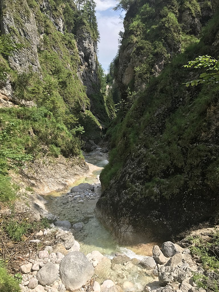
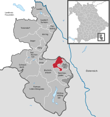
Bischofswiesen
- municipality of Germany
Hiking in Bischofswiesen
Bischofswiesen is a beautiful village located in the Berchtesgadener Land district of Bavaria, Germany. It's a fantastic base for hiking enthusiasts due to its stunning landscapes, proximity to the Berchtesgaden National Park, and access to various trails that cater to different skill levels. Here are some highlights of hiking in Bischofswiesen:...
- Country:
- Postal Code: 83483
- Local Dialing Code: 08652
- Licence Plate Code: BGL
- Coordinates: 47° 38' 58" N, 12° 57' 50" E
- GPS tracks (wikiloc): [Link]
- AboveSeaLevel: 633 м m
- Area: 34.46 sq km
- Population: 7033
- Web site: [Link]


Anger, Bavaria
- municipality of Germany
Hiking in Anger, Bavaria
Hiking in Anger, Bavaria, offers a wonderful opportunity to explore the stunning natural landscapes of the Bavarian Alps. Anger is a picturesque village located near the edge of the Berchtesgaden National Park, making it a fantastic starting point for numerous hiking trails....
- Country:
- Postal Code: 83454
- Local Dialing Code: 08656
- Licence Plate Code: BGL
- Coordinates: 47° 48' 0" N, 12° 51' 0" E
- GPS tracks (wikiloc): [Link]
- AboveSeaLevel: 558 м m
- Area: 45.91 sq km
- Population: 3739
- Web site: [Link]


Bayerisch Gmain
- municipality of Germany
Hiking in Bayerisch Gmain
Bayerisch Gmain is a beautiful hiking destination located near the border of Germany and Austria, in the foothills of the Alps. This picturesque village is part of the Berchtesgadener Land district in Bavaria and offers stunning views, diverse terrain, and a variety of hiking trails suitable for all skill levels....
- Country:
- Postal Code: 83457
- Local Dialing Code: 08651
- Licence Plate Code: BGL
- Coordinates: 47° 43' 10" N, 12° 53' 48" E
- GPS tracks (wikiloc): [Link]
- AboveSeaLevel: 540 м m
- Area: 12.33 sq km
- Population: 3045
- Web site: [Link]


Piding
- municipality of Germany
Hiking in Piding
Piding, located in Bavaria, Germany, is a charming destination for hiking enthusiasts. Nestled in the foothills of the Alps, it offers a variety of trails suitable for different skill levels....
- Country:
- Postal Code: 83448–83451
- Local Dialing Code: 08651
- Licence Plate Code: BGL
- Coordinates: 47° 46' 0" N, 12° 55' 0" E
- GPS tracks (wikiloc): [Link]
- AboveSeaLevel: 455 м m
- Area: 17.67 sq km
- Population: 4213
- Web site: [Link]


Berchtesgaden
- municipality of Germany
Hiking in Berchtesgaden
Berchtesgaden, located in southeastern Germany near the Austrian border, is a breathtaking destination for hiking enthusiasts. The area is part of the Berchtesgaden National Park, which offers stunning landscapes, ranging from towering mountains and lush valleys to pristine alpine lakes. Here are some key points about hiking in Berchtesgaden:...
- Country:
- Postal Code: 83471
- Local Dialing Code: 08652
- Coordinates: 47° 37' 53" N, 13° 0' 15" E
- GPS tracks (wikiloc): [Link]
- AboveSeaLevel: 572 м m
- Area: 35.61 sq km
- Population: 7888
- Web site: [Link]


Freilassing
- town in Bavaria, Germany
Hiking in Freilassing
Freilassing, located in Bavaria, Germany, near the border with Austria, offers a charming backdrop for hiking enthusiasts. The region is characterized by its scenic landscapes, including lush forests, rolling hills, and views of the nearby Alps....
- Country:
- Postal Code: 83395
- Local Dialing Code: 08654
- Licence Plate Code: BGL
- Coordinates: 47° 50' 0" N, 12° 58' 0" E
- GPS tracks (wikiloc): [Link]
- AboveSeaLevel: 423 м m
- Area: 14.81 sq km
- Population: 16194
- Web site: [Link]


Ainring
- municipality of Germany
Hiking in Ainring
Ainring, located in Bavaria, Germany, is a wonderful destination for hiking enthusiasts. Nestled close to the beautiful Berchtesgadener Alps, Ainring offers various trails that cater to different skill levels, ranging from easy walks to more challenging hikes....
- Country:
- Postal Code: 83404
- Local Dialing Code: 08656; 08654
- Licence Plate Code: BGL
- Coordinates: 47° 48' 49" N, 12° 56' 34" E
- GPS tracks (wikiloc): [Link]
- AboveSeaLevel: 459 м m
- Area: 32.97 sq km
- Population: 8099
- Web site: [Link]


Bad Reichenhall
- town in Bavaria, Germany
Hiking in Bad Reichenhall
Bad Reichenhall, located in Bavaria, Germany, is a fantastic destination for hiking enthusiasts. Nestled in the stunning Berchtesgadener Land region, the area offers a beautiful backdrop of mountains, lush forests, and picturesque valleys. Here are some details about hiking in Bad Reichenhall:...
- Country:
- Postal Code: 83435
- Local Dialing Code: 08651
- Coordinates: 47° 43' 29" N, 12° 52' 37" E
- GPS tracks (wikiloc): [Link]
- AboveSeaLevel: 470 м m
- Area: 41.92 sq km
- Population: 17443
- Web site: [Link]


Schönau am Königsee
- municipality of Germany
Hiking in Schönau am Königsee
Schönau am Königsee is a stunning hiking destination located in Bavaria, Germany, near the border with Austria. Nestled in the Berchtesgaden National Park, it offers breathtaking views of the Alps, beautiful lakes, and well-maintained hiking trails suited for various skill levels. Here are some highlights for hiking in the area:...
- Country:
- Postal Code: 83471
- Local Dialing Code: 08652
- Licence Plate Code: BGL
- Coordinates: 47° 36' 0" N, 12° 58' 0" E
- GPS tracks (wikiloc): [Link]
- AboveSeaLevel: 630 м m
- Area: 131.68 sq km
- Population: 5423
- Web site: [Link]


Saaldorf-Surheim
- municipality of Germany
Hiking in Saaldorf-Surheim
Saaldorf-Surheim is a charming municipality located in Bavaria, Germany, not far from the borders of Austria. It is surrounded by beautiful landscapes that are ideal for hiking enthusiasts. Here are some highlights and tips for hiking in and around Saaldorf-Surheim:...
- Country:
- Postal Code: 83416
- Local Dialing Code: 08682; 08666; 08654
- Coordinates: 47° 53' 0" N, 12° 57' 0" E
- GPS tracks (wikiloc): [Link]
- AboveSeaLevel: 449 м m
- Area: 39.09 sq km
- Population: 4125
- Web site: [Link]


Teisendorf
- municipality of Germany
Hiking in Teisendorf
Teisendorf, located in Bavaria, Germany, is a charming town that offers a variety of hiking opportunities amidst beautiful natural scenery. Surrounded by the picturesque Alps and lush landscapes, it's an excellent destination for hiking enthusiasts of all skill levels....
- Country:
- Postal Code: 83317
- Local Dialing Code: 08666
- Licence Plate Code: BGL
- Coordinates: 47° 51' 0" N, 12° 49' 0" E
- GPS tracks (wikiloc): [Link]
- AboveSeaLevel: 501 м m
- Area: 86.77 sq km
- Population: 8061
- Web site: [Link]
Schellenberger Forst
- unincorporated area in Germany
Hiking in Schellenberger Forst
Schellenberger Forst is a beautiful forest area located in Bavaria, Germany, near the town of Berchtesgaden. It's known for its stunning natural scenery, diverse flora and fauna, and well-maintained hiking trails, making it an excellent destination for outdoor enthusiasts....
- Country:
- Coordinates: 47° 42' 0" N, 13° 0' 0" E
- GPS tracks (wikiloc): [Link]
Shares border with regions:
Traunstein
- district of Bavaria, Germany
Hiking in Traunstein
Traunstein, located in Bavaria, Germany, is a beautiful area known for its picturesque landscapes, charming villages, and a variety of hiking opportunities. The region is characterized by its rolling hills, mountains, and lakes, making it ideal for outdoor enthusiasts. Here are some highlights for hiking in Traunstein:...
- Country:
- Capital: Traunstein
- Licence Plate Code: TS
- Coordinates: 47° 53' 24" N, 12° 34' 48" E
- GPS tracks (wikiloc): [Link]
- AboveSeaLevel: 560 м m
- Area: 1533.92 sq km
- Population: 145408
- Web site: [Link]

Hallein District
- district of Austria
Hiking in Hallein District
The Hallein District, located in the Salzburg region of Austria, offers some spectacular hiking opportunities amid stunning natural landscapes, including mountains, forests, and traditional alpine meadows. Here are a few highlights and tips for hiking in this beautiful area:...
- Country:

- Capital: Hallein
- Licence Plate Code: HA
- Coordinates: 47° 39' 0" N, 13° 10' 1" E
- GPS tracks (wikiloc): [Link]
- AboveSeaLevel: 660 м m
- Area: 668.31 sq km
- Population: 59568
- Web site: [Link]


Salzburg-Umgebung District
- district in Austria
Hiking in Salzburg-Umgebung District
Salzburg-Umgebung District, located in the Austrian state of Salzburg, is a fantastic destination for hiking enthusiasts. The region offers a diverse range of trails that cater to all skill levels, from leisurely walks to challenging mountain hikes. Here are some highlights and recommendations for hiking in this beautiful area:...
- Country:
- Capital: Salzburg
- Licence Plate Code: SL
- Coordinates: 47° 52' 1" N, 13° 4' 59" E
- GPS tracks (wikiloc): [Link]
- AboveSeaLevel: 624 м m
- Area: 1004.36 sq km
- Population: 148738
- Web site: [Link]

St. Johann im Pongau District
- district of Austria
Hiking in St. Johann im Pongau District
St. Johann im Pongau is a beautiful district located in Salzburg, Austria, known for its stunning alpine scenery and diverse hiking opportunities. Nestled within the stunning Eastern Alps, the area offers a mix of easy trails, challenging hikes, and beautiful scenery that attracts outdoor enthusiasts of all skill levels. Here are some key highlights and tips for hiking in the region:...
- Country:
- Capital: Sankt Johann im Pongau
- Licence Plate Code: JO
- Coordinates: 47° 21' 0" N, 13° 13' 59" E
- GPS tracks (wikiloc): [Link]
- AboveSeaLevel: 1010 м m
- Area: 1755.37 sq km
- Population: 79579
- Web site: [Link]

Zell am See District
- district of Austria
Hiking in Zell am See District
Zell am See District, located in the beautiful Austrian state of Salzburg, is a fantastic destination for hiking enthusiasts. The area is known for its stunning alpine scenery, including the crystal-clear Lake Zell, majestic mountains, and lush green valleys. Here are some highlights and tips for hiking in this picturesque region:...
- Country:
- Capital: Zell am See
- Licence Plate Code: ZE
- Coordinates: 47° 21' 0" N, 12° 42' 0" E
- GPS tracks (wikiloc): [Link]
- AboveSeaLevel: 761 м m
- Area: 2640.85 sq km
- Population: 86441
- Web site: [Link]

Salzburg
- city in Salzburg federated state, Austria
Hiking in Salzburg
Hiking in Salzburg, Austria offers a fantastic variety of trails and breathtaking scenery, making it a popular destination for outdoor enthusiasts. The region is known for its stunning alpine landscapes, picturesque valleys, and charming villages....
- Country:
- Postal Code: 5082; 5081; 5071; 5061; 5026; 5023; 5020
- Local Dialing Code: 0662
- Licence Plate Code: S
- Coordinates: 47° 47' 50" N, 13° 2' 52" E
- GPS tracks (wikiloc): [Link]
- AboveSeaLevel: 437 м m
- Area: 66 sq km
- Population: 154076
- Web site: [Link]