Salzburg-Umgebung District (Bezirk Salzburg-Umgebung)
- district in Austria
 Hiking in Salzburg-Umgebung District
Salzburg-Umgebung District, located in the Austrian state of Salzburg, is a fantastic destination for hiking enthusiasts. The region offers a diverse range of trails that cater to all skill levels, from leisurely walks to challenging mountain hikes. Here are some highlights and recommendations for hiking in this beautiful area:
Scenic Landscapes
The district boasts stunning landscapes, from lush valleys and tranquil lakes to imposing mountains, including parts of the Eastern Alps. The picturesque scenery makes every hike rewarding, with plenty of opportunities to capture breathtaking views and enjoy nature.
Popular Hiking Areas
-
Fuschlsee: This beautiful lake is surrounded by a variety of hiking trails. The Fuschlsee circular trail is particularly popular, offering a leisurely walk with beautiful views of the lake and surrounding mountains.
-
Wolfgangsee: Known for its crystal-clear waters, the Wolfgangsee region also has several hiking routes. The hike to the Schafberg summit offers panoramic views of the lake and surrounding areas and can be accessed via a cog railway for an easier ascent.
-
Salzburg Mountains: The area offers numerous alpine trails, including routes around the Gaisberg mountain just a short distance from Salzburg city. These trails can range from easy to moderate and provide wonderful views of the city and the surrounding countryside.
-
Dürnberg Mountain: Close to Hallein, this area has tracks suitable for family hikes. The trail to the Dürnberg mountain is of moderate difficulty and provides beautiful views and the option to visit the salt mine.
Tips for Hiking
-
Trail Markings: Trails in Salzburg-Umgebung are well-marked with signs and color-coded to indicate difficulty levels. Always check for updated trail maps at tourist information centers or online resources.
-
Weather Considerations: The weather can change quickly in the mountains, so it’s best to check forecasts and be prepared with waterproof gear, appropriate clothing, and enough food and water.
-
Hiking Season: While summer and early autumn are the most popular times for hiking, early spring can also be beautiful, though some higher trails may still be snow-covered.
-
Local Guides: Consider hiring a local guide who can provide insights on the flora and fauna of the region and help navigate trails.
Additional Activities
Apart from hiking, the Salzburg-Umgebung District is known for other outdoor activities such as mountain biking, paragliding, and swimming in the lakes. The region is also rich in cultural heritage, with charming villages, historic sites, and opportunities to enjoy local cuisine.
Conclusion
With its stunning natural beauty and diverse hiking options, Salzburg-Umgebung is an excellent destination for both novice hikers and seasoned adventurers. Be sure to embrace the local culture and take time to enjoy the breathtaking scenery!
- Country:

- Capital: Salzburg
- Licence Plate Code: SL
- Coordinates: 47° 52' 1" N, 13° 4' 59" E


- GPS tracks (wikiloc): [Link]
- AboveSeaLevel: 624 м m
- Area: 1004.36 sq km
- Population: 148738
- Web site: http://www.salzburg.gv.at/themen/se/bezirke/bh-su.htm
- Wikipedia en: wiki(en)
- Wikipedia: wiki(de)
- Wikidata storage: Wikidata: Q255469
- Wikipedia Commons Category: [Link]
- Wikipedia Commons Maps Category: [Link]
- Freebase ID: [/m/06v4jc]
- GeoNames ID: Alt: [2766817]
- VIAF ID: Alt: [123811594]
- GND ID: Alt: [4017369-0]
- archINFORM location ID: [14704]
- Library of Congress authority ID: Alt: [n83023245]
Includes regions:
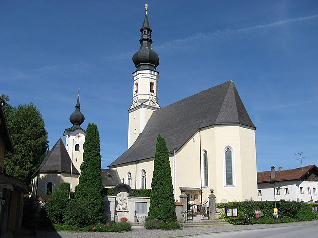
Berndorf bei Salzburg
- municipality in Austria
 Hiking in Berndorf bei Salzburg
Berndorf bei Salzburg, located near the city of Salzburg in Austria, is a picturesque area that offers a variety of hiking opportunities for different skill levels. The region is characterized by its stunning landscapes, rolling hills, and beautiful views of the surrounding mountains, making it a great destination for outdoor enthusiasts....
- Country:

- Postal Code: 5165
- Local Dialing Code: 06217
- Licence Plate Code: SL
- Coordinates: 47° 58' 0" N, 13° 4' 0" E


- GPS tracks (wikiloc): [Link]
- AboveSeaLevel: 548 м m
- Area: 14.48 sq km
- Population: 1689
- Web site: [Link]


Großgmain
- municipality in Austria
Großgmain, located in the Austrian state of Salzburg near the German border, offers beautiful hiking opportunities for outdoor enthusiasts. The area is characterized by stunning alpine scenery, lush forests, and panoramic views of the surrounding mountains. Here are some highlights and tips for hiking in Großgmain:...
- Country:

- Postal Code: 5084
- Local Dialing Code: 06247
- Licence Plate Code: SL
- Coordinates: 47° 43' 30" N, 12° 54' 31" E


- GPS tracks (wikiloc): [Link]
- AboveSeaLevel: 520 м m
- Area: 23 sq km
- Population: 2615
- Web site: [Link]
Elsbethen
- municipality in Austria
Elsbethen, located in Salzburg, Austria, is an excellent destination for hiking enthusiasts. Nestled near the beautiful city of Salzburg, it offers access to the stunning landscapes of the surrounding region, including the Alps....
- Country:

- Postal Code: 5061
- Local Dialing Code: 0662
- Licence Plate Code: SL
- Coordinates: 47° 46' 6" N, 13° 7' 8" E


- GPS tracks (wikiloc): [Link]
- AboveSeaLevel: 658 м m
- Area: 24.16 sq km
- Population: 5424
- Web site: [Link]

Anif
- municipality in Austria
Anif, located near Salzburg, Austria, is a beautiful area for hiking, offering stunning views of the surrounding mountains and valleys. Here are some key points about hiking in Anif:...
- Country:

- Postal Code: 5081
- Local Dialing Code: 06246
- Licence Plate Code: SL
- Coordinates: 47° 45' 0" N, 13° 4' 0" E


- GPS tracks (wikiloc): [Link]
- AboveSeaLevel: 434 м m
- Area: 7.61 sq km
- Population: 4195
- Web site: [Link]
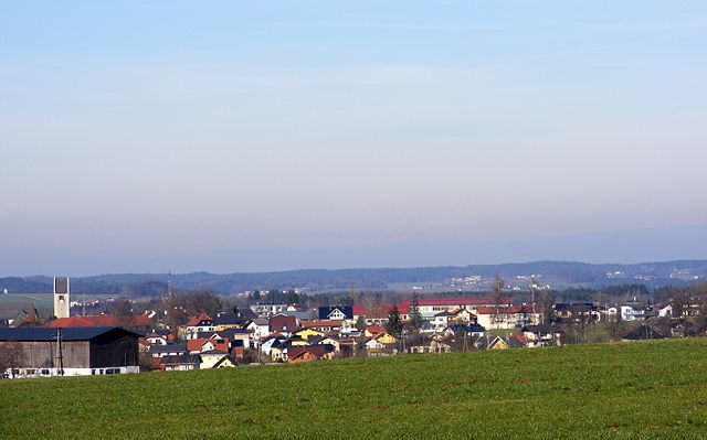

Lamprechtshausen
- municipality in Austria
Lamprechtshausen, located in the Salzburg region of Austria, is an excellent starting point for hikers looking to explore the surrounding natural beauty. The area is characterized by its picturesque Alpine landscapes, dense forests, and charming villages....
- Country:

- Postal Code: 5112
- Local Dialing Code: 06274
- Licence Plate Code: SL
- Coordinates: 47° 58' 0" N, 12° 56' 0" E


- GPS tracks (wikiloc): [Link]
- AboveSeaLevel: 458 м m
- Area: 31.77 sq km
- Population: 4037
- Web site: [Link]

Oberndorf bei Salzburg
- municipality in Austria
 Hiking in Oberndorf bei Salzburg
Oberndorf bei Salzburg, located in Austria, is a charming town near the border with Germany and is famous for its scenic beauty and historical significance. It's perhaps best known as the birthplace of the Christmas carol "Silent Night." Here are some insights into hiking in the area:...
- Country:

- Postal Code: 5110
- Local Dialing Code: 06272
- Licence Plate Code: SL
- Coordinates: 47° 56' 30" N, 12° 56' 30" E


- GPS tracks (wikiloc): [Link]
- AboveSeaLevel: 401 м m
- Area: 4.55 sq km
- Population: 5815
- Web site: [Link]


Grödig
- municipality in Austria
Grödig, located just outside of Salzburg, Austria, offers a beautiful setting for hiking enthusiasts. Nestled at the foothills of the Untersberg mountain, it's known for its stunning landscapes, diverse trails, and proximity to both natural and historical attractions....
- Country:

- Postal Code: 5083; 5082
- Local Dialing Code: 06246
- Licence Plate Code: SL
- Coordinates: 47° 44' 22" N, 13° 2' 10" E


- GPS tracks (wikiloc): [Link]
- AboveSeaLevel: 446 м m
- Area: 23 sq km
- Population: 7262
- Web site: [Link]

Eugendorf
- municipality in Austria
Eugendorf, located just south of Salzburg in Austria, offers beautiful hiking opportunities with a variety of trails for different skill levels. Here are some highlights of what you can expect when hiking in and around Eugendorf:...
- Country:

- Postal Code: 5301
- Local Dialing Code: 06225
- Licence Plate Code: SL
- Coordinates: 47° 52' 1" N, 13° 7' 27" E


- GPS tracks (wikiloc): [Link]
- AboveSeaLevel: 560 м m
- Area: 29.04 sq km
- Population: 6937
- Web site: [Link]
Straßwalchen
- municipality in Austria
Straßwalchen is a charming town located in the Salzburg region of Austria, surrounded by beautiful landscapes that are perfect for hiking enthusiasts. Here are some highlights and tips for hiking in and around Straßwalchen:...
- Country:

- Postal Code: 5204
- Local Dialing Code: 06215
- Licence Plate Code: SL
- Coordinates: 47° 58' 48" N, 13° 15' 17" E


- GPS tracks (wikiloc): [Link]
- AboveSeaLevel: 528 м m
- Area: 44.53 sq km
- Population: 7420
- Web site: [Link]

Neumarkt am Wallersee
- municipality in Austria
 Hiking in Neumarkt am Wallersee
Neumarkt am Wallersee, located in Austria's Salzburg region, is a fantastic destination for hiking enthusiasts. The area is characterized by stunning landscapes, including lakes, rolling hills, and alpine views. Here are some highlights for hiking in and around Neumarkt am Wallersee:...
- Country:

- Postal Code: 5202
- Local Dialing Code: 06216
- Licence Plate Code: SL
- Coordinates: 47° 56' 43" N, 13° 13' 29" E


- GPS tracks (wikiloc): [Link]
- AboveSeaLevel: 552 м m
- Area: 36 sq km
- Population: 6297
- Web site: [Link]
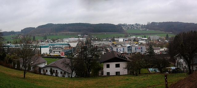
Bergheim
- municipality in Austria
Bergheim, located just a few kilometers south of Salzburg, Austria, is an ideal spot for hikers looking to explore the scenic beauty of the Austrian Alps. Here are some key points about hiking in and around Bergheim:...
- Country:

- Postal Code: 5101
- Local Dialing Code: 0662
- Licence Plate Code: SL
- Coordinates: 47° 50' 25" N, 13° 1' 20" E


- GPS tracks (wikiloc): [Link]
- AboveSeaLevel: 435 м m
- Area: 15.2 sq km
- Population: 5037
- Web site: [Link]

Henndorf am Wallersee
- municipality in Austria
 Hiking in Henndorf am Wallersee
Henndorf am Wallersee is a picturesque village located in the Salzkammergut region of Austria, known for its stunning landscapes and proximity to Wallersee Lake. Hiking in this area offers a wonderful blend of scenic views, natural beauty, and a glimpse of local culture....
- Country:

- Postal Code: 5302
- Local Dialing Code: 06214
- Licence Plate Code: SL
- Coordinates: 47° 53' 0" N, 13° 10' 0" E


- GPS tracks (wikiloc): [Link]
- AboveSeaLevel: 551 м m
- Area: 23.47 sq km
- Population: 4947
- Web site: [Link]

Sankt Gilgen
- village in Austria
St. Gilgen is a picturesque village located on the shores of Lake Wolfgang in Austria, nestled at the foot of the Zwölferhorn Mountain. It’s an ideal destination for hiking enthusiasts, offering a variety of trails that cater to different skill levels and preferences. Here are some highlights to consider when hiking in St. Gilgen:...
- Country:

- Postal Code: 5340
- Local Dialing Code: 06227
- Licence Plate Code: SL
- Coordinates: 47° 46' 0" N, 13° 22' 0" E


- GPS tracks (wikiloc): [Link]
- AboveSeaLevel: 545 м m
- Area: 98.67 sq km
- Population: 3915
- Web site: [Link]
Plainfeld
- municipality in Austria
Plainfield, depending on the specific area you’re referring to, typically offers a range of hiking opportunities. While there may not be extensive national parks or mountainous terrain in Plainfield itself, there are likely local trails and parks that provide a good hiking experience....
- Country:

- Postal Code: 5325
- Local Dialing Code: 06229
- Licence Plate Code: SL
- Coordinates: 47° 50' 0" N, 13° 11' 0" E


- GPS tracks (wikiloc): [Link]
- AboveSeaLevel: 629 м m
- Area: 5.21 sq km
- Population: 1237
- Web site: [Link]
Hallwang
- municipality in Austria
Hallwang is a charming municipality located near Salzburg, Austria. While it may not be as famous for hiking as some other areas, it offers access to beautiful landscapes and trails in the surrounding regions, including the nearby Salzburger Alpen....
- Country:

- Postal Code: 5300
- Local Dialing Code: 0662
- Licence Plate Code: SL
- Coordinates: 47° 51' 0" N, 13° 4' 0" E


- GPS tracks (wikiloc): [Link]
- AboveSeaLevel: 524 м m
- Area: 13.12 sq km
- Population: 4189
- Web site: [Link]

Anthering
- municipality in Austria
Anthering is a charming municipality located in the Salzburg-Umgebung district of Austria, situated near the city of Salzburg. While it's not typically known as a major hiking destination, its proximity to the stunning landscapes of Salzburg makes it a great starting point for exploring the surrounding region....
- Country:

- Postal Code: 5102
- Local Dialing Code: 06223
- Licence Plate Code: SL
- Coordinates: 47° 52' 0" N, 13° 1' 0" E


- GPS tracks (wikiloc): [Link]
- AboveSeaLevel: 422 м m
- Area: 25 sq km
- Population: 3734
- Web site: [Link]

Faistenau
- municipality in Austria
Faistenau is a beautiful municipality located in the Salzkammergut region of Austria, known for its stunning landscapes, quaint village atmosphere, and numerous hiking opportunities. Nestled near the shores of Lake Fuschl and surrounded by the Alps, Faistenau is an ideal destination for hikers of all levels, from casual walkers to more experienced trekkers....
- Country:

- Postal Code: 5324
- Local Dialing Code: 06228
- Licence Plate Code: SL
- Coordinates: 47° 46' 0" N, 13° 13' 0" E


- GPS tracks (wikiloc): [Link]
- AboveSeaLevel: 784 м m
- Area: 51.23 sq km
- Population: 3103
- Web site: [Link]


Seekirchen am Wallersee
- municipality in Austria
 Hiking in Seekirchen am Wallersee
Seekirchen am Wallersee is a beautiful area located in Austria, known for its scenic landscapes and outdoor activities. The region around the Wallersee lake offers a variety of hiking trails suitable for different skill levels, from leisurely walks to more challenging hikes. Here are some highlights and tips for hiking in Seekirchen am Wallersee:...
- Country:

- Postal Code: 5201
- Local Dialing Code: 06212
- Licence Plate Code: SL
- Coordinates: 47° 54' 0" N, 13° 8' 0" E


- GPS tracks (wikiloc): [Link]
- AboveSeaLevel: 512 м m
- Area: 50.27 sq km
- Population: 10764
- Web site: [Link]
Hof bei Salzburg
- municipality in Austria
Hof bei Salzburg is a charming village located in the picturesque region of Salzkammergut in Austria. The area is known for its stunning natural beauty, making it an excellent destination for hiking enthusiasts. Here are some highlights and tips for hiking in and around Hof bei Salzburg:...
- Country:

- Postal Code: 5322
- Local Dialing Code: 06229
- Licence Plate Code: SL
- Coordinates: 47° 49' 0" N, 13° 13' 0" E


- GPS tracks (wikiloc): [Link]
- AboveSeaLevel: 739 м m
- Area: 19.7 sq km
- Population: 3562
- Web site: [Link]

Sankt Georgen bei Salzburg
- municipality in Austria
 Hiking in Sankt Georgen bei Salzburg
Sankt Georgen bei Salzburg is a picturesque area in Austria that offers a variety of hiking opportunities for outdoor enthusiasts. Situated near the city of Salzburg, this region provides a great combination of natural beauty, cultural experiences, and a touch of history....
- Country:

- Postal Code: 5113
- Local Dialing Code: 06272
- Licence Plate Code: SL
- Coordinates: 47° 59' 0" N, 12° 53' 0" E


- GPS tracks (wikiloc): [Link]
- AboveSeaLevel: 403 м m
- Area: 25 sq km
- Population: 2954
- Web site: [Link]

Nußdorf am Haunsberg
- municipality in Austria
 Hiking in Nußdorf am Haunsberg
Nußdorf am Haunsberg is a charming village located in the Salzburg region of Austria, surrounded by stunning natural landscapes and offering various hiking opportunities. Here are some key highlights about hiking in and around Nußdorf am Haunsberg:...
- Country:

- Postal Code: 5151
- Local Dialing Code: 06276
- Licence Plate Code: SL
- Coordinates: 47° 57' 0" N, 13° 0' 0" E


- GPS tracks (wikiloc): [Link]
- AboveSeaLevel: 441 м m
- Area: 35.54 sq km
- Population: 2383
- Web site: [Link]

Strobl
- municipality in Austria
Strobl is a charming village located at the edge of the Salzkammergut region in Austria, framed by the picturesque Wolfgangsee lake. It offers a variety of hiking opportunities for all levels, from leisurely walks along the lake to more challenging mountain trails....
- Country:

- Postal Code: 5350
- Local Dialing Code: 06137
- Licence Plate Code: SL
- Coordinates: 47° 43' 0" N, 13° 28' 0" E


- GPS tracks (wikiloc): [Link]
- AboveSeaLevel: 542 м m
- Area: 93.89 sq km
- Population: 3645
- Web site: [Link]
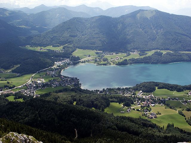

Fuschl am See
- municipality in Austria
Fuschl am See, located in the Salzkammergut region of Austria, is a beautiful destination for hiking, known for its stunning natural scenery and charming lakeside views. Here are some highlights and tips for hiking in this area:...
- Country:

- Postal Code: 5330
- Local Dialing Code: 06226
- Licence Plate Code: SL
- Coordinates: 47° 47' 46" N, 13° 18' 10" E


- GPS tracks (wikiloc): [Link]
- AboveSeaLevel: 669 м m
- Area: 21.4 sq km
- Population: 1520
- Web site: [Link]

Thalgau
- municipality in Austria
Thalgau, located in the Austrian state of Salzburg, is a picturesque village that offers a variety of hiking opportunities for outdoor enthusiasts. Nestled at the foothills of the Salzkammergut mountains, Thalgau serves as a gateway to beautiful landscapes, serene lakes, and scenic views....
- Country:

- Postal Code: 5303
- Local Dialing Code: 06235
- Licence Plate Code: SL
- Coordinates: 47° 50' 0" N, 13° 15' 0" E


- GPS tracks (wikiloc): [Link]
- AboveSeaLevel: 545 м m
- Area: 48.17 sq km
- Population: 5931
- Web site: [Link]
Ebenau
- municipality in Austria
Ebenau is a beautiful village located in the Salzburg region of Austria, surrounded by stunning natural landscapes that provide excellent opportunities for hiking. The area is known for its picturesque views, diverse trails, and rich flora and fauna, making it a fantastic destination for both novice and experienced hikers....
- Country:

- Postal Code: 5323
- Local Dialing Code: 06221
- Licence Plate Code: SL
- Coordinates: 47° 47' 0" N, 13° 10' 0" E


- GPS tracks (wikiloc): [Link]
- AboveSeaLevel: 623 м m
- Area: 17.15 sq km
- Population: 1439
- Web site: [Link]

Seeham
- municipality in Austria
Seeham, a charming village located in the Salzburg region of Austria, offers various hiking opportunities that cater to different skill levels and preferences. The surrounding landscape is characterized by beautiful lakes, rolling hills, and stunning views of the Alps, making it an excellent destination for outdoor enthusiasts....
- Country:

- Postal Code: 5164
- Local Dialing Code: 06217
- Licence Plate Code: SL
- Coordinates: 47° 58' 0" N, 13° 4' 0" E


- GPS tracks (wikiloc): [Link]
- AboveSeaLevel: 503 м m
- Area: 10.38 sq km
- Population: 1939
- Web site: [Link]
Koppl
- municipality in Austria
Koppl, located in Austria near the city of Salzburg, offers a beautiful setting for hiking enthusiasts. The area is characterized by its picturesque landscapes, rolling hills, and scenic views of the surrounding mountains, making it a great destination for both casual walkers and more serious hikers....
- Country:

- Postal Code: 5321
- Local Dialing Code: 06221
- Licence Plate Code: SL
- Coordinates: 47° 48' 29" N, 13° 9' 20" E


- GPS tracks (wikiloc): [Link]
- AboveSeaLevel: 755 м m
- Area: 20.88 sq km
- Population: 3472
- Web site: [Link]
Göming
- municipality in Austria
Göming is a picturesque village located in the Salzburg region of Austria, surrounded by stunning landscapes that make it a great destination for hiking enthusiasts. The area is characterized by lush meadows, rolling hills, and views of the eastern Alps. Here are some key points about hiking in Göming:...
- Country:

- Postal Code: 5114
- Local Dialing Code: 06272
- Licence Plate Code: SL
- Coordinates: 47° 57' 0" N, 12° 57' 0" E


- GPS tracks (wikiloc): [Link]
- AboveSeaLevel: 530 м m
- Area: 8.77 sq km
- Population: 764
- Web site: [Link]


Elixhausen
- municipality in Austria
Elixhausen, located in Austria near Salzburg, offers a charming backdrop for hiking enthusiasts. The area is characterized by picturesque landscapes, rolling hills, and stunning views of the surrounding mountains. While Elixhausen might not have extensive or well-known hiking trails like some larger national parks, it provides a variety of local paths and routes that can cater to different skill levels....
- Country:

- Postal Code: 5161
- Local Dialing Code: 0662
- Licence Plate Code: SL
- Coordinates: 47° 52' 0" N, 13° 4' 0" E


- GPS tracks (wikiloc): [Link]
- AboveSeaLevel: 545 м m
- Area: 8.36 sq km
- Population: 2963
- Web site: [Link]

Dorfbeuern
- municipality in Austria
Dorfbeuern is a charming village located in Austria, known for its picturesque landscapes and ample opportunities for hiking enthusiasts. Situated near the Salzburger Land region, it offers a variety of trails that cater to different skill levels, making it a great destination for both novice and experienced hikers....
- Country:

- Postal Code: 5152
- Local Dialing Code: 06274
- Licence Plate Code: SL
- Coordinates: 48° 1' 0" N, 13° 1' 0" E


- GPS tracks (wikiloc): [Link]
- AboveSeaLevel: 471 м m
- Area: 14.6 sq km
- Population: 1547
- Web site: [Link]
Hintersee
- municipality in the district of Salzburg-Umgebung in the state of Salzburg in Austria
Hintersee is a picturesque destination located in the Salzburg province of Austria, renowned for its stunning natural beauty and a variety of hiking opportunities. Nestled at the edge of the Hohe Tauern National Park and surrounded by majestic mountains, Hintersee offers both scenic views and a range of outdoor activities....
- Country:

- Postal Code: 5324
- Local Dialing Code: 06224
- Licence Plate Code: SL
- Coordinates: 47° 43' 0" N, 13° 16' 0" E


- GPS tracks (wikiloc): [Link]
- AboveSeaLevel: 746 м m
- Area: 47.44 sq km
- Population: 443
- Web site: [Link]

Obertrum
- municipality in Austria
Obertrum am See, located in the Austrian state of Salzburg, is a picturesque village that offers a range of hiking opportunities amidst stunning natural scenery. The area is characterized by beautiful lakes, rolling hills, and alpine views, making it a popular destination for outdoor enthusiasts....
- Country:

- Postal Code: 5162
- Local Dialing Code: 06219
- Licence Plate Code: SL
- Coordinates: 47° 55' 52" N, 13° 2' 55" E


- GPS tracks (wikiloc): [Link]
- AboveSeaLevel: 623 м m
- Area: 21.27 sq km
- Population: 4808
- Web site: [Link]
Köstendorf
- municipality in Austria
Köstendorf, located near Salzburg in Austria, offers a variety of hiking opportunities that cater to different skill levels and preferences. The region is known for its picturesque landscapes, rolling hills, and stunning views of the surrounding mountains....
- Country:

- Postal Code: 5203
- Local Dialing Code: 06216
- Licence Plate Code: SL
- Coordinates: 47° 57' 26" N, 13° 11' 50" E


- GPS tracks (wikiloc): [Link]
- AboveSeaLevel: 561 м m
- Area: 23.1 sq km
- Population: 2631
- Web site: [Link]
Bürmoos
- municipality in Austria
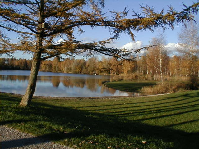
Bürmoos is a charming village in the Salzburg region of Austria, nestled between the rolling hills and picturesque landscapes that characterize this part of the Alps. The area is known for its beautiful nature trails, making it an excellent destination for hikers of all levels....
- Country:

- Postal Code: 5111
- Local Dialing Code: 06274
- Licence Plate Code: SL
- Coordinates: 47° 59' 0" N, 12° 56' 0" E


- GPS tracks (wikiloc): [Link]
- AboveSeaLevel: 436 м m
- Area: 7 sq km
- Population: 4899
- Web site: [Link]

Schleedorf
- municipality in Austria
Schleedorf is a scenic area in Austria, known for its charming landscapes and beautiful hiking trails. If you're planning to hike in this region, here are some key points to consider:...
- Country:

- Postal Code: 5205
- Local Dialing Code: 06216
- Licence Plate Code: SL
- Coordinates: 47° 57' 0" N, 13° 9' 0" E


- GPS tracks (wikiloc): [Link]
- AboveSeaLevel: 613 м m
- Area: 10.32 sq km
- Population: 1067
- Web site: [Link]


Wals-Siezenheim
- municipality in Austria
Wals-Siezenheim, located near Salzburg, Austria, offers beautiful hiking opportunities in a picturesque setting characterized by stunning landscapes, lush greenery, and scenic mountains. Here are some highlights and tips for hiking in this area:...
- Country:

- Postal Code: 5072; 5071
- Local Dialing Code: 0662
- Licence Plate Code: SL
- Coordinates: 47° 46' 0" N, 12° 58' 0" E


- GPS tracks (wikiloc): [Link]
- AboveSeaLevel: 446 м m
- Area: 27 sq km
- Population: 13056
- Web site: [Link]

Mattsee
- municipality in Austria
Mattsee, located in the stunning Salzburg region of Austria, is a fantastic destination for hiking enthusiasts. The area is characterized by picturesque landscapes, rolling hills, and scenic lakes, making it perfect for both casual strolls and more challenging hikes....
- Country:

- Postal Code: 5163
- Local Dialing Code: 06217
- Licence Plate Code: SL
- Coordinates: 47° 58' 0" N, 13° 5' 0" E


- GPS tracks (wikiloc): [Link]
- AboveSeaLevel: 505 м m
- Area: 24.59 sq km
- Population: 3263
- Web site: [Link]
Shares border with regions:

Traunstein
- district of Bavaria, Germany
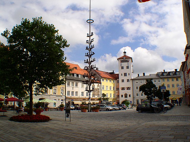
Traunstein, located in Bavaria, Germany, is a beautiful area known for its picturesque landscapes, charming villages, and a variety of hiking opportunities. The region is characterized by its rolling hills, mountains, and lakes, making it ideal for outdoor enthusiasts. Here are some highlights for hiking in Traunstein:...
- Country:

- Capital: Traunstein
- Licence Plate Code: TS
- Coordinates: 47° 53' 24" N, 12° 34' 48" E


- GPS tracks (wikiloc): [Link]
- AboveSeaLevel: 560 м m
- Area: 1533.92 sq km
- Population: 145408
- Web site: [Link]

Berchtesgadener Land
- district of Bavaria, Germany
 Hiking in Berchtesgadener Land
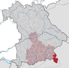
Berchtesgadener Land is a stunning region in Bavaria, Germany, known for its breathtaking landscapes, towering mountains, lush valleys, and crystal-clear lakes. It’s a hiker’s paradise with trails suitable for all levels of experience. Here are some highlights and tips for hiking in this beautiful area:...
- Country:

- Capital: Bad Reichenhall
- Licence Plate Code: BGL
- Coordinates: 47° 44' 0" N, 12° 53' 0" E


- GPS tracks (wikiloc): [Link]
- AboveSeaLevel: 465 м m
- Area: 840.00 sq km
- Population: 90689
- Web site: [Link]
