Berlou (Berlou)

- commune in Hérault, France
- Country:

- Postal Code: 34360
- Coordinates: 43° 29' 25" N, 2° 57' 22" E


- GPS tracks (wikiloc): [Link]
- Area: 11.34 sq km
- Population: 200
- Wikipedia en: wiki(en)
- Wikipedia: wiki(fr)
- Wikidata storage: Wikidata: Q1072049
- Wikipedia Commons Category: [Link]
- Freebase ID: [/m/03gr61y]
- Freebase ID: [/m/03gr61y]
- GeoNames ID: Alt: [6448464]
- GeoNames ID: Alt: [6448464]
- SIREN number: [213400302]
- SIREN number: [213400302]
- BnF ID: [15256631m]
- BnF ID: [15256631m]
- WOEID: [579381]
- WOEID: [579381]
- INSEE municipality code: 34030
- INSEE municipality code: 34030
Shares border with regions:

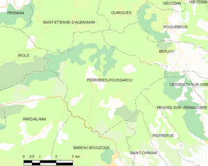
Ferrières-Poussarou
- commune in Hérault, France
- Country:
- Postal Code: 34360
- Coordinates: 43° 29' 6" N, 2° 53' 55" E
- GPS tracks (wikiloc): [Link]
- Area: 26.01 sq km
- Population: 75


Saint-Étienne-d'Albagnan
- commune in Hérault, France
- Country:
- Postal Code: 34390
- Coordinates: 43° 31' 54" N, 2° 51' 23" E
- GPS tracks (wikiloc): [Link]
- Area: 22.7 sq km
- Population: 319


Prades-sur-Vernazobre
- commune in Hérault, France
- Country:
- Postal Code: 34360
- Coordinates: 43° 26' 51" N, 2° 59' 10" E
- GPS tracks (wikiloc): [Link]
- Area: 19.98 sq km
- Population: 306
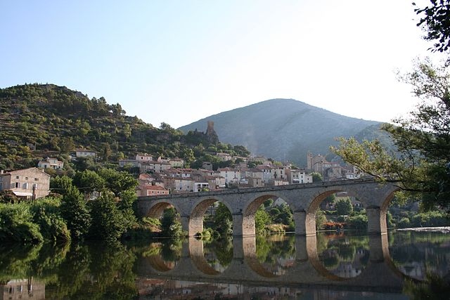
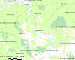
Roquebrun
- commune in Hérault, France
- Country:
- Postal Code: 34460
- Coordinates: 43° 30' 2" N, 3° 1' 50" E
- GPS tracks (wikiloc): [Link]
- Area: 39.64 sq km
- Population: 606
- Web site: [Link]


Cessenon-sur-Orb
- commune in Hérault, France
- Country:
- Postal Code: 34460
- Coordinates: 43° 27' 0" N, 3° 3' 5" E
- GPS tracks (wikiloc): [Link]
- AboveSeaLevel: 52 м m
- Area: 37.29 sq km
- Population: 2240
- Web site: [Link]


Olargues
- commune in Hérault, France
- Country:
- Postal Code: 34390
- Coordinates: 43° 33' 23" N, 2° 54' 53" E
- GPS tracks (wikiloc): [Link]
- Area: 18.6 sq km
- Population: 674