Ferrières-Poussarou (Ferrières-Poussarou)

- commune in Hérault, France
- Country:

- Postal Code: 34360
- Coordinates: 43° 29' 6" N, 2° 53' 55" E


- GPS tracks (wikiloc): [Link]
- Area: 26.01 sq km
- Population: 75
- Wikipedia en: wiki(en)
- Wikipedia: wiki(fr)
- Wikidata storage: Wikidata: Q1148786
- Wikipedia Commons Category: [Link]
- Freebase ID: [/m/03nv7s3]
- Freebase ID: [/m/03nv7s3]
- GeoNames ID: Alt: [6432507]
- GeoNames ID: Alt: [6432507]
- SIREN number: [213401003]
- SIREN number: [213401003]
- BnF ID: [15256701z]
- BnF ID: [15256701z]
- PACTOLS thesaurus ID: [pcrtvEBBNdFJl7]
- PACTOLS thesaurus ID: [pcrtvEBBNdFJl7]
- INSEE municipality code: 34100
- INSEE municipality code: 34100
Shares border with regions:


Berlou
- commune in Hérault, France
- Country:
- Postal Code: 34360
- Coordinates: 43° 29' 25" N, 2° 57' 22" E
- GPS tracks (wikiloc): [Link]
- Area: 11.34 sq km
- Population: 200


Babeau-Bouldoux
- commune in Hérault, France
- Country:
- Postal Code: 34360
- Coordinates: 43° 26' 10" N, 2° 54' 33" E
- GPS tracks (wikiloc): [Link]
- Area: 21.4 sq km
- Population: 295


Pierrerue
- commune in Hérault, France
- Country:
- Postal Code: 34360
- Coordinates: 43° 25' 38" N, 2° 58' 39" E
- GPS tracks (wikiloc): [Link]
- Area: 11.7 sq km
- Population: 292


Saint-Étienne-d'Albagnan
- commune in Hérault, France
- Country:
- Postal Code: 34390
- Coordinates: 43° 31' 54" N, 2° 51' 23" E
- GPS tracks (wikiloc): [Link]
- Area: 22.7 sq km
- Population: 319


Riols
- commune in Hérault, France
- Country:
- Postal Code: 34220
- Coordinates: 43° 30' 18" N, 2° 47' 31" E
- GPS tracks (wikiloc): [Link]
- Area: 56.02 sq km
- Population: 756

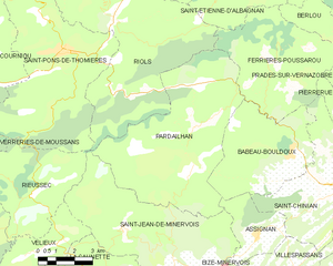
Pardailhan
- commune in Hérault, France
- Country:
- Postal Code: 34360
- Coordinates: 43° 27' 3" N, 2° 50' 47" E
- GPS tracks (wikiloc): [Link]
- Area: 41.18 sq km
- Population: 184


Prades-sur-Vernazobre
- commune in Hérault, France
- Country:
- Postal Code: 34360
- Coordinates: 43° 26' 51" N, 2° 59' 10" E
- GPS tracks (wikiloc): [Link]
- Area: 19.98 sq km
- Population: 306
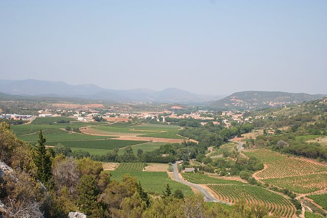
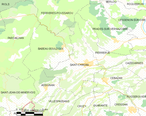
Saint-Chinian
- commune in Hérault, France
- Country:
- Postal Code: 34360
- Coordinates: 43° 25' 19" N, 2° 56' 49" E
- GPS tracks (wikiloc): [Link]
- Area: 23.29 sq km
- Population: 1761
- Web site: [Link]