Bersenbrück (Samtgemeinde Bersenbrück)
- Samtgemeinde in Lower Saxony
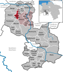
Bersenbrück, located in the Samtgemeinde Bersenbrück in Lower Saxony, Germany, offers a peaceful and picturesque setting for hiking enthusiasts. The region is characterized by its rural landscapes, forests, and charming villages, making it a great destination for both casual walkers and more serious hikers.
Hiking Areas and Trails
While the area may not be as renowned for extensive hiking trails as some mountainous regions, there are several enjoyable routes you can explore:
-
Nature Walks: The surrounding countryside offers a variety of paths that wind through fields, meadows, and forests. These trails are often less crowded, providing a serene hiking experience.
-
Bersenbrück Land Trail: This trail connects several nearby villages and showcases the beautiful landscape of the region. It typically features a mix of cultivated fields and natural habitats.
-
Local Forests: The forests around Bersenbrück, such as near the River Hase, provide shaded trails that are ideal for walking, especially in the warmer months.
-
Nearby Nature Reserves: Exploring the nearby nature reserves can also enhance your hiking experience, allowing you to appreciate local flora and fauna.
Tips for Hiking in Bersenbrück
- Map and Navigation: While there are marked trails, bringing a map or using a hiking app can help you navigate the countryside effectively.
- Weather Considerations: Check the weather forecast before heading out, as conditions can change rapidly. Rain can make trails muddy, so appropriate footwear is essential.
- Local Amenities: There are small villages and towns nearby where you can find refreshments and accommodations if you plan to hike longer distances.
- Respect Nature: As always, when hiking, practice Leave No Trace principles to help preserve the beauty of the natural environment.
Best Time to Hike
The best times for hiking in Bersenbrück are during spring (April to June) and early autumn (September to October) when the weather is generally mild and the scenery is vibrant with colors.
Overall, Bersenbrück offers a quaint and enjoyable experience for those looking to explore the beauty of Lower Saxony’s rural landscapes. Whether you’re a beginner or an experienced hiker, you will find suitable trails to enjoy the outdoors.
- Country:

- Coordinates: 52° 33' 19" N, 7° 56' 47" E


- GPS tracks (wikiloc): [Link]
- Area: 255.45 sq km
- Population: 29192
- Web site: https://www.bersenbrueck.de/
- Wikipedia en: wiki(en)
- Wikipedia: wiki(de)
- Wikidata storage: Wikidata: Q453990
- Wikipedia Commons Category: [Link]
- Freebase ID: [/m/02q0_9t]
- VIAF ID: Alt: [239171829]
- GND ID: Alt: [4338018-9]
- archINFORM location ID: [13097]
- German regional key: 034595402
Includes regions:


Bersenbrück
- municipality of Germany
Bersenbrück, located in Lower Saxony, Germany, offers some charming hiking opportunities for outdoor enthusiasts. The region is characterized by beautiful landscapes, including forests, fields, and rivers, making it suitable for various hiking experiences. Here are some key points you might find helpful:...
- Country:

- Postal Code: 49593
- Local Dialing Code: 05462; 05439
- Coordinates: 52° 32' 0" N, 7° 55' 0" E


- GPS tracks (wikiloc): [Link]
- AboveSeaLevel: 37 м m
- Area: 42.54 sq km
- Population: 8436
- Web site: [Link]

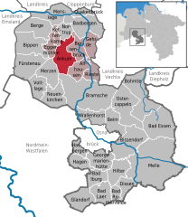
Ankum
- municipality of Germany
Ankum, a small village located in Lower Saxony, Germany, is nestled in a picturesque landscape that can provide a charming escape for those looking to enjoy a day of hiking. While Ankum might not be as widely known for hiking as some mountainous regions, it does offer a variety of walking paths and trails suitable for different skill levels....
- Country:

- Postal Code: 49577
- Local Dialing Code: 05462
- Licence Plate Code: OS
- Coordinates: 52° 32' 36" N, 7° 52' 15" E


- GPS tracks (wikiloc): [Link]
- AboveSeaLevel: 54 м m
- Area: 66.32 sq km
- Population: 7536
- Web site: [Link]


Rieste
- municipality of Germany
Rieste is a picturesque area located in Germany, known for its beautiful landscapes and outdoor activities, including hiking. Here are some highlights and tips for hiking in Rieste:...
- Country:

- Postal Code: 49597
- Local Dialing Code: 05464
- Licence Plate Code: OS
- Coordinates: 52° 29' 0" N, 8° 1' 0" E


- GPS tracks (wikiloc): [Link]
- AboveSeaLevel: 38 м m
- Area: 30.6 sq km
- Population: 3481
- Web site: [Link]

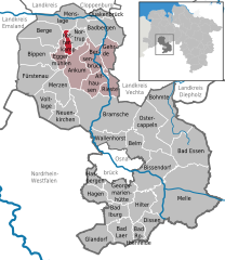
Kettenkamp
- municipality of Germany
Kettenkamp is a scenic area known for its natural beauty and hiking opportunities, particularly in Germany. While it's not as widely recognized as some major hiking destinations, it offers trails that can be enjoyed by both novice and experienced hikers....
- Country:

- Postal Code: 49577
- Local Dialing Code: 05436
- Licence Plate Code: OS
- Coordinates: 52° 35' 0" N, 7° 50' 0" E


- GPS tracks (wikiloc): [Link]
- AboveSeaLevel: 47 м m
- Area: 52.6 sq km
- Population: 1765
- Web site: [Link]

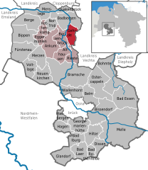
Gehrde
- municipality of Germany
Gehrde is a small town located in Lower Saxony, Germany, and while it may not be as widely known for hiking as some larger national parks or mountainous regions, there are still opportunities for outdoor enthusiasts to explore the natural beauty of the area....
- Country:

- Postal Code: 49596
- Local Dialing Code: 05439
- Licence Plate Code: OS
- Coordinates: 52° 34' 0" N, 8° 1' 0" E


- GPS tracks (wikiloc): [Link]
- AboveSeaLevel: 38 м m
- Area: 36.37 sq km
- Population: 2539
- Web site: [Link]

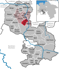
Alfhausen
- municipality of Germany
Alfhausen is a small village in Lower Saxony, Germany, surrounded by picturesque landscapes ideal for hiking enthusiasts. While it may not be a renowned hiking destination, there are several opportunities to explore the scenic countryside, woodlands, and nearby riverbanks....
- Country:

- Postal Code: 49594
- Local Dialing Code: 05464
- Licence Plate Code: OS
- Coordinates: 52° 30' 0" N, 7° 57' 0" E


- GPS tracks (wikiloc): [Link]
- AboveSeaLevel: 43 м m
- Area: 39 sq km
- Population: 3899
- Web site: [Link]

Eggermühlen
- municipality of Germany
Eggermühlen is a quaint village located in Lower Saxony, Germany, that offers a tranquil setting for hiking and enjoying nature. Nestled within picturesque landscapes, it serves as a great starting point for various hiking trails that cater to different skill levels....
- Country:

- Postal Code: 49577
- Local Dialing Code: 05462
- Licence Plate Code: OS
- Coordinates: 52° 34' 0" N, 7° 49' 0" E


- GPS tracks (wikiloc): [Link]
- AboveSeaLevel: 53 м m
- Area: 27.41 sq km
- Population: 1734
- Web site: [Link]
