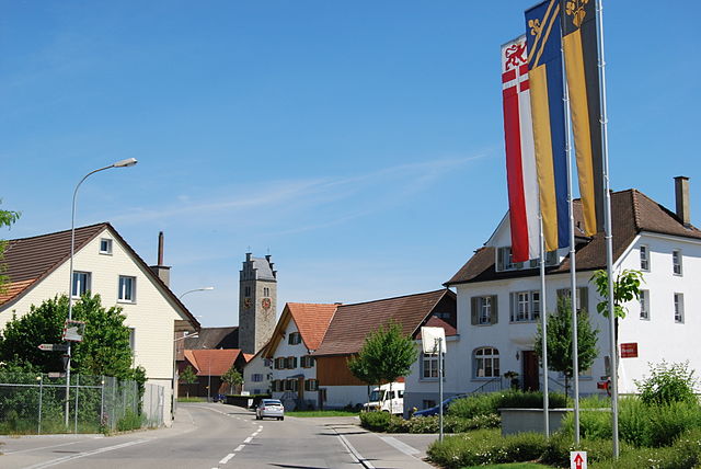
Bettwiesen (Bettwiesen)

- municipality in Switzerland
 Hiking in Bettwiesen
Bettwiesen is a charming location for hiking enthusiasts, surrounded by picturesque landscapes that showcase the beauty of nature. Nestled in Switzerland, Bettwiesen offers a variety of hiking trails suitable for all skill levels, from leisurely walks to more challenging hikes.
Popular Hiking Trails:
-
Bettwiesen Circular Trail: This easy to moderate trail allows hikers to explore the local flora and fauna, with stunning views of the surrounding hills and valleys. It’s perfect for families and those looking for a relaxing outing.
-
Alpine Trails: For those seeking more of a challenge, trails leading up to nearby alpine areas provide a more strenuous hiking experience. These trails offer breathtaking panoramic views, especially on clear days.
-
Nature Trails: There are also several trails designed to highlight the natural environment. These often include educational signage about the local wildlife and plant species, making them ideal for nature enthusiasts and families with children.
Best Time to Hike:
The best time to hike in Bettwiesen is typically from late spring to early autumn, when the weather is pleasant and the trails are well-maintained. However, winter hiking can also be rewarding, especially if you're equipped for snow.
Tips for Hiking in Bettwiesen:
- Gear Up: Make sure to wear appropriate hiking footwear and clothing for the changing weather conditions.
- Stay Hydrated: Bring enough water and snacks, especially if you plan to hike longer trails.
- Respect Nature: Follow the Leave No Trace principles to preserve the beauty of the area.
- Check Trail Conditions: Before heading out, check for any updates on trail conditions, as they can vary based on weather.
Local Amenities:
After a day of hiking, consider visiting local cafes or restaurants in Bettwiesen to enjoy regional Swiss cuisine. This can be a great way to relax and refuel after your outdoor adventure.
Overall, Bettwiesen is a wonderful destination for hiking, offering a range of trails that cater to various interests and fitness levels while surrounded by stunning natural beauty. Enjoy your hike!
- Country:

- Postal Code: 9553
- Local Dialing Code: 071
- Licence Plate Code: TG
- Coordinates: 47° 30' 0" N, 9° 2' 0" E


- GPS tracks (wikiloc): [Link]
- AboveSeaLevel: 550 м m
- Area: 3.84 sq km
- Population: 1248
- Web site: http://www.bettwiesen.ch
- Wikipedia en: wiki(en)
- Wikipedia: wiki(de)
- Wikidata storage: Wikidata: Q65823
- Wikipedia Commons Category: [Link]
- Freebase ID: [/m/0g34x5]
- GeoNames ID: Alt: [8533692]
- VIAF ID: Alt: [234756707]
- OSM relation ID: [1684504]
- HDS ID: [1952]
- Swiss municipality code: [4716]
Shares border with regions:


Wil
- municipality in the canton of St. Gallen, Switzerland
Hiking in Wil
Wil is a beautiful town in the canton of St. Gallen, Switzerland, known for its picturesque landscapes and access to hiking trails that cater to various skill levels. The region offers a mix of easy walks and more challenging hikes, often featuring stunning views of the surrounding hills and the nearby Appenzell region....
- Country:
- Postal Code: 9500
- Local Dialing Code: 071
- Licence Plate Code: SG
- Coordinates: 47° 27' 59" N, 9° 2' 59" E
- GPS tracks (wikiloc): [Link]
- AboveSeaLevel: 571 м m
- Area: 20.7 sq km
- Population: 23768
- Web site: [Link]

Lommis
- municipality in Switzerland
Hiking in Lommis
Lommis, located in the Thurgau region of Switzerland, offers various hiking opportunities characterized by scenic landscapes, rolling hills, and picturesque vineyards. The region is known for its mild climate, making it an excellent destination for year-round hiking. Here are some insights into hiking in Lommis:...
- Country:
- Postal Code: 9506
- Local Dialing Code: 052
- Licence Plate Code: TG
- Coordinates: 47° 30' 59" N, 8° 58' 59" E
- GPS tracks (wikiloc): [Link]
- AboveSeaLevel: 475 м m
- Area: 8.6 sq km
- Population: 1224
- Web site: [Link]


Tobel-Tägerschen
- municipality in Switzerland
Hiking in Tobel-Tägerschen
Tobel-Tägerschen is a scenic area in Switzerland that offers various hiking opportunities amidst beautiful landscapes. Located in the region of Thurgau, it features rolling hills, lush forests, and charming glimpses of rural life. Here are a few highlights and tips for hiking in that region:...
- Country:
- Postal Code: 9555
- Local Dialing Code: 071
- Licence Plate Code: TG
- Coordinates: 47° 31' 0" N, 9° 1' 59" E
- GPS tracks (wikiloc): [Link]
- AboveSeaLevel: 525 м m
- Area: 7.0 sq km
- Population: 1599
- Web site: [Link]


Wängi
- municipality in Switzerland
Hiking in Wängi
Wängi, located in the canton of Thurgau in Switzerland, is a lovely area for hiking enthusiasts. The region is characterized by its picturesque landscapes, including rolling hills, forests, and agricultural fields, making it a peaceful retreat for outdoor activities....
- Country:
- Postal Code: 9545
- Local Dialing Code: 052
- Licence Plate Code: TG
- Coordinates: 47° 29' 36" N, 8° 57' 27" E
- GPS tracks (wikiloc): [Link]
- AboveSeaLevel: 500 м m
- Area: 16.4 sq km
- Population: 4662
- Web site: [Link]

Münchwilen
- municipality in Switzerland
Hiking in Münchwilen
Münchwilen, located in the canton of Thurgau, Switzerland, offers some great opportunities for hiking enthusiasts. The region is characterized by rolling hills, vineyards, and lush green landscapes, which make for picturesque hiking trails....
- Country:
- Postal Code: 9542
- Local Dialing Code: 071
- Licence Plate Code: TG
- Coordinates: 47° 29' 0" N, 8° 58' 59" E
- GPS tracks (wikiloc): [Link]
- AboveSeaLevel: 515 м m
- Area: 7.79 sq km
- Population: 5377
- Web site: [Link]