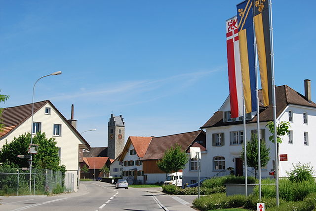
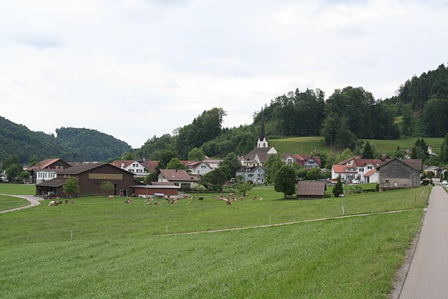
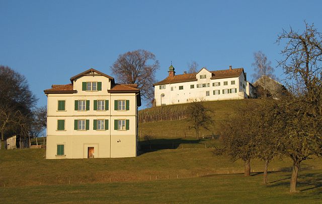
Wängi (Wängi)

- municipality in Switzerland
 Hiking in Wängi
Wängi, located in the canton of Thurgau in Switzerland, is a lovely area for hiking enthusiasts. The region is characterized by its picturesque landscapes, including rolling hills, forests, and agricultural fields, making it a peaceful retreat for outdoor activities.
Popular Hiking Routes
-
The Wängi Nature Trails: These trails often take you through scenic landscapes, allowing you to enjoy the local flora and fauna. The routes vary in difficulty, catering to both beginners and experienced hikers.
-
The Rhine Valley Trail: A bit further from Wängi, you can access parts of the Rhine Valley, which offers stunning views of the Rhine River and surrounding mountainous terrain.
-
Thurgauer Panoramaweg: This panoramic hiking trail stretches through the Thurgau region and provides breathtaking views of Lake Constance and the Alps on clear days.
Tips for Hiking in Wängi
-
Best Season: Spring and early fall are ideal times to hike in this region, as the weather is generally mild, and the landscapes are vibrant with seasonal flowers.
-
Trail Maps: Always carry a map of the trails. local tourist information centers often have resources available.
-
Hiking Gear: Comfortable hiking shoes and layered clothing are recommended. Weather can change quickly, especially in mountainous areas.
-
Safety: Although trails are well-marked, be mindful of your surroundings and ensure you have adequate hydration and snacks.
Local Highlights
-
Cultural Aspects: Wängi is close to historical sites and cultural landmarks. You might consider incorporating these into your hiking trip, such as visiting local churches or museums.
-
Wildlife Watching: Keep your eyes peeled for local wildlife. The area is known for its diverse bird species and other wildlife.
Accessibility
Wängi is accessible via public transport, making it easy to reach from larger cities like Winterthur or Zurich. Local transport facilities are typically well-connected.
Whether you're an experienced hiker or looking for a leisurely walk in nature, Wängi offers a tranquil escape into the Swiss countryside.
- Country:

- Postal Code: 9545
- Local Dialing Code: 052
- Licence Plate Code: TG
- Coordinates: 47° 29' 36" N, 8° 57' 27" E


- GPS tracks (wikiloc): [Link]
- AboveSeaLevel: 500 м m
- Area: 16.4 sq km
- Population: 4662
- Web site: http://www.waengi.ch
- Wikipedia en: wiki(en)
- Wikipedia: wiki(de)
- Wikidata storage: Wikidata: Q68177
- Wikipedia Commons Category: [Link]
- Freebase ID: [/m/0g35n_]
- GeoNames ID: Alt: [7287544]
- VIAF ID: Alt: [244728237]
- OSM relation ID: [1684574]
- HDS ID: [1970]
- Swiss municipality code: [4781]
Shares border with regions:


Matzingen
- municipality in Switzerland
Hiking in Matzingen
Matzingen, located in the canton of Thurgau in Switzerland, offers some lovely hiking opportunities, often accompanied by beautiful landscapes, rolling hills, and picturesque countryside. Here’s an overview to help you with your hiking plans:...
- Country:
- Postal Code: 9548
- Local Dialing Code: 052
- Licence Plate Code: TG
- Coordinates: 47° 31' 36" N, 8° 55' 46" E
- GPS tracks (wikiloc): [Link]
- AboveSeaLevel: 480 м m
- Area: 7.7 sq km
- Population: 2857
- Web site: [Link]

Lommis
- municipality in Switzerland
Hiking in Lommis
Lommis, located in the Thurgau region of Switzerland, offers various hiking opportunities characterized by scenic landscapes, rolling hills, and picturesque vineyards. The region is known for its mild climate, making it an excellent destination for year-round hiking. Here are some insights into hiking in Lommis:...
- Country:
- Postal Code: 9506
- Local Dialing Code: 052
- Licence Plate Code: TG
- Coordinates: 47° 30' 59" N, 8° 58' 59" E
- GPS tracks (wikiloc): [Link]
- AboveSeaLevel: 475 м m
- Area: 8.6 sq km
- Population: 1224
- Web site: [Link]


Eschlikon
- municipality in Switzerland
Hiking in Eschlikon
Eschlikon, located in the Zurich Region of Switzerland, offers a charming backdrop for hiking enthusiasts. The area is characterized by rolling hills, picturesque landscapes, and Swiss countryside charm, making it a great destination for both casual walkers and more experienced hikers....
- Country:
- Postal Code: 8360
- Local Dialing Code: 071
- Licence Plate Code: TG
- Coordinates: 47° 27' 30" N, 8° 57' 46" E
- GPS tracks (wikiloc): [Link]
- AboveSeaLevel: 565 м m
- Area: 6.2 sq km
- Population: 4308
- Web site: [Link]

Bichelsee-Balterswil
- municipality in Switzerland
Hiking in Bichelsee-Balterswil
Bichelsee-Balterswil is a picturesque area in the canton of Thurgau in Switzerland, known for its natural beauty and a variety of hiking trails. The region is characterized by rolling hills, serene lakes, and lush forests, making it an ideal destination for outdoor enthusiasts....
- Country:
- Postal Code: 8362
- Local Dialing Code: 071
- Licence Plate Code: TG
- Coordinates: 47° 26' 59" N, 8° 54' 59" E
- GPS tracks (wikiloc): [Link]
- AboveSeaLevel: 601 м m
- Area: 12.1 sq km
- Population: 2839
- Web site: [Link]

Bettwiesen
- municipality in Switzerland
Hiking in Bettwiesen
Bettwiesen is a charming location for hiking enthusiasts, surrounded by picturesque landscapes that showcase the beauty of nature. Nestled in Switzerland, Bettwiesen offers a variety of hiking trails suitable for all skill levels, from leisurely walks to more challenging hikes....
- Country:
- Postal Code: 9553
- Local Dialing Code: 071
- Licence Plate Code: TG
- Coordinates: 47° 30' 0" N, 9° 2' 0" E
- GPS tracks (wikiloc): [Link]
- AboveSeaLevel: 550 м m
- Area: 3.84 sq km
- Population: 1248
- Web site: [Link]


Stettfurt
- municipality in Switzerland
Hiking in Stettfurt
Stettfurt, located in the picturesque region of Thurgau in Switzerland, offers a wonderful setting for hiking enthusiasts. The area features a variety of trails that cater to different skill levels, from easy walks suitable for families to more challenging routes for experienced hikers....
- Country:
- Postal Code: 9507
- Local Dialing Code: 052
- Licence Plate Code: TG
- Coordinates: 47° 31' 34" N, 8° 57' 20" E
- GPS tracks (wikiloc): [Link]
- AboveSeaLevel: 488 м m
- Area: 6.4 sq km
- Population: 1210
- Web site: [Link]


Aadorf
- municipality in Switzerland
Hiking in Aadorf
Aadorf, located in the canton of Thurgau in Switzerland, offers some beautiful hiking opportunities that cater to various skill levels. The region is characterized by its picturesque landscapes, rolling hills, and lush greenery. Here are some key aspects of hiking in Aadorf:...
- Country:
- Postal Code: 8355
- Local Dialing Code: 052
- Licence Plate Code: TG
- Coordinates: 47° 29' 35" N, 8° 54' 37" E
- GPS tracks (wikiloc): [Link]
- AboveSeaLevel: 534 м m
- Area: 20.0 sq km
- Population: 8885
- Web site: [Link]

Münchwilen
- municipality in Switzerland
Hiking in Münchwilen
Münchwilen, located in the canton of Thurgau, Switzerland, offers some great opportunities for hiking enthusiasts. The region is characterized by rolling hills, vineyards, and lush green landscapes, which make for picturesque hiking trails....
- Country:
- Postal Code: 9542
- Local Dialing Code: 071
- Licence Plate Code: TG
- Coordinates: 47° 29' 0" N, 8° 58' 59" E
- GPS tracks (wikiloc): [Link]
- AboveSeaLevel: 515 м m
- Area: 7.79 sq km
- Population: 5377
- Web site: [Link]