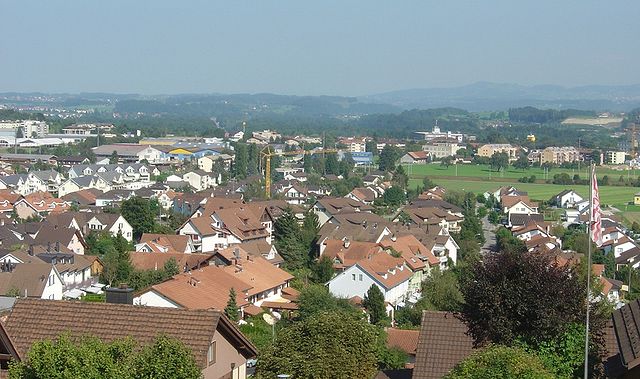
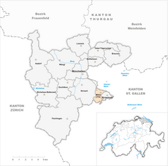
Münchwilen District (Bezirk Münchwilen)

- district of the canton of Thurgau, Switzerland
 Hiking in Münchwilen District
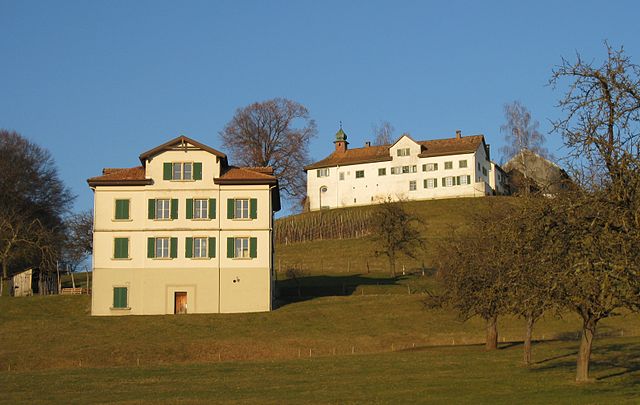
Münchwilen District, located in the Aargau canton of Switzerland, offers a variety of scenic landscapes and hiking opportunities. The area is characterized by its rolling hills, lush forests, and picturesque villages, making it an ideal spot for both casual and experienced hikers.
Hiking Trails
-
Nature Trails: Many trails wind through the region's rich natural environments, providing a chance to explore diverse flora and fauna. Look for signs marking designated trails to ensure you adhere to local guidelines and conservation efforts.
-
Panoramic Views: Some trails lead to elevated viewpoints, offering breathtaking vistas over the surrounding countryside and nearby mountains. The hikes to these points can be moderately challenging, depending on the terrain.
-
Historical Routes: The region is also steeped in history, and some trails will take you through ancient paths that connect various historical sites, charming villages, and churches.
-
Waterways: The district is crisscrossed by rivers and streams, allowing for pleasant hikes near water features. These routes are often less strenuous and suitable for families.
-
Seasonal Considerations: Spring and autumn are especially beautiful times to hike in the area, as the scenery changes with the seasons. Be cautious during winter, as some trails may not be maintained for winter hiking.
Hiking Tips
- Maps and Guides: Always carry a map or GPS device, as some trails may not be clearly marked.
- Good Footwear: Wear sturdy shoes with good grip, especially if you plan on tackling more challenging trails.
- Weather Preparedness: The weather can change rapidly in Switzerland, so check the forecast and dress in layers.
- Local Regulations: Respect local wildlife and plants, and always stay on marked paths to minimize your impact on the environment.
Getting There
Münchwilen is accessible via public transportation, making it easy for hikers from nearby cities to explore the area. Always check local transit schedules to plan your excursions appropriately.
Enjoy your hiking adventures in Münchwilen District!
- Country:

- Licence Plate Code: TG
- Coordinates: 47° 29' 0" N, 8° 59' 0" E


- GPS tracks (wikiloc): [Link]
- AboveSeaLevel: 518 м m
- Area: 155.86 sq km
- Wikipedia en: wiki(en)
- Wikipedia: wiki(de)
- Wikidata storage: Wikidata: Q182001
- Wikipedia Commons Category: [Link]
- Freebase ID: [/m/0g3tdz]
- GeoNames ID: Alt: [8260145]
- archINFORM location ID: [42277]
Includes regions:

Lommis
- municipality in Switzerland
Hiking in Lommis
Lommis, located in the Thurgau region of Switzerland, offers various hiking opportunities characterized by scenic landscapes, rolling hills, and picturesque vineyards. The region is known for its mild climate, making it an excellent destination for year-round hiking. Here are some insights into hiking in Lommis:...
- Country:
- Postal Code: 9506
- Local Dialing Code: 052
- Licence Plate Code: TG
- Coordinates: 47° 30' 59" N, 8° 58' 59" E
- GPS tracks (wikiloc): [Link]
- AboveSeaLevel: 475 м m
- Area: 8.6 sq km
- Population: 1224
- Web site: [Link]


Eschlikon
- municipality in Switzerland
Hiking in Eschlikon
Eschlikon, located in the Zurich Region of Switzerland, offers a charming backdrop for hiking enthusiasts. The area is characterized by rolling hills, picturesque landscapes, and Swiss countryside charm, making it a great destination for both casual walkers and more experienced hikers....
- Country:
- Postal Code: 8360
- Local Dialing Code: 071
- Licence Plate Code: TG
- Coordinates: 47° 27' 30" N, 8° 57' 46" E
- GPS tracks (wikiloc): [Link]
- AboveSeaLevel: 565 м m
- Area: 6.2 sq km
- Population: 4308
- Web site: [Link]


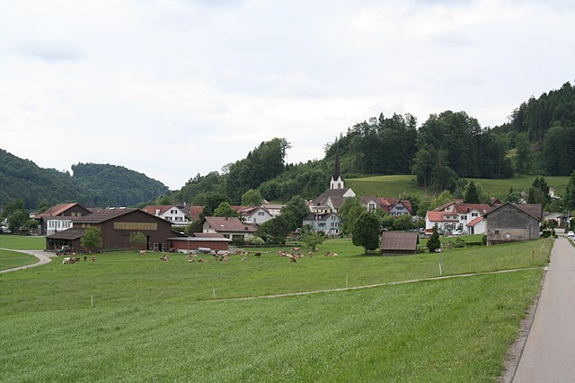
Fischingen
- municipality in the canton of Thurgau, Switzerland
Hiking in Fischingen
Fischingen is a picturesque village located in the canton of Thurgau in Switzerland, surrounded by beautiful landscapes that are perfect for hiking enthusiasts. The area is characterized by rolling hills, lush forests, and serene lakes, making it a fantastic destination for both casual walkers and serious hikers....
- Country:
- Postal Code: 8376
- Local Dialing Code: 071
- Licence Plate Code: TG
- Coordinates: 47° 24' 59" N, 8° 58' 0" E
- GPS tracks (wikiloc): [Link]
- AboveSeaLevel: 625 м m
- Area: 30.7 sq km
- Population: 2695
- Web site: [Link]
Wilen
- municipality in Switzerland
Hiking in Wilen
Wilen is a small village in the municipality of Gmunden, located in Austria. It is nestled near the beautiful Traunsee lake and surrounded by the stunning landscape of the Salzkammergut region, which is known for its picturesque scenery, including mountains, forests, and lakes. Here's what you can expect when hiking in and around Wilen:...
- Country:
- Postal Code: 9535
- Local Dialing Code: 071
- Licence Plate Code: TG
- Coordinates: 47° 27' 0" N, 9° 2' 0" E
- GPS tracks (wikiloc): [Link]
- AboveSeaLevel: 552 м m
- Area: 2.25 sq km
- Population: 2504
- Web site: [Link]


Sirnach
- municipality in Switzerland
Hiking in Sirnach
Sirnach is a beautiful area located in the canton of Thurgau in Switzerland, known for its picturesque landscapes and outdoor activities, including hiking. Here are some highlights and tips for hiking in and around Sirnach:...
- Country:
- Postal Code: 8370
- Local Dialing Code: 071
- Licence Plate Code: TG
- Coordinates: 47° 27' 16" N, 9° 0' 8" E
- GPS tracks (wikiloc): [Link]
- AboveSeaLevel: 655 м m
- Area: 12.4 sq km
- Population: 7737
- Web site: [Link]


Tobel-Tägerschen
- municipality in Switzerland
Hiking in Tobel-Tägerschen
Tobel-Tägerschen is a scenic area in Switzerland that offers various hiking opportunities amidst beautiful landscapes. Located in the region of Thurgau, it features rolling hills, lush forests, and charming glimpses of rural life. Here are a few highlights and tips for hiking in that region:...
- Country:
- Postal Code: 9555
- Local Dialing Code: 071
- Licence Plate Code: TG
- Coordinates: 47° 31' 0" N, 9° 1' 59" E
- GPS tracks (wikiloc): [Link]
- AboveSeaLevel: 525 м m
- Area: 7.0 sq km
- Population: 1599
- Web site: [Link]

Bichelsee-Balterswil
- municipality in Switzerland
Hiking in Bichelsee-Balterswil
Bichelsee-Balterswil is a picturesque area in the canton of Thurgau in Switzerland, known for its natural beauty and a variety of hiking trails. The region is characterized by rolling hills, serene lakes, and lush forests, making it an ideal destination for outdoor enthusiasts....
- Country:
- Postal Code: 8362
- Local Dialing Code: 071
- Licence Plate Code: TG
- Coordinates: 47° 26' 59" N, 8° 54' 59" E
- GPS tracks (wikiloc): [Link]
- AboveSeaLevel: 601 м m
- Area: 12.1 sq km
- Population: 2839
- Web site: [Link]

Bettwiesen
- municipality in Switzerland
Hiking in Bettwiesen
Bettwiesen is a charming location for hiking enthusiasts, surrounded by picturesque landscapes that showcase the beauty of nature. Nestled in Switzerland, Bettwiesen offers a variety of hiking trails suitable for all skill levels, from leisurely walks to more challenging hikes....
- Country:
- Postal Code: 9553
- Local Dialing Code: 071
- Licence Plate Code: TG
- Coordinates: 47° 30' 0" N, 9° 2' 0" E
- GPS tracks (wikiloc): [Link]
- AboveSeaLevel: 550 м m
- Area: 3.84 sq km
- Population: 1248
- Web site: [Link]


Wängi
- municipality in Switzerland
Hiking in Wängi
Wängi, located in the canton of Thurgau in Switzerland, is a lovely area for hiking enthusiasts. The region is characterized by its picturesque landscapes, including rolling hills, forests, and agricultural fields, making it a peaceful retreat for outdoor activities....
- Country:
- Postal Code: 9545
- Local Dialing Code: 052
- Licence Plate Code: TG
- Coordinates: 47° 29' 36" N, 8° 57' 27" E
- GPS tracks (wikiloc): [Link]
- AboveSeaLevel: 500 м m
- Area: 16.4 sq km
- Population: 4662
- Web site: [Link]


Rickenbach
- municipality in the canton of Thurgau, Switzerland
Hiking in Rickenbach
Rickenbach in the canton of Thurgau, Switzerland, offers beautiful hiking opportunities with picturesque landscapes that include rolling hills, vineyards, and scenic views of Lake Constance. Here are some key features and tips for hiking in Rickenbach:...
- Country:
- Postal Code: 9532
- Local Dialing Code: 071
- Licence Plate Code: TG
- Coordinates: 47° 26' 50" N, 9° 2' 50" E
- GPS tracks (wikiloc): [Link]
- AboveSeaLevel: 551 м m
- Area: 1.6 sq km
- Population: 2775
- Web site: [Link]


Aadorf
- municipality in Switzerland
Hiking in Aadorf
Aadorf, located in the canton of Thurgau in Switzerland, offers some beautiful hiking opportunities that cater to various skill levels. The region is characterized by its picturesque landscapes, rolling hills, and lush greenery. Here are some key aspects of hiking in Aadorf:...
- Country:
- Postal Code: 8355
- Local Dialing Code: 052
- Licence Plate Code: TG
- Coordinates: 47° 29' 35" N, 8° 54' 37" E
- GPS tracks (wikiloc): [Link]
- AboveSeaLevel: 534 м m
- Area: 20.0 sq km
- Population: 8885
- Web site: [Link]


Braunau
- municipality in Switzerland
Hiking in Braunau
Braunau, while not a well-known hiking destination itself, is located in Switzerland near the borders of more prominent hiking areas, particularly in the region of the Swiss Alps. However, it provides access to various scenic trails and the surrounding natural beauty that the Swiss landscape offers....
- Country:
- Postal Code: 9502
- Local Dialing Code: 071
- Licence Plate Code: TG
- Coordinates: 47° 30' 16" N, 9° 4' 8" E
- GPS tracks (wikiloc): [Link]
- AboveSeaLevel: 693 м m
- Area: 9.2 sq km
- Population: 770
- Web site: [Link]

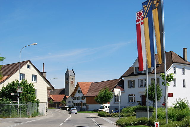
Münchwilen
- municipality in Switzerland
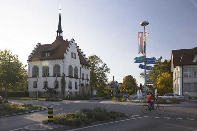
Hiking in Münchwilen
Münchwilen, located in the canton of Thurgau, Switzerland, offers some great opportunities for hiking enthusiasts. The region is characterized by rolling hills, vineyards, and lush green landscapes, which make for picturesque hiking trails....
- Country:
- Postal Code: 9542
- Local Dialing Code: 071
- Licence Plate Code: TG
- Coordinates: 47° 29' 0" N, 8° 58' 59" E
- GPS tracks (wikiloc): [Link]
- AboveSeaLevel: 515 м m
- Area: 7.79 sq km
- Population: 5377
- Web site: [Link]
Shares border with regions:


Weinfelden District
- district of the canton of Thurgau, Switzerland
Hiking in Weinfelden District
Weinfelden District, located in the canton of Thurgau in Switzerland, offers a variety of hiking opportunities that showcase the natural beauty of the region. Here are some highlights for hiking enthusiasts:...
- Country:
- Capital: Weinfelden
- Licence Plate Code: TG
- Coordinates: 47° 34' 0" N, 9° 6' 0" E
- GPS tracks (wikiloc): [Link]
- AboveSeaLevel: 447 м m
- Area: 227.2 sq km


Frauenfeld District
- district of the canton of Thurgau, Switzerland
Hiking in Frauenfeld District
Frauenfeld District, located in the canton of Thurgau in Switzerland, offers a beautiful array of hiking opportunities that cater to various skill levels. The region is characterized by its gentle hills, lush green landscapes, and picturesque views, making it an excellent choice for both experienced hikers and those new to the activity....
- Country:
- Capital: Frauenfeld
- Licence Plate Code: TG
- Coordinates: 47° 33' 0" N, 8° 53' 0" E
- GPS tracks (wikiloc): [Link]
- AboveSeaLevel: 652 м m
- Area: 279.6 sq km