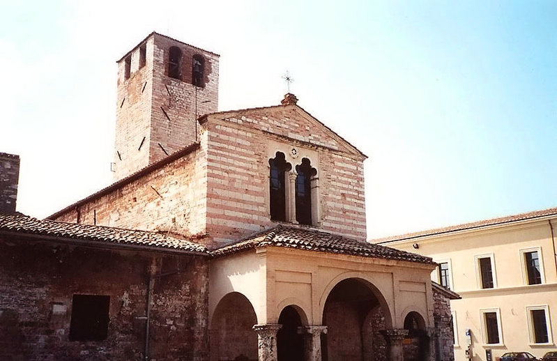
Bevagna (Bevagna)
.svg)
- Italian comune
 Hiking in Bevagna
Bevagna is a charming medieval village located in the Umbria region of Italy, known for its rich history, picturesque landscapes, and beautiful rolling hills. While Bevagna itself may not be a well-known hiking destination like some of its neighboring areas (like Assisi or the Sibillini Mountains), it does offer opportunities for hiking and exploring the breathtaking countryside.
Hiking Opportunities in Bevagna:
-
Scenic Trails: The surrounding countryside features a variety of trails that wind through vineyards, olive groves, and hills, offering stunning views of the Umbrian landscape. You can find routes suitable for all levels of hikers.
-
Historic Paths: Some trails may lead you past historical sites or ancient ruins, allowing you to combine hiking with cultural exploration. You might encounter churches, old stone walls, and remnants of Roman architecture.
-
Nature Reserve: The nearby Monte Subasio Regional Park, located a short drive away, provides more extensive hiking options with marked trails that range from easy walks to more challenging hikes, all showcasing the natural beauty of the area.
-
Wine and Olive Oil Tours: Combining hiking with local cuisine can be a great experience. Many vineyards and olive oil producers in the area offer tasting tours where you can hike to the site and enjoy the local products after your hike.
Tips for Hiking in Bevagna:
-
Weather: Always check the weather forecast before your hike, as conditions can vary greatly. The best times for hiking in Umbria are in the spring (April to June) and fall (September to October) when the temperatures are mild.
-
Footwear: Ensure you wear sturdy hiking boots or shoes suitable for uneven terrain, as some trails can be rocky.
-
Maps and Guidance: Consider obtaining a local hiking map or hiring a guide, especially if you venture into more remote areas.
-
Stay Hydrated: Bring plenty of water, as some trails may not have access to drinking water.
-
Respect the Environment: Follow local guidelines for preserving the natural beauty of the area, including sticking to marked trails and taking your trash with you.
Exploring the Bevagna area on foot allows you to appreciate not only the stunning scenery but also the rich cultural heritage of this beautiful part of Italy. Enjoy your hiking adventure!
- Country:

- Postal Code: 06031
- Local Dialing Code: 0742
- Licence Plate Code: PG
- Coordinates: 42° 56' 0" N, 12° 37' 0" E


- GPS tracks (wikiloc): [Link]
- AboveSeaLevel: 210 м m
- Area: 56.22 sq km
- Population: 5013
- Web site: http://www.comune.bevagna.pg.it
- Wikipedia en: wiki(en)
- Wikipedia: wiki(it)
- Wikidata storage: Wikidata: Q20144
- Wikipedia Commons Gallery: [Link]
- Wikipedia Commons Category: [Link]
- Freebase ID: [/m/01vprl]
- GeoNames ID: Alt: [6536864]
- BnF ID: [124415597]
- VIAF ID: Alt: [139652773]
- OSM relation ID: [42240]
- GND ID: Alt: [4346858-5]
- Library of Congress authority ID: Alt: [n87898440]
- MusicBrainz area ID: [81ca9f1a-b52a-4db4-94a2-b2903df808b4]
- UN/LOCODE: [ITBV6]
- Digital Atlas of the Roman Empire ID: [16699]
- DMOZ ID: Alt: [Regional/Europe/Italy/Umbria/Localities/Bevagna/]
- Treccani ID: [bevagna]
- Enciclopedia Italiana ID: [bevagna]
- ISTAT ID: 054004
- Italian cadastre code: A835
Shares border with regions:


Cannara
- Italian comune
Hiking in Cannara
Cannara is a charming town located in the Umbria region of Italy, surrounded by beautiful landscapes that offer a variety of hiking opportunities. Here’s an overview of what you can expect when hiking in and around Cannara:...
- Country:
- Postal Code: 06033
- Local Dialing Code: 0742
- Licence Plate Code: PG
- Coordinates: 43° 0' 0" N, 12° 35' 0" E
- GPS tracks (wikiloc): [Link]
- AboveSeaLevel: 197 м m
- Area: 32.81 sq km
- Population: 4337
- Web site: [Link]

Foligno
- Italian comune
Hiking in Foligno
Foligno, located in the heart of Italy's Umbria region, offers a beautiful landscape perfect for hiking enthusiasts. The area is characterized by rolling hills, picturesque valleys, and a rich tapestry of nature that includes forests, fields, and scenic views....
- Country:
- Postal Code: 06034
- Local Dialing Code: 0742
- Licence Plate Code: PG
- Coordinates: 42° 57' 22" N, 12° 42' 12" E
- GPS tracks (wikiloc): [Link]
- AboveSeaLevel: 234 м m
- Area: 264.67 sq km
- Population: 57059
- Web site: [Link]


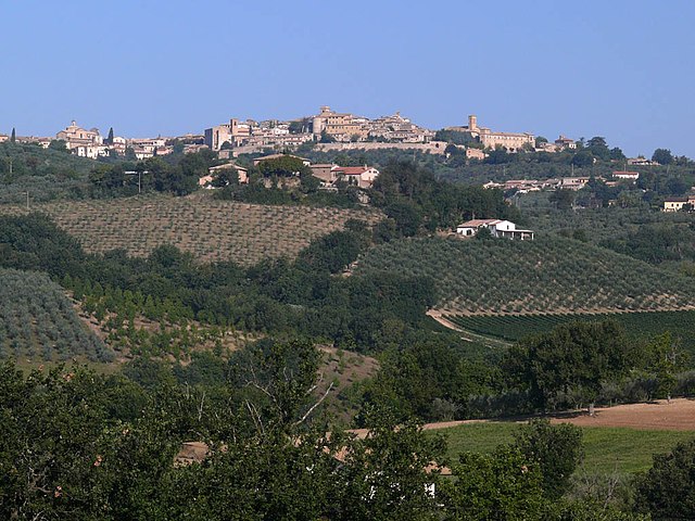
Gualdo Cattaneo
- Italian comune
Hiking in Gualdo Cattaneo
Gualdo Cattaneo, a charming hilltop town in the Umbria region of Italy, offers several hiking opportunities that showcase its beautiful landscapes, rich history, and serene countryside. The area is characterized by rolling hills, vineyards, olive groves, and picturesque views, making it a great destination for outdoor enthusiasts....
- Country:
- Postal Code: 06035
- Local Dialing Code: 0742
- Licence Plate Code: PG
- Coordinates: 42° 55' 0" N, 12° 33' 0" E
- GPS tracks (wikiloc): [Link]
- AboveSeaLevel: 446 м m
- Area: 96.63 sq km
- Population: 5965
- Web site: [Link]

Montefalco
- Italian comune
Hiking in Montefalco
Montefalco, often referred to as the "Balcony of Umbria," is a beautiful hilltop town in central Italy known for its stunning panoramic views, rich history, and excellent wine, particularly the Sagrantino. Hiking in and around Montefalco offers a unique combination of natural beauty, cultural experiences, and culinary delights....
- Country:
- Postal Code: 06036
- Local Dialing Code: 0742
- Licence Plate Code: PG
- Coordinates: 42° 53' 27" N, 12° 38' 54" E
- GPS tracks (wikiloc): [Link]
- AboveSeaLevel: 473 м m
- Area: 69.51 sq km
- Population: 5577
- Web site: [Link]


Spello
- Italian comune
Hiking in Spello
Spello, a picturesque town located in the Umbria region of Italy, is known for its stunning landscapes, historical architecture, and charming streets. Hiking around Spello offers a delightful way to explore the natural beauty and cultural heritage of the area. Here’s what you need to know about hiking in and around Spello:...
- Country:
- Postal Code: 06038
- Local Dialing Code: 0742
- Licence Plate Code: PG
- Coordinates: 42° 59' 0" N, 12° 40' 0" E
- GPS tracks (wikiloc): [Link]
- AboveSeaLevel: 280 м m
- Area: 61.65 sq km
- Population: 8565
- Web site: [Link]