
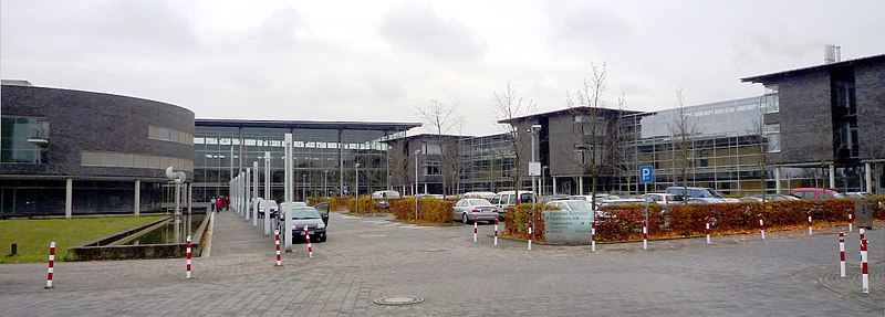
Bielefeld (Bielefeld)

- city in Germany
 Hiking in Bielefeld
Bielefeld, located in North Rhine-Westphalia, Germany, offers a variety of hiking opportunities for outdoor enthusiasts. The region is characterized by diverse landscapes, including forests, hills, and meadows, making it perfect for both casual walkers and serious hikers.
Popular Hiking Trails in Bielefeld:
-
Teutoburg Forest: This extensive forest area near Bielefeld provides numerous trails ranging from easy to challenging. One of the most famous trails is the Hermannsweg, which offers stunning views and historic sites, including the Externsteine rock formation.
-
Sparrenberg Park: This park features well-maintained paths that are ideal for leisurely hikes. You can explore the park and enjoy views of the Bielefeld cityscape and the Sparrenburg Castle.
-
Bielefeld’s Local Trails: The city has several marked trails that connect to the outskirts. The “Bielefelder Rundweg” is a circular path that showcases the scenic beauty of the area, covering various terrains and passing through woodlands and open fields.
-
Rotalac Trail: A lesser-known but beautiful trail that combines forest paths with rural landscapes, providing a peaceful hiking experience away from urban noise.
Tips for Hiking in Bielefeld:
-
Best Time to Visit: The best times for hiking in the area are spring and fall, when the weather is mild, and the scenery is particularly beautiful due to blooming flowers or autumn foliage.
-
Prepare for the Terrain: Some trails can be steep and rocky, especially in the Teutoburg Forest. Good hiking boots are recommended for proper support.
-
Stay Hydrated and Fuel Up: Always carry enough water and snacks, especially if you plan to hike longer trails.
-
Check Local Map Resources: The local tourist information office can provide maps and guides to the best hiking spots in and around Bielefeld.
-
Respect Nature: Follow the principle of Leave No Trace to preserve the natural beauty of the area.
Whether you prefer leisurely walks or more strenuous hikes, Bielefeld and its surroundings offer a variety of options that can be enjoyed year-round.
- Country:

- Postal Code: 33647; 33619; 33617; 33615; 33613; 33611; 33609; 33607; 33605; 33604; 33602; 33501
- Local Dialing Code: 0521; 05209; 05206; 05205; 05202; 05208; 05203
- Licence Plate Code: BI
- Coordinates: 52° 1' 0" N, 8° 32' 0" E


- GPS tracks (wikiloc): [Link]
- AboveSeaLevel: 118 м m
- Area: 258.82 sq km
- Population: 333451
- Web site: https://www.bielefeld.de/
- Wikipedia en: wiki(en)
- Wikipedia: wiki(de)
- Wikidata storage: Wikidata: Q2112
- Wikipedia Commons Gallery: [Link]
- Wikipedia Commons Category: [Link]
- Wikipedia Commons Maps Category: [Link]
- Freebase ID: [/m/018m98]
- GeoNames ID: Alt: [2949186]
- BnF ID: [119717772]
- VIAF ID: Alt: [312796170]
- OSM relation ID: [62646]
- GND ID: Alt: [4006510-8]
- archINFORM location ID: [382]
- Library of Congress authority ID: Alt: [n79145551]
- MusicBrainz area ID: [dbdd7aff-9bf5-4084-98c3-722f27d7bb4d]
- WOEID: [638806]
- Quora topic ID: [Bielefeld]
- Encyclopædia Britannica Online ID: [place/Bielefeld]
- EMLO location ID: [ace4d17f-ef2a-4bb5-b036-e93af6c31429]
- Facebook Places ID: [110710585624249]
- Great Russian Encyclopedia Online ID: [1866077]
- DMOZ ID: Alt: [Regional/Europe/Germany/States/North_Rhine-Westphalia/Localities/Bielefeld/]
- National Library of Israel ID: [000977673]
- NUTS code: [DEA41]
- Nomisma ID: [bielefeld]
- Klexikon article ID: [Bielefeld]
- Global Anabaptist Mennonite Encyclopedia Online ID: [Bielefeld (Nordrhein-Westfalen, Germany)]
- NE.se ID: [bielefeld]
- Encyclopedia of Modern Ukraine ID: [39984]
- German municipality key: 05711000
- GNS Unique Feature ID: 115821
- German district key: 05711
Includes regions:
Senne (district)
- urban district of Bielefeld, Germany
Hiking in Senne (district)
Senne, located in the Bielefeld area of North Rhine-Westphalia, Germany, offers a variety of hiking opportunities ideal for both casual walkers and more experienced hikers. The landscape is characterized by beautiful forests, rolling hills, and scenic views, making it a pleasant area to explore....
- Country:
- Coordinates: 51° 56' 0" N, 8° 30' 0" E
- GPS tracks (wikiloc): [Link]
- Area: 32.19 sq km
Gadderbaum (district)
- urban district of Bielefeld, Germany
Hiking in Gadderbaum (district)
Gadderbaum is a district in Bielefeld, Germany, known for its beautiful natural surroundings, which can provide a great setting for hiking and outdoor activities. While Gadderbaum itself may not be a major hiking destination like some national parks, it offers access to trails and paths in the nearby areas....
- Country:
- Coordinates: 52° 0' 0" N, 8° 31' 0" E
- GPS tracks (wikiloc): [Link]
- Area: 8.67 sq km
Heepen
- quarter of Bielefeld, Germany
Hiking in Heepen
Heepen is a district located in Bielefeld, Germany, and while it may not be widely recognized as a major hiking destination, it does offer some opportunities for outdoor enthusiasts. The surrounding areas in and around Bielefeld feature various trails and natural landscapes that can be explored....
- Country:
- Coordinates: 52° 2' 0" N, 8° 37' 0" E
- GPS tracks (wikiloc): [Link]
- Area: 38.02 sq km
Jöllenbeck
- quarter of Bielefeld, Germany
Hiking in Jöllenbeck
Jöllenbeck, located in the northwestern part of Bielefeld, Germany, offers some beautiful hiking opportunities for those looking to explore nature. The area is characterized by its picturesque landscapes, including forests, rolling hills, and charming rural environments. Here are some aspects to consider if you're planning to hike in Jöllenbeck:...
- Country:
- Coordinates: 52° 6' 0" N, 8° 31' 0" E
- GPS tracks (wikiloc): [Link]
- Area: 29.69 sq km
Schildesche
- quarter of Bielefeld, Germany
Hiking in Schildesche
Schildesche is a district located in the city of Bielefeld, Germany. While it's not widely known as a major hiking destination, it does offer some pleasant walking and hiking opportunities nearby, particularly for those who appreciate a mix of urban and natural environments....
- Country:
- Coordinates: 52° 2' 59" N, 8° 31' 5" E
- GPS tracks (wikiloc): [Link]
- Area: 10.95 sq km


Sennestadt
- quarter of Bielefeld, Germany
Hiking in Sennestadt
Sennestadt is a district in the city of Bielefeld, Germany, located in the northern part of the Teutoburg Forest. This area is known for its scenic landscapes, rolling hills, and diverse flora and fauna, making it a great destination for hiking enthusiasts....
- Country:
- Postal Code: 33689
- Local Dialing Code: 05205
- Coordinates: 51° 57' 0" N, 8° 35' 0" E
- GPS tracks (wikiloc): [Link]
- Area: 24.71 sq km
- Population: 21710
Stieghorst
- quarter of Bielefeld, Germany
Hiking in Stieghorst
Stieghorst is a district located in the city of Bielefeld in North Rhine-Westphalia, Germany. While it is primarily an urban area, there are opportunities for hiking and enjoying nature in the nearby surroundings....
- Country:
- Coordinates: 52° 0' 0" N, 8° 35' 0" E
- GPS tracks (wikiloc): [Link]
- Area: 27.87 sq km
Brackwede
- quarter of Bielefeld, Germany
Hiking in Brackwede
Brackwede is a district of Bielefeld, located in North Rhine-Westphalia, Germany. While it may not be known as a major hiking destination, it offers some pleasant opportunities for outdoor enthusiasts to explore the natural surroundings....
- Country:
- Postal Code: 33649; 33647
- Local Dialing Code: 0521
- Coordinates: 51° 59' 0" N, 8° 31' 0" E
- GPS tracks (wikiloc): [Link]
- Area: 38.15 sq km
- Population: 40455
Bielefeld-Mitte (district)
- urban district of Bielefeld, Germany
Hiking in Bielefeld-Mitte (district)
Bielefeld-Mitte is an urban district in the city of Bielefeld, Germany, and while it may not be known for extensive hiking trails like some rural areas, it does offer various opportunities for walking and exploring nature within a city environment. Here are some key points to consider when hiking or walking in Bielefeld-Mitte:...
- Country:
- Coordinates: 52° 1' 29" N, 8° 33' 33" E
- GPS tracks (wikiloc): [Link]
- Area: 18.53 sq km
Dornberg (district)
- urban district of Bielefeld, Germany
Hiking in Dornberg (district)
Dornberg is a district in Bielefeld, Germany, that offers some lovely opportunities for hiking. Nestled on the outskirts of the city, it serves as a gateway to the surrounding Teutoburg Forest, an area known for its beautiful landscapes, varied terrain, and rich biodiversity. Here are some highlights of hiking in this region:...
- Country:
- Postal Code: 33739; 33619
- Local Dialing Code: 05203; 0521
- Coordinates: 52° 3' 0" N, 8° 28' 0" E
- GPS tracks (wikiloc): [Link]
- Area: 29.09 sq km
- Population: 19313
Shares border with regions:

Gütersloh
- district of North Rhine-Westphalia
Hiking in Gütersloh
Gütersloh district in North Rhine-Westphalia, Germany, offers a variety of hiking opportunities set against a picturesque backdrop of nature and charming landscapes. Here are some highlights for hiking in this area:...
- Country:
- Licence Plate Code: GT
- Coordinates: 51° 55' 0" N, 8° 20' 0" E
- GPS tracks (wikiloc): [Link]
- AboveSeaLevel: 70 м m
- Web site: [Link]


Lippe
- German district in North Rhine-Westphalia
Hiking in Lippe
Lippe, located in North Rhine-Westphalia, Germany, is known for its picturesque landscapes, historical sites, and diverse hiking opportunities. Here are some key points to consider if you’re planning a hiking trip in the Lippe district:...
- Country:
- Licence Plate Code: LIP
- Coordinates: 52° 0' 0" N, 8° 55' 0" E
- GPS tracks (wikiloc): [Link]
- AboveSeaLevel: 129 м m
- Web site: [Link]
Herford
- German district of North Rhine-Westphalia
Hiking in Herford
Herford district, located in North Rhine-Westphalia, Germany, offers a variety of hiking opportunities amid beautiful landscapes, charming towns, and scenic nature trails. Here are some highlights that you can expect when hiking in this region:...
- Country:
- Licence Plate Code: HF
- Coordinates: 52° 10' 0" N, 8° 35' 0" E
- GPS tracks (wikiloc): [Link]
- AboveSeaLevel: 59 м m
- Web site: [Link]