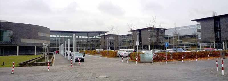
Detmold Government Region (Regierungsbezirk Detmold)

- government region of North Rhine-Westphalia, Germany
 Hiking in Detmold Government Region
Detmold, located in the North Rhine-Westphalia region of Germany, is surrounded by beautiful landscapes and offers numerous hiking opportunities for outdoor enthusiasts. Here are some key points about hiking in the Detmold region:
Natural Settings:
-
Teutoburg Forest: This forest, also known as Teutoburger Wald, is a prominent feature of the Detmold area. It is characterized by its lush woodlands, hills, and sandstone formations. The area is rich in biodiversity and offers trails suitable for various skill levels.
-
Externsteine: One of the most famous natural monuments in Germany, the Externsteine are towering sandstone rock formations that provide stunning views of the surrounding area. There are several hiking paths leading to and around these formations.
-
Nature Reserves: The region has several protected areas that highlight its unique flora and fauna. These reserves often feature marked trails that allow hikers to explore the local ecosystem.
Hiking Trails:
-
Hermannsweg: This is a famous long-distance hiking trail that runs for about 156 kilometers (97 miles) from the town of Detmold to the picturesque town of Rheine. It offers a mix of scenic views, cultural landmarks, and historical significance. The route includes various terrains and is well-marked, making it suitable for experienced hikers.
-
Local Trails: There are many shorter, well-maintained trails around Detmold that cater to different hiking levels. Many trails are looped, providing opportunities to explore local nature while enjoying the sights.
Preparing for Your Hike:
- Maps and Navigation: It's advisable to carry a local hiking map or download trail maps on your smartphone, as not all trails may be signposted clearly.
- Weather Conditions: Check the weather forecast before heading out, as conditions can change rapidly, especially in forested areas.
- Gear: Wear appropriate hiking shoes and bring sufficient water, snacks, and a first-aid kit.
- Wildlife: Be aware of local wildlife, and respect the natural environment by sticking to designated trails and practicing ‘Leave No Trace’ principles.
Local Tips:
- Visitor Centers: Consider visiting local tourist information centers for maps, guided tours, and additional resources on hiking routes.
- Cultural Sites: Combine your hike with visits to local historical sites like the Detmold Palace or the open-air museum in Detmold, which offers insight into the area's cultural history.
Hiking in the Detmold region is a rewarding experience for nature lovers and adds a unique charm to the exploration of Westphalia. Happy hiking!
- Country:

- Coordinates: 52° 0' 0" N, 8° 45' 0" E


- GPS tracks (wikiloc): [Link]
- AboveSeaLevel: 119 м m
- Area: 6518.14 sq km
- Web site: http://www.brdt.nrw.de/
- Wikipedia en: wiki(en)
- Wikipedia: wiki(de)
- Wikidata storage: Wikidata: Q7923
- Wikipedia Commons Gallery: [Link]
- Wikipedia Commons Category: [Link]
- Freebase ID: [/m/019tmd]
- GeoNames ID: Alt: [2937935]
- VIAF ID: Alt: [157731737]
- OSM relation ID: [73347]
- GND ID: Alt: [4011556-2]
- TGN ID: [7196790]
- NUTS code: [DEA4]
- GNS Unique Feature ID: -1758701
Includes regions:


Bielefeld
- city in Germany
Hiking in Bielefeld
Bielefeld, located in North Rhine-Westphalia, Germany, offers a variety of hiking opportunities for outdoor enthusiasts. The region is characterized by diverse landscapes, including forests, hills, and meadows, making it perfect for both casual walkers and serious hikers....
- Country:
- Postal Code: 33647; 33619; 33617; 33615; 33613; 33611; 33609; 33607; 33605; 33604; 33602; 33501
- Local Dialing Code: 0521; 05209; 05206; 05205; 05202; 05208; 05203
- Licence Plate Code: BI
- Coordinates: 52° 1' 0" N, 8° 32' 0" E
- GPS tracks (wikiloc): [Link]
- AboveSeaLevel: 118 м m
- Area: 258.82 sq km
- Population: 333451
- Web site: [Link]

Gütersloh
- district of North Rhine-Westphalia
Hiking in Gütersloh
Gütersloh district in North Rhine-Westphalia, Germany, offers a variety of hiking opportunities set against a picturesque backdrop of nature and charming landscapes. Here are some highlights for hiking in this area:...
- Country:
- Licence Plate Code: GT
- Coordinates: 51° 55' 0" N, 8° 20' 0" E
- GPS tracks (wikiloc): [Link]
- AboveSeaLevel: 70 м m
- Web site: [Link]
Paderborn
- German district of North Rhine-Westphalia
Hiking in Paderborn
Paderborn, located in North Rhine-Westphalia, Germany, offers a variety of hiking opportunities, combining natural beauty with cultural landmarks. The region is characterized by its mix of forests, parks, and scenic countryside, making it a pleasant destination for both casual walkers and more experienced hikers....
- Country:
- Licence Plate Code: PB
- Coordinates: 51° 42' 36" N, 8° 44' 24" E
- GPS tracks (wikiloc): [Link]
- AboveSeaLevel: 221 м m
- Area: 1246.8 sq km
- Web site: [Link]

Höxter
- German district in North Rhine-Westphalia
Hiking in Höxter
Höxter is a picturesque district located in North Rhine-Westphalia, Germany, known for its stunning landscapes, historical sites, and outdoor activities, making it an excellent destination for hiking enthusiasts. Here’s a comprehensive overview of hiking in the Höxter district:...
- Country:
- Capital: Höxter
- Licence Plate Code: HX
- Coordinates: 51° 40' 0" N, 9° 15' 0" E
- GPS tracks (wikiloc): [Link]
- AboveSeaLevel: 193 м m
- Web site: [Link]


Lippe
- German district in North Rhine-Westphalia
Hiking in Lippe
Lippe, located in North Rhine-Westphalia, Germany, is known for its picturesque landscapes, historical sites, and diverse hiking opportunities. Here are some key points to consider if you’re planning a hiking trip in the Lippe district:...
- Country:
- Licence Plate Code: LIP
- Coordinates: 52° 0' 0" N, 8° 55' 0" E
- GPS tracks (wikiloc): [Link]
- AboveSeaLevel: 129 м m
- Web site: [Link]
Herford
- German district of North Rhine-Westphalia
Hiking in Herford
Herford district, located in North Rhine-Westphalia, Germany, offers a variety of hiking opportunities amid beautiful landscapes, charming towns, and scenic nature trails. Here are some highlights that you can expect when hiking in this region:...
- Country:
- Licence Plate Code: HF
- Coordinates: 52° 10' 0" N, 8° 35' 0" E
- GPS tracks (wikiloc): [Link]
- AboveSeaLevel: 59 м m
- Web site: [Link]


Minden-Lübbecke District
- district in North Rhine-Westphalia, Germany
Hiking in Minden-Lübbecke District
Minden-Lübbecke is a beautiful district in North Rhine-Westphalia, Germany, known for its picturesque landscapes, diverse flora and fauna, and numerous hiking opportunities. Here are some highlights and tips for hiking in the area:...
- Country:
- Licence Plate Code: MI
- Coordinates: 52° 23' 57" N, 8° 43' 4" E
- GPS tracks (wikiloc): [Link]
- AboveSeaLevel: 58 м m
- Area: 1051.97 sq km
- Web site: [Link]