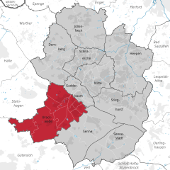
Brackwede (Brackwede)
- quarter of Bielefeld, Germany
Brackwede is a district of Bielefeld, located in North Rhine-Westphalia, Germany. While it may not be known as a major hiking destination, it offers some pleasant opportunities for outdoor enthusiasts to explore the natural surroundings.
Hiking Trails and Nature
-
Local Parks and Green Spaces: Brackwede and its surrounding areas have several parks and natural sites where you can enjoy lighter hiking or walking. Notable areas include local parks along the Schage, which can provide wonderful short walking trails and lush greenery.
-
Nearby Forests: The nearby Teuto mountain range and forests like the Teutoburger Wald provide more extensive trails for those looking for a more rigorous hiking experience. You can explore numerous paths that wind through this rich landscape, featuring a variety of flora and fauna.
-
Scenic Views: If you venture a little further into the Teutoburg Forest, you'll find trails that lead to stunning panoramic views, especially from elevated spots like the Hermann Monument.
Hiking Tips
-
Trail Maps: Always carry a map or have a reliable hiking app, as it can help you navigate the trails more easily.
-
Weather Preparedness: Check the weather conditions before heading out, as the area can experience changes quickly, especially in the forests.
-
Safety: Make sure to have appropriate gear, such as sturdy hiking boots, water, snacks, and a first-aid kit.
-
Wildlife: Keep an eye out for local wildlife — it's often an enjoyable part of the hiking experience.
Local Hiking Groups
Consider joining local hiking clubs or groups if you’re looking to connect with other hikers or explore the area more comprehensively. They often organize regular hikes and can provide local insights.
Accessibility
Brackwede is accessible via public transport from Bielefeld city center, making it easy to get to starting points for hikes.
In summary, while Brackwede may not be a renowned hiking destination, it offers pleasant walking opportunities and access to more challenging trails nearby. Enjoy your hike!
- Country:

- Postal Code: 33649; 33647
- Local Dialing Code: 0521
- Coordinates: 51° 59' 0" N, 8° 31' 0" E


- GPS tracks (wikiloc): [Link]
- Area: 38.15 sq km
- Population: 40455
- Wikidata storage: Wikidata: Q630083
- Wikipedia Commons Category: [Link]
- Wikipedia Commons Maps Category: [Link]
- VIAF ID: Alt: [147220840]
- OSM relation ID: [976442]
- archINFORM location ID: [11470]

