Bischofszell (Bischofszell)
- municipality in Switzerland
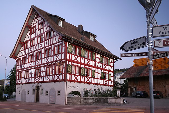
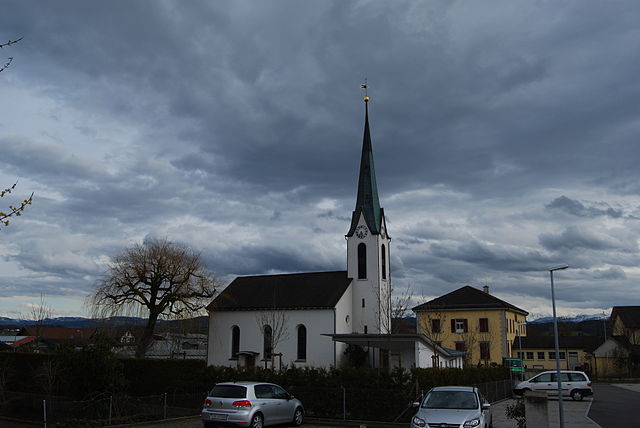
Bischofszell is a charming town located in the canton of Thurgau in Switzerland, known for its picturesque landscapes and rich cultural heritage. While it's not as famous as some of the larger hiking destinations in the Swiss Alps, it offers a variety of hiking opportunities for nature lovers and outdoor enthusiasts.
Hiking Routes
-
Thur River Trail: One of the most popular routes starts along the banks of the Thur River. This trail features beautiful views of the river, lush greenery, and occasional sightings of local wildlife. It's suitable for all levels of hikers.
-
Bischofszell to the Appenzell Region: You can hike from Bischofszell towards the Appenzell region, which offers stunning panoramic views of the surrounding hills and valleys. This route can be a bit challenging but is worth it for the scenery.
-
Wine Trails: The region is also known for its vineyards, and there are dedicated wine trails that combine hiking with wine tasting. These trails offer a leisurely hike through the vineyards, with opportunities to sample local wines.
-
Cultural Trails: Some paths offer insights into the local history and culture, featuring historical landmarks, local architecture, and information plaques about the region's heritage.
Tips for Hiking in Bischofszell
-
Best Time to Go: Spring through fall is the best time for hiking, as the weather is generally mild and the landscape is vibrant with flora.
-
Prepare for Varying Weather: Swiss weather can change quickly, so it’s wise to dress in layers and bring a waterproof jacket, even in summer.
-
Maps & Signage: Most trails are well-marked, but it's always a good idea to carry a map. You can find local maps at tourist information centers or online.
-
Local Guidance: Consider joining a guided hike or tour. Local instructors can provide insights into the area and ensure you don't miss any hidden gems.
-
Respect Nature: As always, practice Leave No Trace principles to help protect the natural beauty of the region.
Whether you're looking for a leisurely stroll along the river or a more challenging mountain hike, Bischofszell has something to offer all types of hikers.
- Country:

- Postal Code: 9220
- Local Dialing Code: 071
- Licence Plate Code: TG
- Coordinates: 47° 29' 59" N, 9° 14' 0" E


- GPS tracks (wikiloc): [Link]
- AboveSeaLevel: 506 м m
- Area: 11.7 sq km
- Population: 6009
- Web site: http://www.bischofszell.ch
- Wikipedia en: wiki(en)
- Wikipedia: wiki(de)
- Wikidata storage: Wikidata: Q64865
- Wikipedia Commons Category: [Link]
- Freebase ID: [/m/0g30fj]
- GeoNames ID: Alt: [8394414]
- VIAF ID: Alt: [157777186]
- OSM relation ID: [1684507]
- GND ID: Alt: [4006957-6]
- archINFORM location ID: [15651]
- Library of Congress authority ID: Alt: [n83059776]
- MusicBrainz area ID: [086dc400-fdb9-4cea-a63f-c04be76f590e]
- HDS ID: [1865]
- EMLO location ID: [47627924-07a4-40f0-a02e-1993a37b1918]
- Swiss municipality code: [4471]
- NKCR AUT ID: [ge901216]
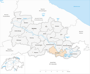
Shares border with regions:


Waldkirch
- municipality in the canton of St. Gallen, Switzerland
Waldkirch is a charming village located in the scenic region of the Emmental in Switzerland, surrounded by picturesque landscapes that are perfect for hiking enthusiasts. Here are some highlights and tips for hiking in and around Waldkirch:...
- Country:

- Postal Code: 9205
- Local Dialing Code: 071
- Licence Plate Code: SG
- Coordinates: 47° 27' 59" N, 9° 16' 59" E


- GPS tracks (wikiloc): [Link]
- AboveSeaLevel: 629 м m
- Area: 31.25 sq km
- Population: 3498
- Web site: [Link]


Zihlschlacht-Sitterdorf
- municipality in Switzerland
 Hiking in Zihlschlacht-Sitterdorf
Zihlschlacht-Sitterdorf is a picturesque area located in the canton of Thurgau in Switzerland, known for its stunning landscapes and diverse hiking opportunities. Here’s a general overview of what you can expect when hiking in this beautiful region:...
- Country:

- Postal Code: 8588
- Local Dialing Code: 071
- Licence Plate Code: TG
- Coordinates: 47° 31' 0" N, 9° 15' 59" E


- GPS tracks (wikiloc): [Link]
- AboveSeaLevel: 527 м m
- Area: 12.2 sq km
- Population: 2367
- Web site: [Link]


Kradolf-Schönenberg
- municipality in Switzerland
Kradolf-Schönenberg is a charming municipality located in the Canton of Thurgau in Switzerland. While it may not be as widely known as some of the larger Swiss hiking destinations, it offers beautiful landscapes and a peaceful hiking experience amidst nature, making it a great spot for outdoor enthusiasts....
- Country:

- Postal Code: 9214
- Local Dialing Code: 071
- Licence Plate Code: TG
- Coordinates: 47° 30' 59" N, 9° 10' 59" E


- GPS tracks (wikiloc): [Link]
- AboveSeaLevel: 455 м m
- Area: 10.9 sq km
- Population: 3570
- Web site: [Link]


Niederbüren
- municipality in Switzerland
Niederbüren is a picturesque location in Switzerland, situated in the canton of St. Gallen, which offers a variety of hiking opportunities for outdoor enthusiasts. The region is characterized by its beautiful landscapes, rolling hills, lush forests, and stunning views of the surrounding mountains....
- Country:

- Postal Code: 9246
- Local Dialing Code: 071
- Licence Plate Code: SG
- Coordinates: 47° 27' 42" N, 9° 12' 54" E


- GPS tracks (wikiloc): [Link]
- AboveSeaLevel: 538 м m
- Area: 15.92 sq km
- Population: 1524
- Web site: [Link]


Hauptwil-Gottshaus
- municipality in Switzerland
Hauptwil-Gottshaus is a charming area located in the Canton of Thurgau in Switzerland, known for its beautiful landscapes, rolling hills, and scenic trails. Hiking in this region offers a chance to experience the tranquility of the Swiss countryside, with a mix of forested areas, farmland, and stunning viewpoints....
- Country:

- Postal Code: 9213
- Local Dialing Code: 071
- Licence Plate Code: TG
- Coordinates: 47° 27' 59" N, 9° 16' 59" E


- GPS tracks (wikiloc): [Link]
- AboveSeaLevel: 550 м m
- Area: 12.5 sq km
- Population: 1943
- Web site: [Link]


Hohentannen
- municipality in Switzerland
Hohentannen is a lesser-known hiking destination that offers stunning views and a variety of trails suited for different skill levels. It's often less crowded than more popular hiking spots, making it an ideal place for those looking to enjoy nature in a more secluded environment....
- Country:

- Postal Code: 9216
- Local Dialing Code: 071
- Licence Plate Code: TG
- Coordinates: 47° 30' 0" N, 9° 12' 59" E


- GPS tracks (wikiloc): [Link]
- AboveSeaLevel: 570 м m
- Area: 8.0 sq km
- Population: 602
- Web site: [Link]


Niederhelfenschwil
- municipality in Switzerland
Niederhelfenschwil, located in the canton of St. Gallen in Switzerland, is a great destination for hiking enthusiasts. The area is characterized by its beautiful landscapes, rolling hills, and lush green forests, making it suitable for various levels of hiking experience. Here are some key points to consider when hiking in Niederhelfenschwil:...
- Country:

- Postal Code: 9527
- Local Dialing Code: 071
- Licence Plate Code: SG
- Coordinates: 47° 28' 42" N, 9° 9' 56" E


- GPS tracks (wikiloc): [Link]
- AboveSeaLevel: 559 м m
- Area: 16.34 sq km
- Population: 3117
- Web site: [Link]
