Weinfelden District (Bezirk Weinfelden)

- district of the canton of Thurgau, Switzerland
 Hiking in Weinfelden District
Weinfelden District, located in the canton of Thurgau in Switzerland, offers a variety of hiking opportunities that showcase the natural beauty of the region. Here are some highlights for hiking enthusiasts:
Scenic Trails
-
Lake Constance Trails: The shores of Lake Constance present picturesque paths with views of the water, vineyards, and the Alps in the distance. Trails around the lake often feature easy walking paths suitable for all skill levels.
-
Thurgau Auen Trail: This scenic trail takes you through the wetlands and natural reserves along the Thur River. It’s a great way to enjoy the diverse flora and fauna of the region.
-
Vineyard Hikes: Thurgau is known for its vineyards, and many trails wind through rolling hills covered in grapevines. The Route of the Wine offers opportunities to taste local wines and enjoy stunning vistas.
Local Highlights
- Niederuzwil: Often a starting point for hikes, this village offers routes that lead into the surrounding hills and forests.
- Weinfelden: The district's capital, Weinfelden, has plenty of trails leading into its nearby countryside, perfect for a day hike.
Nature and Wildlife
The region is home to diverse wildlife, and hiking in the Weinfelden District provides opportunities to observe various birds and plant species. Be sure to explore designated nature reserves for an up-close experience with the local ecosystem.
Tips for Hikers
- Maps and Guides: When planning hikes, consider obtaining local maps or using mobile apps that feature the trails in the Weinfelden District. The Swiss hiking network is well-marked, so follow the signs and trail markers.
- Weather Conditions: Always check the weather before heading out, as conditions can change rapidly in the mountains.
- Hydration and Snacks: Carry enough water and snacks, especially on longer hikes. While there are places to stop for food, it’s always good to have something on hand.
- Hiking Gear: Wear sturdy hiking boots, and dress in layers to handle the variable weather.
Accessibility
Most trails in the Weinfelden District are accessible via public transport, making it easy to reach trailheads without needing a car.
With its stunning landscapes, charming small towns, and diverse ecosystems, the Weinfelden District is a wonderful destination for hikers of all skill levels. Happy hiking!
- Country:

- Capital: Weinfelden
- Licence Plate Code: TG
- Coordinates: 47° 34' 0" N, 9° 6' 0" E


- GPS tracks (wikiloc): [Link]
- AboveSeaLevel: 447 м m
- Area: 227.2 sq km
- Wikipedia en: wiki(en)
- Wikipedia: wiki(de)
- Wikidata storage: Wikidata: Q175071
- Wikipedia Commons Category: [Link]
- Freebase ID: [/m/0g3ycs]
- GeoNames ID: Alt: [8260147]
- archINFORM location ID: [42276]
Includes regions:
Bischofszell
- municipality in Switzerland
Hiking in Bischofszell
Bischofszell is a charming town located in the canton of Thurgau in Switzerland, known for its picturesque landscapes and rich cultural heritage. While it's not as famous as some of the larger hiking destinations in the Swiss Alps, it offers a variety of hiking opportunities for nature lovers and outdoor enthusiasts....
- Country:
- Postal Code: 9220
- Local Dialing Code: 071
- Licence Plate Code: TG
- Coordinates: 47° 29' 59" N, 9° 14' 0" E
- GPS tracks (wikiloc): [Link]
- AboveSeaLevel: 506 м m
- Area: 11.7 sq km
- Population: 6009
- Web site: [Link]

Märstetten
- municipality in Switzerland
Hiking in Märstetten
Märstetten, located in the canton of Thurgau in Switzerland, is surrounded by natural beauty and offers several opportunities for hiking enthusiasts. The region features a mix of rolling hills, farmland, and forested areas, providing diverse and scenic hiking trails....
- Country:
- Postal Code: 8560
- Local Dialing Code: 071
- Licence Plate Code: TG
- Coordinates: 47° 36' 0" N, 9° 3' 59" E
- GPS tracks (wikiloc): [Link]
- AboveSeaLevel: 425 м m
- Area: 9.9 sq km
- Population: 2817
- Web site: [Link]

Erlen
- municipality in Switzerland
Hiking in Erlen
Erlen is a small municipality in the canton of Thurgau, Switzerland, known for its picturesque landscapes and access to various outdoor activities, including hiking. While Erlen itself may not be a major hiking destination, it is well-positioned for enjoying the surrounding natural beauty....
- Country:
- Postal Code: 8586
- Local Dialing Code: 071
- Licence Plate Code: TG
- Coordinates: 47° 33' 4" N, 9° 14' 10" E
- GPS tracks (wikiloc): [Link]
- AboveSeaLevel: 445 м m
- Area: 12.2 sq km
- Population: 3687
- Web site: [Link]
Zihlschlacht-Sitterdorf
- municipality in Switzerland
Hiking in Zihlschlacht-Sitterdorf
Zihlschlacht-Sitterdorf is a picturesque area located in the canton of Thurgau in Switzerland, known for its stunning landscapes and diverse hiking opportunities. Here’s a general overview of what you can expect when hiking in this beautiful region:...
- Country:
- Postal Code: 8588
- Local Dialing Code: 071
- Licence Plate Code: TG
- Coordinates: 47° 31' 0" N, 9° 15' 59" E
- GPS tracks (wikiloc): [Link]
- AboveSeaLevel: 527 м m
- Area: 12.2 sq km
- Population: 2367
- Web site: [Link]
Bürglen
- municipality in Switzerland
Hiking in Bürglen
Bürglen is a charming village located in the Thurgau canton of Switzerland, known for its picturesque landscapes and scenic views. Hiking in this area offers a wonderful opportunity to experience the natural beauty of the region, including rolling hills, vineyards, and lush forests....
- Country:
- Postal Code: 8575
- Local Dialing Code: 071
- Licence Plate Code: TG
- Coordinates: 47° 32' 59" N, 9° 8' 59" E
- GPS tracks (wikiloc): [Link]
- AboveSeaLevel: 441 м m
- Area: 11.7 sq km
- Population: 3788
- Web site: [Link]

Birwinken
- municipality in Switzerland
Hiking in Birwinken
Birwinken is a charming area in Switzerland that offers a variety of hiking opportunities. Nestled in the scenic landscapes, it is an excellent place for outdoor enthusiasts to explore nature. Here are some highlights and tips for hiking in Birwinken:...
- Country:
- Postal Code: 8585
- Local Dialing Code: 071
- Licence Plate Code: TG
- Coordinates: 47° 35' 0" N, 9° 12' 0" E
- GPS tracks (wikiloc): [Link]
- AboveSeaLevel: 550 м m
- Area: 12.3 sq km
- Population: 1352
- Web site: [Link]

Wuppenau
- municipality in Switzerland
Hiking in Wuppenau
Wuppenau is a relatively lesser-known area, which might not be as popular as some larger hiking destinations, but it can offer an enjoyable experience for those looking to explore its natural beauty. Here are some general tips and insights for hiking in the Wuppenau area:...
- Country:
- Postal Code: 9514
- Local Dialing Code: 071
- Licence Plate Code: TG
- Coordinates: 47° 29' 41" N, 9° 7' 10" E
- GPS tracks (wikiloc): [Link]
- AboveSeaLevel: 696 м m
- Area: 12.1 sq km
- Population: 1126
- Web site: [Link]

Amlikon-Bissegg
- municipality in Switzerland
Hiking in Amlikon-Bissegg
Amlikon-Bissegg is a picturesque area in Switzerland, known for its beautiful landscapes and tranquil hiking trails. Located in the canton of Thurgau, it offers a wonderful mix of nature, farms, and rural charm, making it an excellent destination for hikers of all levels....
- Country:
- Postal Code: 8514
- Local Dialing Code: 071
- Licence Plate Code: TG
- Coordinates: 47° 33' 59" N, 9° 2' 59" E
- GPS tracks (wikiloc): [Link]
- AboveSeaLevel: 422 м m
- Area: 14.4 sq km
- Population: 1335
- Web site: [Link]
Affeltrangen
- municipality in Switzerland
Hiking in Affeltrangen
Affeltrangen is a picturesque village located in the canton of Thurgau, Switzerland. The surrounding region offers a variety of hiking opportunities that cater to different skill levels and preferences. Here are some highlights about hiking in and around Affeltrangen:...
- Country:
- Postal Code: 9556
- Local Dialing Code: 071
- Licence Plate Code: TG
- Coordinates: 47° 30' 59" N, 9° 1' 0" E
- GPS tracks (wikiloc): [Link]
- AboveSeaLevel: 489 м m
- Area: 14.4 sq km
- Population: 2562
- Web site: [Link]

Kradolf-Schönenberg
- municipality in Switzerland
Hiking in Kradolf-Schönenberg
Kradolf-Schönenberg is a charming municipality located in the Canton of Thurgau in Switzerland. While it may not be as widely known as some of the larger Swiss hiking destinations, it offers beautiful landscapes and a peaceful hiking experience amidst nature, making it a great spot for outdoor enthusiasts....
- Country:
- Postal Code: 9214
- Local Dialing Code: 071
- Licence Plate Code: TG
- Coordinates: 47° 30' 59" N, 9° 10' 59" E
- GPS tracks (wikiloc): [Link]
- AboveSeaLevel: 455 м m
- Area: 10.9 sq km
- Population: 3570
- Web site: [Link]

Wigoltingen
- municipality in Switzerland
Hiking in Wigoltingen
Wigoltingen, a charming village in the canton of Thurgau in Switzerland, offers a variety of hiking opportunities for nature enthusiasts. Its picturesque landscape features rolling hills, lush greenery, and scenic views, making it an appealing destination for outdoor activities....
- Country:
- Postal Code: 8556
- Local Dialing Code: 052
- Licence Plate Code: TG
- Coordinates: 47° 36' 2" N, 9° 2' 44" E
- GPS tracks (wikiloc): [Link]
- AboveSeaLevel: 429 м m
- Area: 17.2 sq km
- Population: 2438
- Web site: [Link]

Sulgen
- municipality in Switzerland
Hiking in Sulgen
Sulgen is a charming village located in the canton of Thurgau, Switzerland. While it may not be as famous as some other hiking destinations in Switzerland, it does offer some beautiful trails and scenic landscapes that are perfect for hiking enthusiasts....
- Country:
- Postal Code: 8583
- Local Dialing Code: 071
- Licence Plate Code: TG
- Coordinates: 47° 32' 32" N, 9° 11' 35" E
- GPS tracks (wikiloc): [Link]
- AboveSeaLevel: 486 м m
- Area: 9.1 sq km
- Population: 3766
- Web site: [Link]

Bussnang
- municipality in Switzerland
Hiking in Bussnang
Bussnang is a picturesque municipality located in the canton of Thurgau, Switzerland. It is surrounded by beautiful landscapes, making it an ideal destination for hiking enthusiasts. Here are some highlights of hiking in and around Bussnang:...
- Country:
- Postal Code: 9565
- Local Dialing Code: 071
- Licence Plate Code: TG
- Coordinates: 47° 33' 30" N, 9° 5' 2" E
- GPS tracks (wikiloc): [Link]
- AboveSeaLevel: 445 м m
- Area: 19.0 sq km
- Population: 2319
- Web site: [Link]

Hauptwil-Gottshaus
- municipality in Switzerland
Hiking in Hauptwil-Gottshaus
Hauptwil-Gottshaus is a charming area located in the Canton of Thurgau in Switzerland, known for its beautiful landscapes, rolling hills, and scenic trails. Hiking in this region offers a chance to experience the tranquility of the Swiss countryside, with a mix of forested areas, farmland, and stunning viewpoints....
- Country:
- Postal Code: 9213
- Local Dialing Code: 071
- Licence Plate Code: TG
- Coordinates: 47° 27' 59" N, 9° 16' 59" E
- GPS tracks (wikiloc): [Link]
- AboveSeaLevel: 550 м m
- Area: 12.5 sq km
- Population: 1943
- Web site: [Link]

Hohentannen
- municipality in Switzerland
Hiking in Hohentannen
Hohentannen is a lesser-known hiking destination that offers stunning views and a variety of trails suited for different skill levels. It's often less crowded than more popular hiking spots, making it an ideal place for those looking to enjoy nature in a more secluded environment....
- Country:
- Postal Code: 9216
- Local Dialing Code: 071
- Licence Plate Code: TG
- Coordinates: 47° 30' 0" N, 9° 12' 59" E
- GPS tracks (wikiloc): [Link]
- AboveSeaLevel: 570 м m
- Area: 8.0 sq km
- Population: 602
- Web site: [Link]

Berg
- municipality in Switzerland
Hiking in Berg
Berg, located in the Thurgau region of Switzerland, is a charming area that offers a variety of hiking opportunities amid picturesque landscapes. The region is known for its rolling hills, vineyards, and views over Lake Constance. Here are some key aspects to consider:...
- Country:
- Postal Code: 8572
- Local Dialing Code: 071
- Licence Plate Code: TG
- Coordinates: 47° 33' 59" N, 9° 9' 59" E
- GPS tracks (wikiloc): [Link]
- AboveSeaLevel: 540 м m
- Area: 13.1 sq km
- Population: 3328
- Web site: [Link]

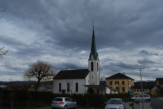
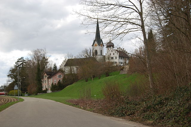
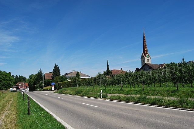
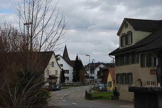
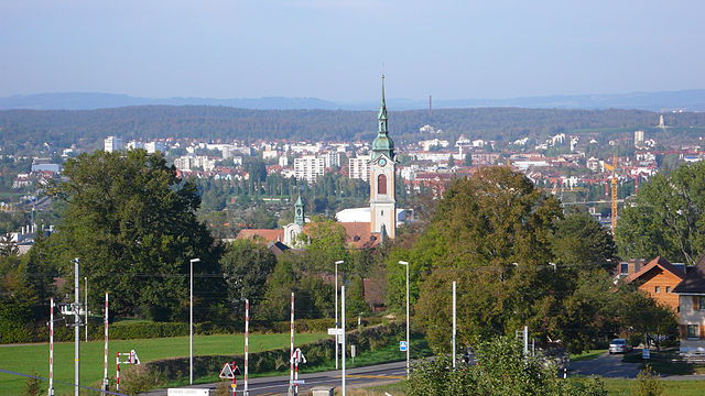
Weinfelden
- municipality in Switzerland
Hiking in Weinfelden
Weinfelden, located in the canton of Thurgau in Switzerland, offers a variety of hiking opportunities that showcase the beautiful landscapes of the area, including vineyards, rolling hills, and views of the nearby Bodensee (Lake Constance). Here are some highlights about hiking in Weinfelden:...
- Country:
- Postal Code: 8570
- Local Dialing Code: 071
- Licence Plate Code: TG
- Coordinates: 47° 33' 59" N, 9° 6' 0" E
- GPS tracks (wikiloc): [Link]
- AboveSeaLevel: 432 м m
- Area: 15.48 sq km
- Population: 11388
- Web site: [Link]
Schönholzerswilen
- municipality in Switzerland
Hiking in Schönholzerswilen
Schönholzerswilen is a small village located in the canton of Thurgau, Switzerland. It is surrounded by beautiful landscapes that offer various hiking opportunities for outdoor enthusiasts. Here are some highlights for hiking in and around Schönholzerswilen:...
- Country:
- Postal Code: 8577
- Local Dialing Code: 071
- Licence Plate Code: TG
- Coordinates: 47° 30' 59" N, 9° 8' 25" E
- GPS tracks (wikiloc): [Link]
- AboveSeaLevel: 586 м m
- Area: 10.9 sq km
- Population: 845
- Web site: [Link]
Shares border with regions:


Münchwilen District
- district of the canton of Thurgau, Switzerland
Hiking in Münchwilen District
Münchwilen District, located in the Aargau canton of Switzerland, offers a variety of scenic landscapes and hiking opportunities. The area is characterized by its rolling hills, lush forests, and picturesque villages, making it an ideal spot for both casual and experienced hikers....
- Country:
- Licence Plate Code: TG
- Coordinates: 47° 29' 0" N, 8° 59' 0" E
- GPS tracks (wikiloc): [Link]
- AboveSeaLevel: 518 м m
- Area: 155.86 sq km


Arbon District
- district of the canton of Thurgau, Switzerland
Hiking in Arbon District
Hiking in the Arbon District, located in the Thurgau Canton of Switzerland, offers a variety of scenic trails that showcase the beautiful landscapes of the region. Here are some key aspects to consider if you're planning to hike in this area:...
- Country:
- Capital: Arbon
- Licence Plate Code: TG
- Coordinates: 47° 31' 0" N, 9° 26' 0" E
- GPS tracks (wikiloc): [Link]
- AboveSeaLevel: 416 м m
- Area: 88.8 sq km

Kreuzlingen District
- district of the canton of Thurgau, Switzerland
Hiking in Kreuzlingen District
Kreuzlingen District, located in the canton of Thurgau in Switzerland, offers a variety of scenic hiking opportunities, especially due to its proximity to the beautiful Lake Constance (Bodensee) and the surrounding natural landscapes. Here are some highlights of hiking in the area:...
- Country:
- Capital: Kreuzlingen
- Licence Plate Code: TG
- Coordinates: 47° 38' 0" N, 9° 10' 0" E
- GPS tracks (wikiloc): [Link]
- AboveSeaLevel: 511 м m
- Area: 129 sq km


Frauenfeld District
- district of the canton of Thurgau, Switzerland
Hiking in Frauenfeld District
Frauenfeld District, located in the canton of Thurgau in Switzerland, offers a beautiful array of hiking opportunities that cater to various skill levels. The region is characterized by its gentle hills, lush green landscapes, and picturesque views, making it an excellent choice for both experienced hikers and those new to the activity....
- Country:
- Capital: Frauenfeld
- Licence Plate Code: TG
- Coordinates: 47° 33' 0" N, 8° 53' 0" E
- GPS tracks (wikiloc): [Link]
- AboveSeaLevel: 652 м m
- Area: 279.6 sq km