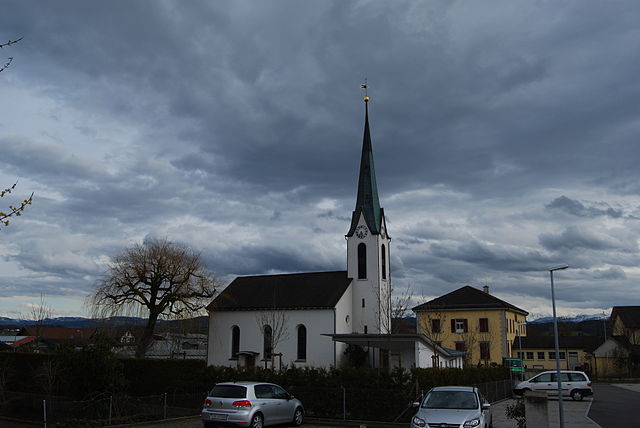
Hohentannen (Hohentannen)

- municipality in Switzerland
 Hiking in Hohentannen
Hohentannen is a lesser-known hiking destination that offers stunning views and a variety of trails suited for different skill levels. It's often less crowded than more popular hiking spots, making it an ideal place for those looking to enjoy nature in a more secluded environment.
Hiking Trails
The region features several trails, ranging from easy to moderate difficulty. Here are some highlights:
-
Scenic Vista Hikes: Many trails in Hohentannen lead to breathtaking viewpoints where hikers can gaze over valleys and mountains. Look for sections that are known for their panoramic views.
-
Forest Trails: The region is characterized by lush forests. Hiking through these areas can be refreshing, and the shade makes for pleasant trekking, especially during warmer months.
-
Wildlife Watching: The trails are often home to various flora and fauna, making them great for wildlife enthusiasts. Bring your binoculars for birdwatching opportunities.
-
Historical Paths: Some trails may also lead to historical landmarks or areas of cultural significance, adding educational value to your hike.
Best Times to Hike
The ideal time for hiking in Hohentannen is during the late spring to early autumn months, when the weather is generally mild and pleasant. Always check the local weather forecast before heading out.
Preparation Tips
- Footwear: Wear sturdy hiking boots for support and traction.
- Navigation: Bring a map or GPS device, as some trails may not be well-marked.
- Hydration: Carry enough water and snacks, especially for longer hikes.
- Safety Gear: Consider carrying a first-aid kit and let someone know your hiking plans.
Conclusion
Hohentannen offers a wonderful opportunity for hikers seeking a quiet escape into nature. Whether you're planning a short day hike or a more extended adventure, the area’s diverse landscapes and trails provide a rewarding experience for all types of outdoor enthusiasts.
- Country:

- Postal Code: 9216
- Local Dialing Code: 071
- Licence Plate Code: TG
- Coordinates: 47° 30' 0" N, 9° 12' 59" E


- GPS tracks (wikiloc): [Link]
- AboveSeaLevel: 570 м m
- Area: 8.0 sq km
- Population: 602
- Web site: http://www.hohentannen.ch
- Wikipedia en: wiki(en)
- Wikipedia: wiki(de)
- Wikidata storage: Wikidata: Q66309
- Wikipedia Commons Category: [Link]
- Freebase ID: [/m/0g32j0]
- GeoNames ID: Alt: [7286100]
- VIAF ID: Alt: [234356713]
- OSM relation ID: [1684529]
- HDS ID: [1874]
- Swiss municipality code: [4495]
Shares border with regions:
Bischofszell
- municipality in Switzerland
Hiking in Bischofszell
Bischofszell is a charming town located in the canton of Thurgau in Switzerland, known for its picturesque landscapes and rich cultural heritage. While it's not as famous as some of the larger hiking destinations in the Swiss Alps, it offers a variety of hiking opportunities for nature lovers and outdoor enthusiasts....
- Country:
- Postal Code: 9220
- Local Dialing Code: 071
- Licence Plate Code: TG
- Coordinates: 47° 29' 59" N, 9° 14' 0" E
- GPS tracks (wikiloc): [Link]
- AboveSeaLevel: 506 м m
- Area: 11.7 sq km
- Population: 6009
- Web site: [Link]

Erlen
- municipality in Switzerland
Hiking in Erlen
Erlen is a small municipality in the canton of Thurgau, Switzerland, known for its picturesque landscapes and access to various outdoor activities, including hiking. While Erlen itself may not be a major hiking destination, it is well-positioned for enjoying the surrounding natural beauty....
- Country:
- Postal Code: 8586
- Local Dialing Code: 071
- Licence Plate Code: TG
- Coordinates: 47° 33' 4" N, 9° 14' 10" E
- GPS tracks (wikiloc): [Link]
- AboveSeaLevel: 445 м m
- Area: 12.2 sq km
- Population: 3687
- Web site: [Link]
Zihlschlacht-Sitterdorf
- municipality in Switzerland
Hiking in Zihlschlacht-Sitterdorf
Zihlschlacht-Sitterdorf is a picturesque area located in the canton of Thurgau in Switzerland, known for its stunning landscapes and diverse hiking opportunities. Here’s a general overview of what you can expect when hiking in this beautiful region:...
- Country:
- Postal Code: 8588
- Local Dialing Code: 071
- Licence Plate Code: TG
- Coordinates: 47° 31' 0" N, 9° 15' 59" E
- GPS tracks (wikiloc): [Link]
- AboveSeaLevel: 527 м m
- Area: 12.2 sq km
- Population: 2367
- Web site: [Link]

Kradolf-Schönenberg
- municipality in Switzerland
Hiking in Kradolf-Schönenberg
Kradolf-Schönenberg is a charming municipality located in the Canton of Thurgau in Switzerland. While it may not be as widely known as some of the larger Swiss hiking destinations, it offers beautiful landscapes and a peaceful hiking experience amidst nature, making it a great spot for outdoor enthusiasts....
- Country:
- Postal Code: 9214
- Local Dialing Code: 071
- Licence Plate Code: TG
- Coordinates: 47° 30' 59" N, 9° 10' 59" E
- GPS tracks (wikiloc): [Link]
- AboveSeaLevel: 455 м m
- Area: 10.9 sq km
- Population: 3570
- Web site: [Link]

Sulgen
- municipality in Switzerland
Hiking in Sulgen
Sulgen is a charming village located in the canton of Thurgau, Switzerland. While it may not be as famous as some other hiking destinations in Switzerland, it does offer some beautiful trails and scenic landscapes that are perfect for hiking enthusiasts....
- Country:
- Postal Code: 8583
- Local Dialing Code: 071
- Licence Plate Code: TG
- Coordinates: 47° 32' 32" N, 9° 11' 35" E
- GPS tracks (wikiloc): [Link]
- AboveSeaLevel: 486 м m
- Area: 9.1 sq km
- Population: 3766
- Web site: [Link]